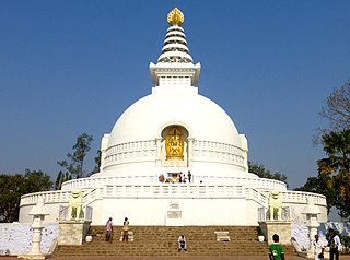
Rajgir, old name Rajagriha, meaning "The City of Kings," is an ancient city and university town in the district of Nalanda in Bihar, India. It was the capital of the Haryanka dynasty, the Pradyota dynasty, the Brihadratha dynasty and the Mauryan Empire, as well as the dwelling ground of historical figures such as Buddha, Mahavira and Bimbisara. Due to its religious significance, the city holds a place of prominence in Hindu, Buddhist and Jain scriptures. As of 2011, the population of the town was reported to be 41,000 while the population in the community development block was about 88,500.

Shikharji, also known as Sammet or Sammed Shikharji, is one of the holiest pilgrimage sites for Jains, in Giridih district, Jharkhand. It is located on Parasnath hill, the highest mountain in the state of Jharkhand. It is the most important Jain Tirtha, for it is the place where twenty of the twenty-four Jain tirthankaras along with many other monks attained Moksha. It is one of the five principal pilgrimage destinations along with Girnar, Pawapuri, Champapuri, Dilwara, Palitana and Ashtapad Kailash.

Chanderi, is a town of historical importance in Ashoknagar District of the state Madhya Pradesh in India. It is situated at a distance of 127 km from Shivpuri, 37 km from Lalitpur, 55 km from Ashok Nagar and about 46 km from Isagarh. It is surrounded by hills southwest of the Betwa River. Chanderi is surrounded by hills, lakes and forests and is spotted with several monuments of the Bundela Rajputs. It is famous for ancient Jain Temples. Its population in 2011 was 33,081.

Chatra district is district one of the twenty-four districts of Jharkhand state, India. The district was formed after separation from Hazaribagh district in 1991. Chatra is the administrative headquarters of this district. The district covers an area of 3718 km2.
Lesliganj block is one of the administrative blocks of Palamu district, Jharkhand state, India.

Bijoliya is a census town in Bhilwara district in the state of Rajasthan, India and is surrounded by nature and waterfalls and is famous for Tapodaya Teerth Kshetra and Mandakini Temple.
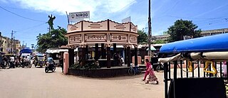
Madhupur is a town with a municipality in Deoghar district in the Indian state of Jharkhand. It is a subdivisional town, famous for the production of sweets and widely considered a popular health resort for tourists as the water and overall climate is said to cure many stomach and digestion ailments.
Narasimharajapura or NRpura is a town and taluk headquarter in Chikkmagaluru district, Karnataka, India. It is situated in the Malenadu region of the district. In 1915, Yuvaraja Shri Narasimharaja Wodeyar visited Yedehalli and in his memory, the town was named after him. The taluk was ruled by Ganga, Kadamba, Santhara, Hoysala and Vijayanagara kings.
Mahuwa is a town in Surat district in the Indian state of Gujarat.
Hunterganj, is a historic town in the Chatra subdivision of the Chatra district, Jharkhand, India.
Chatra is a town in the Chatra subdivision of the Chatra district in the Indian state of Jharkhand. It is also the administrative headquarter of Chatra district.

Nareli Jain Temple or Shri Gyanodaya Tirth Kshetra, is a new Jain temple located on the outskirts of Ajmer 7 kilometers from the city center and 128 kilometers west of Jaipur on the main national highway 8.
Simaria is a community development block that forms an administrative division in the Simaria subdivision of the Chatra district, Jharkhand state, India.
Shaligram Ramnarayanpur (Hunterganj) is a community development block that forms an administrative division in the Chatra subdivision of the Chatra district in the Indian state of Jharkhand.
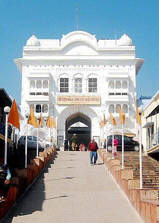
Digamber Jain Bada Mandir Hastinapur is a Jain temple complex located in Hastinapur, Uttar Pradesh. It is the oldest Jain temple in Hastinapur dedicated to Shantinatha, the 16th Jain Tirthankara.
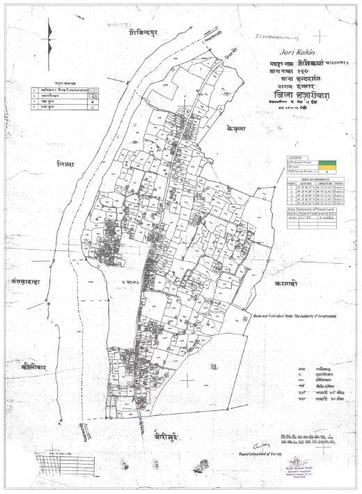
Itkhori is a village and gram panchayat in the Itkhori CD block in the Chatra subdivision of the Chatra district in the Indian state of Jharkhand.
Kauleshwari Temple is a pilgrimage centre where Kauleshwari Devi, a form of Sati/Kali, is worshipped. It is in the Chatra subdivision of Chatra district in Jharkhand, India.
Simaria is a village in the Simaria CD block in the Simaria subdivision of the Chatra district in the Indian state of Jharkhand.
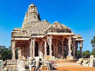
Sarvodaya Jain temple is a Jain temple in Amarkantak town in Anuppur, Madhya Pradesh. Nearest airport is Raipur C.G. and nearest railway station is Pendra road C.G. You can also reach easily from Bilaspur CG and Anuppur MP, by Car. Rental car, taxi and auto rickshaw are easily available From Pendra Road. Many Lodges, Ashram and Hotels are available in Amarkantak and as well as Pendraroad. Amarkantak is a well-known Teerth. It is famous for beautiful Nature, mountains and climate. Ma Narmada Temple, Narmada kund, Kapil dhara, Dudh Dhara, Son muda, Mai ki bahiya, Durga dhara, Bhrigu kamandal, Arandi ashram, Kalyan ashram and many more attractive places are Beauty of Amarkantak. Beauty and architecture of Sarvoday Jain temple is also remarkable.
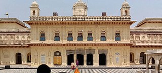
Kanak Bhawan is a temple in Ram Janmabhoomi, Ayodhya, which is in the north-east of Ramkot. It is one of the most famous temples of Ayodhya. It is believed that this palace (temple) was gifted by Kaikeyi, immediately after the marriage of Rama with Sita and hence, it is their personal palace. According to the mythology, after the original Kanak Bhawan was damaged, it was rebuilt by Krishna himself in the Dvapar Yuga. It is believed that it was renovated by Vikramaditya in the medieval period. Later, it was renovated by Queen Vrishabhanu Kunwari which is still present today. The main idols installed in the sanctum sanctorum are of Rama and Sita.


