
Puno is a city in southeastern Peru, located on the shore of Lake Titicaca. It is the capital city of the Puno Region and the Puno Province with a population of approximately 140,839. The city was established in 1668 by viceroy Pedro Antonio Fernández de Castro as capital of the province of Paucarcolla with the name San Juan Bautista de Puno. The name was later changed to San Carlos de Puno, in honor of king Charles II of Spain. Puno has several churches dating back from the colonial period; they were built to service the Spanish population and evangelize the natives.

Arequipa is a province in the Arequipa Region, Peru. Its capital, Arequipa, is Peru's third most populous province of Peru. It borders the provinces of Islay, Camaná, Caylloma, and the Cusco and Puno regions. According to INEI in the year 2014 it has a population of 958.351 people.
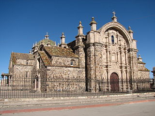
Lampa province is a province of the Puno region in Peru. Its population is about 40,856. The capital is Lampa.

Canchis Province is one of thirteen provinces in the Cusco Region in the southern highlands of Peru.

Quispicanchi Province is one of thirteen provinces in the Cusco Region in the southern highlands of Peru.
Ollachea District is one of ten districts of the province Carabaya in Peru.

Santa Lucía District is one of ten districts of the province Lampa in Peru.
Checacupe or Ch'iqa Kupi is one of eight districts of the Canchis Province in the Cusco Region in Peru.

Marangani District is one of eight districts of the province Canchis in Peru.
Sicuani District is one of eight districts of the province Canchis in Peru.

The Cordillera Vilcanota is a mountain range located in Peru southeast of Cusco, on the boundary between the regions of Cusco and Puno. It extends between 13°39' and 14°29'S and 70°31' and 71°20'W for about 80 km. It includes 469 glaciers.

Pomanota is a mountain in the Vilcanota mountain range in the Andes of Peru, about 5,516 metres (18,097 ft) high. It is situated in the Cusco Region, Canchis Province, San Pablo District and in the Puno Region, Carabaya Province, Corani District as well as in the Melgar Province, Nuñoa District. Pomanota lies southeast of the Joyllor Puñuna, the highest elevation in the glaciated area of Quelccaya, and northwest of the Jonorana.
Pukara means a ruin of the fortifications made by the natives of the central Andean cultures.
Ch'iyar Jaqhi may refer to:
Quello Cunca is a mountain in the Vilcanota mountain range in the Andes of Peru, about 5,100 metres (16,732 ft) high. It is situated in the Cusco Region, Quispicanchi Province, Marcapata District. Quello Cunca lies southwest of the mountains Sullulluni, Llusca Ritti and Jori Pintay, southwest of the mountain Tocllayoc and north of the mountain Condor Puñuna.
Kuntur Puñuna is a mountain in the Andes of Peru, about 4,800 metres (15,748 ft) high. It is located in the Puno Region, Lampa Province, Santa Lucía District.
Orco Puñuna is a mountain in the western extensions of the Vilcanota mountain range in the Andes of Peru, about 5,200 metres (17,060 ft) high. It is situated in the Cusco Region, Canchis Province, Pitumarca District, east of Sibinacocha. Orco Puñuna lies south of the mountain Othaña and southwest of the mountains Cóndor Tuco, Chuallani and Yana Orjo.


