Juan Aldama, Zacatecas

Last updated
Juan Aldama
Iglesia Juan Aldama (Zacatecas).jpg
St. John the Baptist Parish
Mexico States blank map.svg
Red pog.svg
Juan Aldama
Location in Mexico
Coordinates: 24°17′28″N103°23′38″W / 24.29111°N 103.39389°W / 24.29111; -103.39389
CountryFlag of Mexico.svg  Mexico
State Zacatecas
Settled1591
Elevation
2,023 m (6,637 ft)
Time zone UTC-6 (Central Time Zone)
  Summer (DST) UTC-7 (Central Time Zone)

Juan Aldama is a city in the northwestern portion of the Mexican state of Zacatecas. It is the biggest community in the Municipality of Juan Aldama and the seat of the municipal government.

Contents

History

The region was originally inhabited by Indigenous Zacatecos.

The area was settled in 1591 by some of the Tlaxcaltecan families led by mestizo military Captain Miguel Caldera. [1]

The town was renamed for Independence revolutionary Juan Aldama. It had previously been known as San Juan Bautista del Mezquital and Villa Aréchiga.

Demographics

Geography

Juan Aldama is located in the northwestern portion of the Mexican state of Zacatecas. Juan Aldama is surrounded by small towns such as Ojitos, Jalpa, Cienega more known as general Juan Jose Rios, Las Norias, Corrales and Paradillas and many more

Climate

Climate data for Juan Aldama (1951–2010)
MonthJanFebMarAprMayJunJulAugSepOctNovDecYear
Record high °C (°F)30.0
(86.0)
30.5
(86.9)
36.0
(96.8)
37.0
(98.6)
39.0
(102.2)
39.5
(103.1)
39.0
(102.2)
35.0
(95.0)
35.0
(95.0)
37.0
(98.6)
31.0
(87.8)
31.0
(87.8)
39.5
(103.1)
Mean daily maximum °C (°F)20.6
(69.1)
22.5
(72.5)
26.0
(78.8)
29.2
(84.6)
31.6
(88.9)
31.6
(88.9)
28.9
(84.0)
28.1
(82.6)
26.5
(79.7)
25.6
(78.1)
23.6
(74.5)
21.1
(70.0)
26.3
(79.3)
Daily mean °C (°F)12.3
(54.1)
13.6
(56.5)
16.5
(61.7)
19.6
(67.3)
22.3
(72.1)
23.3
(73.9)
21.8
(71.2)
21.3
(70.3)
19.8
(67.6)
17.8
(64.0)
15.2
(59.4)
13.0
(55.4)
18.0
(64.4)
Mean daily minimum °C (°F)4.0
(39.2)
4.7
(40.5)
7.1
(44.8)
10.0
(50.0)
13.0
(55.4)
15.1
(59.2)
14.7
(58.5)
14.4
(57.9)
13.1
(55.6)
10.0
(50.0)
6.8
(44.2)
4.9
(40.8)
9.8
(49.6)
Record low °C (°F)−7.5
(18.5)
−10.0
(14.0)
−4.5
(23.9)
−2.0
(28.4)
5.0
(41.0)
9.5
(49.1)
6.0
(42.8)
2.5
(36.5)
4.0
(39.2)
−3.5
(25.7)
−5.0
(23.0)
−14.0
(6.8)
−14.0
(6.8)
Average precipitation mm (inches)7.2
(0.28)
7.1
(0.28)
2.7
(0.11)
3.8
(0.15)
12.3
(0.48)
58.3
(2.30)
91.9
(3.62)
110.9
(4.37)
88.6
(3.49)
27.6
(1.09)
10.9
(0.43)
9.8
(0.39)
431.1
(16.97)
Average precipitation days (≥ 0.1 mm)1.31.20.50.91.86.19.010.68.23.51.31.345.7
Source: Servicio Meteorologico Nacional [2] [3]

Economy

Related Research Articles

<span class="mw-page-title-main">Aldama Municipality, Tamaulipas</span>

Aldama is a municipality of the northeastern Mexican state of Tamaulipas. According to the census of 2010, the municipality had an area of 3,672 square kilometres (1,418 sq mi) and a population of 29,470, including the town of Aldama with a population of 13,661.

<span class="mw-page-title-main">Tlaltenango de Sánchez Román Municipality</span> Place in Zacatecas, Mexico

Tlaltenango de Sánchez Román is a municipality located in the southwestern portion of the Mexican state of Zacatecas. The average elevation of the municipality is 1,723 meters (5,653 ft) above sea level and the municipality covers an area of 808.082 square kilometres (312.002 sq mi). The municipality lies in a valley bordered by the Sierra de Morones and lies on the banks of the Tlaltenango River, which runs north and is a tributary of the Bolaños River.

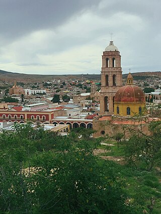
Tayahua is a small provincial town in the central Mexican state of Zacatecas. The town has less than 2,193 inhabitants. Tayahua is a municipality of the city Villanueva. It is located south of Villanueva and north of the City Tabasco. This town was once inhabited by the famous actor/singer, Antonio Aguilar. before he built his own ranch "El Soyate" approximately 6km north of Tayahua off the main highway road. Antonio Aguilar and family once lived in La Hacienda by the Catholic Church in Tayahua.

<span class="mw-page-title-main">Sombrerete, Zacatecas</span> City and municipality in Zacatecas, Mexico

Sombrerete is a town and municipality located in the northwest of the Mexican state of Zacatecas, bordering the state of Durango.

<span class="mw-page-title-main">Calera de Víctor Rosales</span> Municipality in Zacatecas, Mexico

Calera is one of the 58 municipalities in the Mexican state of Zacatecas. It is located on the central part of the state of Zacatecas and it is bounded by the municipalities of General Enrique Estrada, Fresnillo, Villa de Cos, Pánuco, Morelos and Zacatecas. The municipality covers a total surface area of 389 square kilometers (150 sq mi). The municipality makes up for 0.5% of the area of the state of Zacatecas.

<span class="mw-page-title-main">Concepción del Oro Municipality</span> Municipality in the Mexican state of Zacatecas

Concepción del Oro is one of the 58 municipalities in the Mexican state of Zacatecas. It is located on the northern part of the state and it is bounded by the municipalities of Mazapil and El Salvador; it also lies next to the states of Coahuila and San Luis Potosí. The municipality covers a total surface area of 2,559 square kilometers (988 sq mi).

<span class="mw-page-title-main">Milpillas de Allende</span> Town in Zacatecas, México

Milpillas de Allende is a town in the southern portion of the Mexican state of Zacatecas, at around 21°19'31" N, 103°36'50" W, in the municipality of Teúl de González Ortega. People of this singular town grow corn and blue agave in peculiar red soil, and also engage in cattle ranching.

<span class="mw-page-title-main">Colotlán</span> Municipality and town in Jalisco, Mexico

The municipality of Colotlán is in the northern extremity of the Mexican state of Jalisco. The municipality covers an area of approximately 648 square kilometers. Colotlán is located at 22°12′N103°18′W. It stands at 1,550 metres (5,090 ft) above sea level.

<span class="mw-page-title-main">Villanueva, Zacatecas</span> City in Zacatecas, Mexico

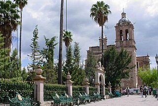
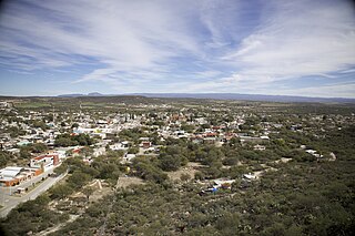
Villanueva is a city in the Mexican state of Zacatecas. It is the administrative seat of the municipality of Villanueva.

<span class="mw-page-title-main">Zumpango del Río</span> City in the Mexican state of Guerrero

Zumpango del Río is the seat of the municipality of Eduardo Neri, in the southern Mexican state of Guerrero.

<span class="mw-page-title-main">Cosío</span> Municipality in the Mexican state of Aguascalientes

Cosio is a municipality and town in the Mexican state of Aguascalientes. It stands at 22°22′N102°18′W. The municipal seat is the town of Cosío. As of 2020, the town of Cosío had a population of 17,000.

<span class="mw-page-title-main">Río Grande Municipality, Zacatecas</span> Municipality in Zacatecas, Mexico

Río Grande is a municipality in the Mexican state of Zacatecas.

<span class="mw-page-title-main">General Francisco R. Murguía Municipality</span> Municipality in Zacatecas, Mexico

General Francisco R. Murguía is a municipality in the Mexican state of Zacatecas, located approximately 140 kilometres (87 mi) north of the state capital of Zacatecas City. Its municipal seat is located in Nieves.

<span class="mw-page-title-main">Saín Alto Municipality</span> Municipality in Zacatecas, Mexico

Sain Alto is a municipality in the Mexican state of Zacatecas, located approximately 110 kilometres (68 mi) northwest of the state capital of Zacatecas City.

<span class="mw-page-title-main">Juchipila</span> Municipality in Zacatecas, Mexico

Juchipila is a municipality in the Mexican state of Zacatecas, located approximately 160 kilometres (99 mi) southwest of the state capital Zacatecas City.

Genaro Codina is a municipality in the Mexican state of Zacatecas, located approximately 30 kilometres (19 mi) southwest of the state capital at the city of Zacatecas. It is named after Genaro Codina, musician and composer of the state anthem, the "March of Zacatecas".

<span class="mw-page-title-main">Mezquital del Oro</span> Municipality in Zacatecas, Mexico

Mezquital del Oro is a municipality in the Mexican state of Zacatecas, located approximately 190 kilometres (120 mi) southwest of Zacatecas City, the state capital.

Trinidad García de la Cadena is a municipality in the Mexican state of Zacatecas, located approximately 200 kilometres (120 mi) southwest of Zacatecas City, the state capital. It is named after General Trinidad García de la Cadena, governor of Zacatecas from 1869 to 1870 and from 1876 to 1880.

El Salvador is a municipality in the Mexican state of Zacatecas, located approximately 260 kilometres (160 mi) northeast of Zacatecas City, the state capital.

<span class="mw-page-title-main">Susticacán</span> Municipality in Zacatecas, Mexico

Susticacán is a municipality in the Mexican state of Zacatecas, located approximately 55 kilometres (34 mi) west of Zacatecas City, the state capital.

References

  1. Burciaga Campos, José Arturo; Oropeza Saucedo, Marco Antonio; Barrón Guevara, Pedro (2009). Juan Aldama: memoria sobre el arte popular (Primeraición ed.). Zacatecas, Zacatecas, Mexico: IDEAZ, Instituto de Desarrollo Artesanal del Estado de Zacatecas. ISBN   9786077889083.
  2. "Estado de Zacatecas-Estacion: Juan Aldama". Normales Climatologicas 1951–2010 (in Spanish). Servicio Meteorologico Nacional. Archived from the original on 27 April 2015. Retrieved 20 April 2015.
  3. "Extreme Temperatures and Precipitation for Juan Aldama 1964–2011" (in Spanish). Servicio Meteorológico Nacional. Archived from the original on 27 April 2015. Retrieved 20 April 2015.