Juan Dolio

Last updated
Juan Dolio
Dominican Republic location map.svg
Red pog.svg
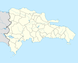
Juan Dolio
Juan Dolio in the Dominican Republic
Coordinates: 18°25′30″N69°25′27″W / 18.42500°N 69.42417°W / 18.42500; -69.42417
CountryFlag of the Dominican Republic.svg  Dominican Republic
Province San Pedro de Macoris
Population
 (2010) [1]
2,488

Juan Dolio is a seaside community and tourist destination in the province of San Pedro de Macoris on the southern coast of the Dominican Republic on the island of Hispaniola. Juan Dolio has 2,488 inhabitants (2010 [1] ) and belongs to the district municipality Guayacanes.

Contents

Geographical location

Main Districts of Juan Dolio Juan Dolio Map 1.jpg
Main Districts of Juan Dolio

The former fishing village of Juan Dolio is located on the Caribbean Sea and extends over a length of about 7 km along the coast and on both sides of the access road Avenida Boulevard passing through Juan Dolio. The western and eastern end of the access road Avenida Boulevard connects Juan Dolio with the highway DR-3 Autovia Del Este which bypasses the village in the north.

The distance to the country's capital Santo Domingo, located west of Juan Dolio, is about 50 km and the provincial capital of San Pedro de Macorís is about 12 km in the eastern direction. While the north and east of the village consists mainly of wide pastures, fallow land and sugar cane fields, the western part of Juan Dolio passes almost seamlessly into the community of Guayacanes. Also in the western direction are the tourist town Boca Chica (approx. 23 km) and the Las Américas International Airport (30 km).

History

In the pre-Columbian era, Juan Dolio was the site of an indigenous Arawaks settlement of the Taíno people known as El Corral with its cemetery near the western end of the bay. The natural bay of the Playa Juan Dolio protected by the coral reef in front was used as a harbor for their canoes. Occasionally, archaeological findings are still made in the center area of Juan Dolio.

Since the late nineteenth century the community of Juan Dolio was a section of the municipality of San José de los Llanos. On May 8, 1884, by Decree No. 2223, the communities of Juan Dolio and Guayacanes were segregated and added to the Maritime District of San Pedro de Macoris.

The legal foundation of the tourist destination Juan Dolio, began with the enactment of Decree No. 3133 of January 23, 1973, which sets the limits and extension of the area populated by fishermen and farmers. During the late 1980s Juan Dolio became one of the first tourist resorts in the country and an exclusive destination for mainly European tourists. Later the business concept of an All-inclusive resort offered by the various hotels lead to a tourist boom and the construction of new hotels in the western part of Juan Dolio, Villas Del Mar. In 1995 the hotels in Juan Dolio had a daily average of 5,500 tourists. After Hurricane Georges devastated Juan Dolio in 1998, many of the hotel chains moved their business further east where the new tourist destination Bávaro-Punta Cana was just built from the ground. The owners of the damaged resorts in Juan Dolio had problems attracting new business partners and most of the beach hotels were closed. Some of the older hotels were demolished and became development sites for real estate projects.

With the low cost of properties after the hurricane damage, developers found a new opportunity and started second homes projects in the area. Projects like Guavaberry Golf Club, Club Hemingway and Metro Country Club became very popular, and a new business model was adopted creating a destination dedicated to the media industries.

Since 2006 Juan Dolio is part of the municipality of Guayacanes, the latest district in the San Pedro de Macorís Province, created by Law No. 203-06 of May 3, 2006. Formally established in December 2007, the town council of Guayacanes is now also responsible for the administration of Juan Dolio.

In 2015 the film studios Pinewood was established in the community creating a revival of Juan Dolio.

Many sports celebrities and business personalities choose Juan Dolio as their main residence or vacations home for the privacy and security in town.

Infrastructure

The center of the elongated village is located near the bay Playa Juan Dolio, which is a popular beach among locals and visitors. The bay is also used by the remaining few local fishermen to land their boats.

In the north-west of the town center lies the district of Mar Del Sol, in the north lies the gated community of the Metro Golf & Country Club and in the east of the center begins the district of Villas Del Mar. The western part of Juan Dolio adjoins the neighboring community and administration headquarters of the district, Guayacanes.

The village is traversed by a main street, Calle Principal, running parallel to the beach and the access road Boulevard. On weekends the Calle Principal can be driven in only one direction from west to east. Located along the main street are numerous small shops, restaurants, bars, guesthouses, mostly small residential buildings and an occasional multi-story apartment building.

Newly created during the past two decades, at the eastern end of the Calle Principal starts the district of Villas Del Mar, which also houses the two major beach resorts of Juan Dolio. Financially strong investors have used Villas Del Mar in the past repeatedly for their real estate development projects. The zone is characterized by modern high-rising apartment towers and some luxurious residential complexes, in some cases still under construction.

Playa Juan Dolio Juan Dolio Beach 2.jpg
Playa Juan Dolio
Playa Juan Dolio Juan Dolio Beach 1.jpg
Playa Juan Dolio

Beaches

The beach in the center of the community, the Playa Juan Dolio, is publicly accessible and provides parking spaces for visitors. The view from the main road to the beach of Villas del Mar, the Playa Real, is blocked by high-rising condo buildings. The free access to the Playa Real is often limited by the private security personnel of the different condo towers along the beach. All beaches in the different sections of Juan Dolio were renewed and extended within a government project in the winter of 2006/07 and attract, especially on weekends, a growing number of visitors. The public beach of Juan Dolio, the Playa Juan Dolio, is not as famous as the beach of the tourist town Boca Chica for instance, but seems more natural and unspoiled. Coconut palms grow on the sand, the sea is turquoise and there is no large hotel in sight.

Related Research Articles

Tourism in Puerto Rico attracts millions of visitors each year, with more than 5.1 million passengers arriving at the Luis Muñoz Marín International Airport in 2022, the main point of arrival into the island of Puerto Rico. With a $8.9 billion revenue in 2022, tourism has been a very important source of revenue for Puerto Rico for a number of decades given its favorable warm climate, beach destinations and its diversity of natural wonders, cultural and historical sites, festivals, concerts and sporting events. As Puerto Rico is an unincorporated territory of the United States, U.S. citizens do not need a passport to enter Puerto Rico, and the ease of travel attracts many tourists from the mainland U.S. each year.

<span class="mw-page-title-main">Varadero</span> Place in Matanzas, Cuba

Varadero, also referred to as Playa Azul, is a resort town in the province of Matanzas, Cuba, and one of the largest resort areas in the Caribbean. Varadero Beach is rated one of the world's best beaches in TripAdvisor's Traveler's Choice Awards since 2019, ranking at number two. Common activities include fishing and excursions to Matanzas, Cárdenas, and the Península de Zapata.

<span class="mw-page-title-main">San Pedro Sula</span> City and municipality in Cortés, Honduras

San Pedro Sula is the capital of Cortés Department, Honduras. It is located in the northwest corner of the country in the Sula Valley, about 50 kilometers south of Puerto Cortés on the Caribbean Sea. With a population of 701,200 in the central urban area and a population of 1,445,598 in its metropolitan area in 2023, it is the nation's primary industrial center and second largest city after the capital Tegucigalpa, and the largest city in Central America that is not a capital city.

<span class="mw-page-title-main">Puerto Escondido, Oaxaca</span> City in Oaxaca, Mexico

Puerto Escondido is a small port and tourist center in the municipality of San Pedro Mixtepec Distrito 22 in the Mexican state of Oaxaca. Prior to the 1930s, there was no town. The bay had been used as a port intermittently to ship coffee, but there was no permanent settlement due to the lack of potable water. The name "Puerto Escondido" had roots in the legend of a woman who escaped her captors and hid here. The Nahuatl word for this area was Zicatela, meaning “place of large thorns". Today, it refers to the area's most famous beach.

<span class="mw-page-title-main">Puerto del Carmen</span> Town in Canary Islands, Spain

Puerto del Carmen is the main tourist town on the island of Lanzarote, Canary Islands, Spain. It is part of the municipality of Tías. Most of Lanzarote's over 1 million visitors per year choose this town as their destination. As a result, almost all of the town's economy revolves around tourism.

<span class="mw-page-title-main">Huatulco</span> Tourist development in Mexico

Huatulco, formally Bahías de Huatulco, centered on the town of La Crucecita, is a tourist development in Mexico. It is located on the Pacific coast in the state of Oaxaca. Huatulco's tourism industry is centered on its nine bays, thus the name Bahias de Huatulco, but has since been unofficially shortened to simply Huatulco. Huatulco has a wide variety of accommodation from rooms for rent, small economy hotels, luxury villas, vacation condominia, bed and breakfasts, as well as several luxury resorts standing on or near the shores of Tangolunda Bay. The Camino Real Zaashila, Quinta Real Huatulco, Las Brisas, Dreams Resort & Spa, and the Barceló are examples of the most popular larger resorts in the area.

<span class="mw-page-title-main">San Felipe, Baja California</span> City in the Mexican state of Baja California

San Felipe is a coastal city in San Felipe Municipality, Baja California, located on the Gulf of California. The population of San Felipe was reported as 17,143 inhabitants in the 2020 Mexican Census. San Felipe is historically a fishing town. Today it is also a popular tourist destination, known for its beaches, nature, and desert racing, as home to the San Felipe 250.

<span class="mw-page-title-main">Adeje</span> Municipality in Canary Islands, Spain

Adeje is a town and municipality in the southwestern part of the island of Tenerife, one of the Canary Islands, and part of the province of Santa Cruz de Tenerife, Spain. The town Adeje is located 4 km from the coast, 8 km north of the resort town Los Cristianos, 60 km southwest of the island capital Santa Cruz de Tenerife and about 17 km northwest of Tenerife South Airport.

<span class="mw-page-title-main">Maspalomas</span> Region in Canary Islands, Spain

Maspalomas is a tourist resort in the south of the island of Gran Canaria, Canary Islands, stretching from Bahía Feliz in the east to Meloneras in the west, including the resort towns of San Agustín, Playa del Inglés and San Fernando. Maspalomas constitutes the southernmost part of the municipality of San Bartolomé de Tirajana, and of the island.

<span class="mw-page-title-main">Villa Gesell</span> City in Buenos Aires, Argentina

Villa Gesell is a seaside resort city in Villa Gesell Partido, Buenos Aires Province, Argentina. It was founded in 1931, with the intention of turning a dune field into a timber plantation. The growth of the city allowed it to annex the nearby cities of Mar de las Pampas, Las Gaviotas and Mar Azul.

<span class="mw-page-title-main">Cayo Guillermo</span> Resort island and village in Ciego de Ávila, Cuba

Cayo Guillermo is a cay of the Jardines del Rey archipelago. It is located on the northern coast of Cuba, between the Bay of Dogs and the Atlantic Ocean. It is part of the Ciego de Ávila Province, and lies in the Morón municipality.

<span class="mw-page-title-main">DR-3 (Dominican Republic highway)</span>

DR-3 is one of three main dual carriageway highways of the Dominican Republic, connecting Santo Domingo to the eastern cities of the republic. The highway begins at the Plaza de La Bandera, on the western side of Santo Domingo, and travels eastward through downtown Santo Domingo and continues east to Santo Domingo Este. Outside Santo Domingo it runs roughly parallel to the Caribbean Sea toward the eastern cities of the nation. DR-3 creates a rapid connection to the Las Américas International Airport, located only 30 kilometers east of Santo Domingo. DR-3 continues eastward to the beach towns of Andrés and Boca Chica. DR-3 then continues east and slightly north to the eastern cities of San Pedro de Macorís, La Romana, and Higüey and has connections to the routes that lead to the resort towns of Bayahibe, Bávaro, and Punta Cana. DR-3 has been part of a long program to improve, expand, and modernize the highways of the Republic. Most of DR-3 has been expanded to two or three lanes of traffic each way.

<span class="mw-page-title-main">Puerto Rico Highway 2</span> Highway in Puerto Rico

Puerto Rico Highway 2 (PR-2) is a road in Puerto Rico that connects the cities of San Juan and Ponce. At 156 miles (230 km) long, it is Puerto Rico's longest singled-signed highway.

<span class="mw-page-title-main">Tourism in Uruguay</span>

Tourism in Uruguay is an important part of the nation's economy.

<span class="mw-page-title-main">Canas Urbano</span> Barrio of Ponce, Puerto Rico

Canas Urbano is one of the 31 barrio of the municipality of Ponce, Puerto Rico. Along with Machuelo Abajo, Magueyes Urbano, Portugués Urbano, and San Antón, Canas Urbano is one of the municipality's five originally rural barrios that are now also part of the urban zone of the city of Ponce. The name of this barrio is of native indigenous origin. It was created in 1953.

<span class="mw-page-title-main">Balneario</span> Latin American seaside settlement

A balneario is an Iberian and Latin American resort town, typically a seaside resort, and less commonly along the shores of lakes and rivers or next to hot springs. In Spain, balneario typically only refers to spa town resorts. These resorts offer recreation, sports, entertainment, food, hospitality and safety services, retail, and cultural events. These balneario towns are characterized by being flooded by masses of tourists during the summer seasons.

<span class="mw-page-title-main">Tourism in the Dominican Republic</span> Overview of tourism in the Dominican Republic

Tourism in the Dominican Republic is an important sector of the country's economy. More than 8.5 million tourists visited the Dominican Republic in 2022, making it the most popular tourist destination in the Caribbean and putting it in the top 5 overall in the Americas. The industry accounts for 11.6% of the nation's GDP and is a particularly important source of revenue in coastal areas of the country. The nation's tropical climate, white sand beaches, diverse mountainous landscape and colonial history attracts visitors from around the world. In 2022, the nation's tourism was named the best-performing nation post-pandemic with over 5% visitors more in comparison to pre-pandemic levels in 2019.

<span class="mw-page-title-main">Condado Beach</span> Place in San Juan, Puerto Rico

Condado Beach is a large public-access beach located in El Condado, a district of Santurce in San Juan, Puerto Rico. It is considered a dangerous beach with strong undercurrents.

References

  1. 1 2 Censo Nacional de Población y Vivienda 2010, Oficina Nacional de Estadistica