The juniper (Juniperus) is a type of shrub and tree in the cypress family.
Contents
- Places
- Canada
- England
- United States
- Arts and entertainment
- Businesses
- Maritime vessels
- People and fictional characters
- Other uses
- See also
Juniper may also refer to:
The juniper (Juniperus) is a type of shrub and tree in the cypress family.
Juniper may also refer to:
Aberdeen is a city in Scotland.

Annapolis County is a county in the Canadian province of Nova Scotia located in the western part of the province located on the Bay of Fundy. The county seat is Annapolis Royal.
Sherwood may refer to:
Rockingham may refer to:

Lassen Volcanic National Park is a national park of the United States in northeastern California. The dominant feature of the park is Lassen Peak, the largest plug dome volcano in the world and the southernmost volcano in the Cascade Range. Lassen Volcanic National Park is one of the few areas in the world where all four types of volcanoes can be found: plug dome, shield, cinder cone, and stratovolcano.
The name "Miramichi" was first applied to a region in the northeast of New Brunswick, Canada, and has since been applied to other places in Canada and the United States. Although other interpretations have been suggested, it is believed that "Miramichi" was derived from the Montagnais words "Maissimeu Assi", and was perhaps introduced for use in European languages by Jacques Cartier in 1535.
BlackRock is a global investment management firm.

The Ocala National Forest is the second largest nationally protected forest in the U.S. State of Florida. It covers 607 square miles (1,570 km2) of North Central Florida. It is located three miles (5 km) east of Ocala and 16 miles (26 km) southeast of Gainesville. The Ocala National Forest, established in 1908, is the oldest national forest east of the Mississippi River and the southernmost national forest in the continental U.S. The word Ocala is thought to be a derivative of a Timucuan term meaning "fair land" or "big hammock". The forest is headquartered in Tallahassee, as are all three National Forests in Florida, but there are local ranger district offices located in Silver Springs and Umatilla.
Highway 104 in Nova Scotia, Canada, runs from Fort Lawrence at the New Brunswick border near Amherst to River Tillard near St. Peter's. Except for the portion on Cape Breton Island between Port Hawkesbury and St. Peter's, it forms the main route of the Trans-Canada Highway across the province.

Lassen National Forest is a United States national forest of 1,700 square miles (4,300 km2) in northeastern California. It is named after pioneer Peter Lassen, who mined, ranched and promoted the area to emigrant parties in the 1850s.

Indigenous peoples of the Northeastern Woodlands include Native American tribes and First Nation bands residing in or originating from a cultural area encompassing the northeastern and Midwest United States and southeastern Canada. It is part of a broader grouping known as the Eastern Woodlands. The Northeastern Woodlands is divided into three major areas: the Coastal, Saint Lawrence Lowlands, and Great Lakes-Riverine zones.

Trunk 4 is part of the Canadian province of Nova Scotia's system of Trunk Highways. The route runs from Highway 104 exit 7 near Thomson Station to Glace Bay. Until the construction of the Trans-Canada Highway, Trunk 4 was a major traffic link in northern Nova Scotia and Cape Breton, and is still used on Cape Breton as an alternative to Highway 105. The highway was originally called the King's Highway, however, this name is no longer applied to the entire road. The only remaining historic section of the highway that maintains the name "King" is King's Road in Sydney.

The Atlantic Northeast is a geographic and cultural region of eastern North America bounded by the Atlantic Ocean to the east and (loosely) by the Saint Lawrence River to the northwest. Though no official boundary exists, the most common conception includes the Maritime provinces, southern Quebec, and the island of Newfoundland in Canada, and the New England region of the United States. Broader conceptions reach further north into Canada, including Labrador and the Côte-Nord region of Quebec. Narrower conceptions may be limited to the coastal areas east of the Appalachian Mountains. The variety of definitions can be attributed to overlapping commonalities of the region's history, culture, geography, ecology, society, and other factors.
The Maritimes and Northeast Pipeline is a natural gas transmission pipeline that runs from the former Sable Offshore Energy Project (SOEP) gas plant in Goldboro, Nova Scotia, Canada to Dracut, Massachusetts, United States.
Blandford is a community in the Canadian province of Nova Scotia, located in the Chester Municipal District on the Aspotogan Peninsula on the Lighthouse Route. Blandford originally included the present day communities of New Harbour, Upper Blandford, and Deep Cove.

USCGC Sycamore (WLB-209) is a United States Coast Guard seagoing buoy tender, the second of her name and the ninth of the Juniper-class. She is now home-ported in Newport, Rhode Island, following a one year long Midlife Maintenance Availability (MMA) in Baltimore, Maryland. She was originally home-ported in Cordova, Alaska. Sycamore primarily tends to aids-to-navigation (ATON) in Martha's Vineyard, the Long Island Sound, Hudson River, and New York City Harbor and entrances; however, she is also responsible for maintenance support of National Data Buoy Center's offshore weather buoys. In addition to her primary ATON role, Sycamore also performs other duties, such as, marine environmental protection, maritime law enforcement, domestic icebreaking, search and rescue, and homeland security missions.
Relations between Boston, Massachusetts, United States and Halifax, Nova Scotia, Canada date back to the founding of Halifax in 1749, when Boston businesses had an interest in the new settlement for shipping and fish trade. The bond between the two cities became stronger following the Halifax Explosion in 1917, after Boston sent significant aid and disaster relief to Halifax. Boston, which is the capital of Massachusetts, is the most populous city in New England. Likewise, Halifax, which is the capital of Nova Scotia, is the most populous city in Atlantic Canada. New England and Atlantic Canada border each other by land and sea along the Canada–United States border. Boston and Halifax are both major port cities on the Atlantic Ocean.

Thomas Gilbert (1714-1797) was a soldier in King George's War, the French and Indian War and the American Revolution. He was known as the "Leader of the New England Tories". He became a Loyalist, originally from Assonet in Freetown, Massachusetts, he settled a community that was eventually named after him, Gilberts Cove, Nova Scotia.

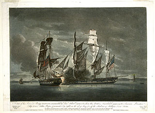
The Province of Nova Scotia was heavily involved in the American Revolutionary War (1776–1783). At that time, Nova Scotia also included present-day New Brunswick until that colony was created in 1784. The Revolution had a significant impact on shaping Nova Scotia, "almost the 14th American Colony". At the beginning, there was ambivalence in Nova Scotia over whether the colony should join the Americans in the war against Britain. Largely as a result of American privateer raids on Nova Scotia villages, as the war continued, the population of Nova Scotia solidified their support for the British. Thousands of Loyalist refugees fled to Nova Scotia during the war, and many were resettled in the region after the signing of the 1783 Treaty of Paris as "United Empire Loyalists".