Jurdab

Last updated

Jurdab (Arabic: جرداب) is a village located in the Kingdom of Bahrain. It neighbors the villages of Jid Ali and Sanad and the 9th area in Isa Town, to the south of the capital Manama.

Arabic Central Semitic language

Arabic is a Central Semitic language that first emerged in Iron Age northwestern Arabia and is now the lingua franca of the Arab world. It is named after the Arabs, a term initially used to describe peoples living in the area bounded by Mesopotamia in the east and the Anti-Lebanon mountains in the west, in northwestern Arabia, and in the Sinai Peninsula. Arabic is classified as a macrolanguage comprising 30 modern varieties, including its standard form, Modern Standard Arabic, which is derived from Classical Arabic.

Jid Ali Village in Capital Governorate, Bahrain

Jid Ali is a Bahraini geographical centre containing mixed residential and commercial properties located near the coast of Tubli Bay. Based south of the capital Manama in the Kingdom of Bahrain. It is located within the Capital Governorate. It is known for its various shops and for international and local cuisines as well as fast food.

Sanad, Bahrain human settlement in Bahrain

Sanad is a town in Bahrain.

Contents

Etymology

The name Jurdab is believed to have originated from the Persian word گرداب (Ger-dab) meaning whirlpool. [1]

Whirlpool Body of rotating water produced by the meeting of opposing currents

A whirlpool is a body of rotating water produced by opposing currents or a current running into an obstacle. Small whirlpools form when a bath or a sink is draining. More powerful ones in seas or oceans may be termed maelstroms. Vortex is the proper term for a whirlpool that has a downdraft.

History

In J. G. Lorimer's Gazetteer of the Persian Gulf (1908), he writes that Jurdab consisted of 30 reed huts inhabited by the Baharna, whom were date palm cultivators. There were an estimated 2,230 date palms in the village. [2]

Date palm palm tree cultivated for its edible sweet fruit

Phoenix dactylifera, commonly known as date or date palm, is a flowering plant species in the palm family, Arecaceae, cultivated for its edible sweet fruit. Although its exact place of origin is uncertain because of long cultivation, it probably originated from the Fertile Crescent region straddling between Egypt and Mesopotamia. The species is widely cultivated across Northern Africa, the Middle East, The Horn of Africa and South Asia, and is naturalized in many tropical and subtropical regions worldwide. P. dactylifera is the type species of genus Phoenix, which contains 12–19 species of wild date palms, and is the major source of commercial production.

Related Research Articles

Al Maadeed also spelled Al Maadid or Al Maadhid, is one of the primary tribes in Qatar.

Aali Town in Northern Governorate, Bahrain

A'ali is one of the biggest towns in Bahrain. It was part of the municipality of Mintaqah although from 2001 to 2014 it lay within the Central Governorate. It is a part of the Northern Governorate. A'ali is famous for its ancient burial mounds, especially several very large burial mounds in the city centre. A'ali is also famous for its traditional handcrafted pottery, which can be seen and bought from different potters and boutiques in the town.

Zinj, Bahrain Village in Capital Governorate, Bahrain

Zinj is a suburb in the city of Manama, Bahrain.

Bilad Al Qadeem Town in Capital Governorate, Bahrain

Bilad al-Qadeem is a suburb of Manama in Bahrain.
Nuaija District in Ad Dawhah, Qatar

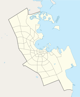
Nuaija is a district in Qatar, located in the municipality of Ad Dawhah.
Mushayrib District in Ad-Dawhah, Qatar

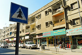
Mushayrib is a district in Qatar, located in the municipality of Ad Dawhah. As of the 2010 census, the former district of Al Asmakh has been integrated into Mushayrib.

Al Qa`abiyah is a settlement in Qatar, located in the municipality of Ash Shamal. It is located 8 miles south-east of the city of Ar Ru'ays and is 7 miles from the coast. J.G. Lorimer mentioned Al Qa`abiyah in 1908 in his Gazetteer of the Persian Gulf, remarking on the presence of a masonry well yielding good water.

Al Buainain is a clan of Bani Tamim tribe, and the clan is divided to three main branches which are al-Muhammad and al-Ali. The clan is based primarily in Eastern Province of Saudi Arabia, Qatar, United Arab Emirates and Bahrain. The tribe used to be involved in the lucrative pearl diving industry.

The Al Muhannadi also spelled as Al-Mohannadi tribe is an Arab tribal confederation of bedouin origins, based primarily in the Arab states of the Persian Gulf, especially in Qatar. Being a tribal confederation that emerged in the coastal town of Al Khor, the larger portion of its members belong to the Bani Hajer tribe. It is also known as Al Mahanda. The leading family of the tribe is the Al Misned family.

Bani Jamra Village in Northern Governorate, Bahrain

Bani Jamra is a village in the north-west of Bahrain. It lies west of the capital Manama, east of the coastal village of Budaiya. It is administered under the Northern Governorate.

Agriculture in Qatar

Agriculture in Qatar is inherently limited in scope due to the harsh climate and lack of arable land. In spite of this, small-scale farming, nomadic herding, and fishing were the predominant means of subsistence in the region prior to the 20th century. Sea-based activities such as pearling and fishing served as the primary sources of income for Qataris until the commencement of oil drilling in 1939.

Al Markhiya District in Ad-Dawhah, Qatar

Al Markhiya is a neighborhood of Doha, Qatar. It is one of the later-developed areas of northern Doha. The district hosts three awsaq al-furjan complexes, which are part of a development project by the government to host all commercial establishments in centralized areas.

Seqaya is a suburb located in the Kingdom of Bahrain. It used to be a village separate from the capital Manama, but rapid urbanization of the city engulfed the village. It is predominantly a residential area and lies close to Salmaniya.

Janabiyah Village in Northern Governorate, Kingdom of Bahrain

Janabiyah (Arabic:الجنبية) is a village situated in the north-west of Bahrain, close to the Gulf of Bahrain. It is located south of Bani Jamra and to the west of the village of Saar. It is under the Northern Governorate administrative region of the country. The village is mainly popular for its camel farms that host around 100 camels.
Sanabis

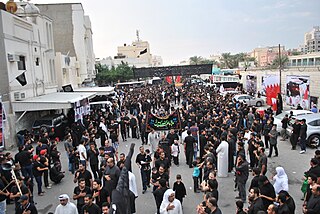
Sanabis is a village located in the Kingdom of Bahrain, in the suburbs of the capital city, Manama.

Al Mukaynis is a locality of Mebaireek located in the municipality of Ar Rayyan, Qatar. Mudhlem Cave, which translates to "Dark Cave" in Arabic, is located in the area. Nearby Al Rekayya Farms is a popular bird watching site.

Al Sakhama Village in Al Daayen, Qatar

Al Sakhama is a village in Qatar, located in the municipality of Al Daayen. It is situated near the border with Umm Salal Municipality.

Al Luqta District in Al Rayyan, Qatar

Al Luqta is a district of Al Rayyan City in Qatar, located in the municipality of Al Rayyan.

Umm Al Houl District in Al Wakrah, Qatar

Umm Al Houl is a district in Qatar located in the municipality of Al Wakrah. To the north of Umm Al Houl is the city of Al Wakrah while Mesaieed is to the south.

Tenbek Village in Al Daayen, Qatar

Tenbek is a village in Qatar located in the municipality of Al Daayen.

References

  1. Holes, Clive (2001). Dialect, culture, and society in eastern Arabia ([Online-Ausg.]. ed.). Boston: Brill. p. XXXII. ISBN   9789004107632.
  2. Lorimer, John Gordon. "'Gazetteer of the Persian Gulf. Vol. II. Geographical and Statistical. J G Lorimer. 1908' [221] (244/2084)". Qatar Digital Library . British Library: India Office Records and Private Papers. Retrieved 12 May 2018.

Coordinates: 26°10′N50°35′E / 26.167°N 50.583°E / 26.167; 50.583

Geographic coordinate system Coordinate system

A geographic coordinate system is a coordinate system that enables every location on Earth to be specified by a set of numbers, letters or symbols. The coordinates are often chosen such that one of the numbers represents a vertical position and two or three of the numbers represent a horizontal position; alternatively, a geographic position may be expressed in a combined three-dimensional Cartesian vector. A common choice of coordinates is latitude, longitude and elevation. To specify a location on a plane requires a map projection.