
Sagarmāthā was one of the fourteen zones of Nepal until the restructuring of zones into provinces. The headquarters of Sagarmatha is Rajbiraj. Sagarmāthā is a Nepali word derived from सगर (sagar) meaning "sky" and माथा (māthā) meaning "head".

Okhaldhunga is the headquarters of the Okhaldhunga District in the Sagarmatha Zone of Nepal. At the time of the 1991 Nepal census it had a population of 3761 living in 790 individual households.

Khotang District is one of 14 districts of Province No. 1 of eastern Nepal. The district, with Diktel as its district headquarters, covers an area of 1,591 km2 (614 sq mi) and has a population (2011) of 206,312. The district has been bordered by Bhojpur District in the east, Udayapur district in the south, Okhaldhunga district in the west and Solukhumbu district in the North.

Okhaldhunga District is one of 14 districts of Province No. 1 in eastern Nepal. The district, with Okhaldhunga as its district headquarters, covers an area of 1,074.5 km2 (414.9 sq mi) and had a population of 156,702 in 2001 and 147,984 in 2011.
Solukhumbu District (Nepali: सोलुखुम्बु जिल्ला [solukʰumbu], Sherpa: ཤར་ཁུམ་བུ་རྫོང་ཁ།, Wylie: shar khum bu dzong kha) is one of 14 districts of Province No. 1 of eastern Nepal. As the name suggests, it consists of the subregions Solu and Khumbu.
Wambule is the language of the Wambule Rai, one of the Kiranti (किरान्ती) tribes of eastern Nepal. Wambule is spoken by more than 5000 people living around the confluence of the Sunkosi (सुनकोसी) and Dudhkosi (दूधकोसी) rivers near Kui-Bhir Hill. The Wambule-speaking area comprises the southernmost part of Okhaldhunga district, the westernmost part of Khotang district, the northernmost part of Udayapur district, and the northeasternmost part of Sindhuli district.
Prapcha is a village development committee in Okhaldhunga District in the Sagarmatha Zone of mid-eastern Nepal. At the time of the 1991 Nepal census it had a population of 1259 living in 249 individual households.
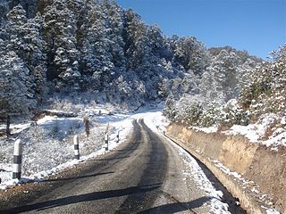
Rumjatar is a market in Siddhicharan Municipality in the Okhaldhunga District in the Sagarmatha Zone of mid-eastern Nepal. It neighbours the airport beside the Solukhumbu District. This village center was merged into the municipality in May 2014. At the 1991 Nepal census, it had a population of 2,825 in 600 households.
Baraneshwar is a village development committee in Okhaldhunga District in the Sagarmatha Zone of mid-eastern Nepal. At the time of the 1991 Nepal census it had a population of 3240 living in 656 individual households.
Phulbari is a village development committee in Okhaldhunga District in the Sagarmatha Zone of mid-eastern Nepal. At the time of the 1991 Nepal census it had a population of 3815 living in 708 individual households.
Pokli is a village development committee in Okhaldhunga District in the Sagarmatha Zone of mid-eastern Nepal. At the time of the 1991 Nepal census it had a population of 2610 living in 529 individual households.
Rajadip is a village development committee in Okhaldhunga District in the Sagarmatha Zone of mid-eastern Nepal. At the time of the 1991 Nepal census it had a population of 1784 living in 370 individual households.
Ratmata is a village development committee in Okhaldhunga District in the Sagarmatha Zone of mid-eastern Nepal. At the time of the 1991 Nepal census it had a population of 2507 living in 450 individual households.
Sisneri is a village development committee in Okhaldhunga District in the Sagarmatha Zone of mid-eastern Nepal. At the time of the 1991 Nepal census it had a population of 3542 living in 636 individual households.
Thoksela is a village development committee in Okhaldhunga District in the Sagarmatha Zone of mid-eastern Nepal. At the time of the 1991 Nepal census it had a population of 2128 living in 651 individual households.
Ubu, Nepal is a Village Development Committee in Okhaldhunga District in the Province No. 1 of mid-eastern Nepal. At the time of the 1991 Nepal census it had a population of 3075 residing in 604 individual households.
Yasam, Nepal is a village development committee in Okhaldhunga District in the Province No. 1 of mid-eastern Nepal. At the time of the 1991 Nepal census it had a population of 1661 living in 330 individual households.
Govindapur Malahanama is a village development committee in Siraha District in the Sagarmatha Zone of south-eastern Nepal. At the time of the 1991 Nepal census it had a population of 6758.
Sothayan is a village development committee in Siraha District in the Sagarmatha Zone of south-eastern Nepal. At the time of the 1991 Nepal census it had a population of 3004 people living in 539 individual households.

Siddhicharan is a municipality and the district headquarter of Okhaldhunga District in Province No. 1 of Nepal that was established in May 2014 by merging the two former Village development committees Andheri, Thulachhap, Jyamire, Salleri, Rumjatar and Okhaldhunga. It is named after the Nepali poet Siddhicharan Shrestha. At the time of the 2011 Nepal census it had a population of 27,995 people living in 6,994 individual households.