
The Yauyos Province is a province located in the Lima Region of Peru. It is one of the eleven that make up that region.
Tampukancha is an ancient Incan religious center located in Peru. It is located in the Cusco Region, Anta Province, Zurite District, about 30 miles from Cusco, the historic capital of the Inca Empire.

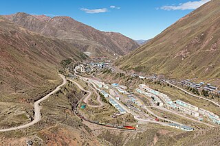
Incahuasi or Incawasi is an archaeological site in Peru. It is located in the Lima Region, Cañete Province, Lunahuaná District.
Ticllacocha is a lake in Peru located in the Lima Region, Yauyos Province, Tanta District. It is situated at a height of about 4,475 metres (14,682 ft), south of the lakes Paucarcocha, Chuspicocha and Piscococha and northwest of the mountains Ticlla and Huayna Cotoni.

Ticlla or Qutuni, also called Tiklla or Tiqlla, is a 5,897-metre-high (19,347 ft) mountain in the Cordillera Central in the Andes of Peru. Strictly speaking the popular name Ticlla refers to a group of peaks of the Qutuni-Ticlla cirque. The highest mountain of the massif is named Qutuni. It lies in a sub-range of the Cordillera Central named Pichqa Waqra.
Aqupallqa is a mountain in the Cordillera Central in the Andes of Peru, about 5,445 metres (17,864 ft) high. It is situated in the Lima Region, Yauyos Province, Tanta District. Aqupallqa lies north of the mountain Wayna Qutuni and the lake Tikllaqucha and northwest of the mountain Qutuni.

Tiktiqucha is a lake in Peru located in the Lima Region, Huarochirí Province, Chicla District. Tiktiqucha lies near the Antikuna mountain pass, southwest of a lake named Waqraqucha and southeast of the peak of Tikti Mach'ay.

Canchacanchajasa is a 4,987-metre-high (16,362 ft) mountain in the Urubamba mountain range in the Andes of Peru. It is located in the Cusco Region, Calca Province, Calca District, north of the Urubamba River. Canchacanchajasa is situated southeast of Sirihuani, north of Cóndorhuachana and Huamanchoque and southwest of Sahuasiray. It lies in the upper part of the Cancha Cancha valley (kancha kancha) at the Lares trek.
Carhuascancha or Tumarinaraju is a mountain in the Cordillera Blanca in the Andes of Peru with an elevation of 5,648 metres (18,530 ft) or 5,668 metres (18,596 ft) above sea level. It is situated in the Ancash Region, Huari Province, Huantar District, and in the Huaraz Province, Huaraz District. Carhuascancha lies north-west of Huantsán.
Yuraq Kancha is a mountain in the Wansu mountain range in the Andes of Peru, about 5,000 metres (16,404 ft) high. It is situated in the Cusco Region, Chumbivilcas Province, Santo Tomás District. Yuraq Kancha lies north of Minasniyuq and Qullpa K'uchu. The river Qañawimayu originates near the mountain.
Inka Kancha is a 5,146-metre-high (16,883 ft) mountain in the Andes of Peru. It is situated in the Lima Region, Huarochiri Province, Chicla District. Inka Kancha lies near the Antikuna mountain pass, south of Sillaqaqa.
Kaywa is a mountain in the Andes of Peru, about 4,800 m (15,748 ft) high. It is situated in the Huancavelica Region, Huancavelica Province, Acobambilla District, and in the Lima Region, Yauyos Province, Huantán District. Kaywa lies west of Wich'iqucha and northwest of Quylluqucha.
Qanchis Kancha is a mountain in the Andes of Peru, about 5,000 metres (16,404 ft) high. It is situated in the Lima Region, Huarochiri Province, Chicla District. Qanchis Kancha lies near the Antikuna mountain pass, southwest of Tikti Mach'ay and Jirish Mach'ay.
Wiqu is a mountain in the Paryaqaqa or Waruchiri mountain range in the Andes of Peru, about 5,200 m (17,060 ft) high. It is located in the Lima Region, Huarochirí Province, Quinti District, and in the Yauyos Province, Tanta District. Wiqu lies southwest of Paryaqaqa and northeast of Parya Chaka.
Patacancha is a 4,666-metre-high (15,308 ft) mountain in the Urubamba mountain range in the Andes of Peru. It is located in the Cusco Region, Urubamba Province, Ollantaytambo District. Patacancha lies at the Patacancha River above the village of Patacancha, northeast of Huarmaripayoc and southeast of Huacratanca.
Qhapaq Kancha is an archaeological site in Peru of the Inca period on top of a mountain of the same name. It is located in the Cusco Region, Calca Province, Coya District.
Hirka Kancha is a mountain in the Andes of Peru, about 5,000 m (16,000 ft) high. It is located in the Lima Region, Oyón Province, Oyón District.
Awki Sunqu is a mountain in the Cordillera Central in the Andes of Peru which reaches an altitude of approximately 5,050 m (16,570 ft). It is located in the Lima Region, Yauyos Province, in the districts of Huantan and Tupe. It lies west of the lakes named Wich'iqucha and Quylluqucha, south of Chuntani.
Muki is a mountain in the Cordillera Central in the Andes of Peru which reaches a height of approximately 4,800 metres (15,748 ft). It is located in the Lima Region, Yauyos Province, Tanta District. Muki lies northwest of Paqarin Pawka at a lake named Ch'uspiqucha.
Muki is a mountain in the Cordillera Central in the Andes of Peru which reaches a height of approximately 4,800 metres (15,748 ft). It is located in the Lima Region, Yauyos Province, on the border of the districts of Huancaya and Tomas.


