Lima Region

Last updated
Lima Region
Bandera Region Lima.png
Flag
Escudo Region Lima.png
Seal
Peru - Lima Department (locator map).svg
Location of the Lima region in Peru
Country Peru
Subdivisions10 provinces and 171 districts
Capital Lima
Government
  GovernorRicardo Chavarría
(2019–2022)
Area
  Total32,129.31 km2 (12,405.20 sq mi)
Highest elevation
5,654 m (18,550 ft)
Lowest elevation
0 m (0 ft)
Population
(2017)
  Total9,485,405
  Density300/km2 (760/sq mi)
UBIGEO
15
Dialing code 01
ISO 3166 code PE-LIM
Principal resourcesN/A
Poverty rateN/A
Percentage of Peru's GDP N/A
Website www.regionlima.gob.pe

The Lima Region (Spanish pronunciation:  [ˈlima] ) is located in the central coast of the country. Its capital and most populated city is the homonymous Lima. The province of Lima has a special autonomy regime in regional affairs, and the rest of the provinces are governed from the city of Huacho, seat of the Regional Government.

Lima Capital city in Peru

Lima is the capital and the largest city of Peru. It is located in the valleys of the Chillón, Rímac and Lurín rivers, in the central coastal part of the country, overlooking the Pacific Ocean. Together with the seaport of Callao, it forms a contiguous urban area known as the Lima Metropolitan Area. With a population of more than 9 million, Lima is the most populous metropolitan area of Peru and the third-largest city in the Americas, behind São Paulo and Mexico City.

Lima Province Province in Lima, Peru

Lima Province is located in the central coast of Peru and is the only province in the country not belonging to any of the twenty-five regions. Its capital is Lima, which is also the nation's capital.

Huacho Town in Lima, Peru

Huacho is a city in Peru, capital of the Huaura Province and capital of the Lima Region. It is located 223 feet above sea level and 148 km north of the city of Lima. The city is located on the Pan-American Highway and it is close to the Lachay National Reserve, so it has extensive vegetation and wildlife.

Contents

Geography

The region is bordered by the Ancash Region on the north, the Huánuco Region, Pasco Region, and Junín Region on the east, the Huancavelica Region on the southeast, the Ica Region on the south, and the Pacific Ocean and the Lima Province on the west.

The region has a coastal and an Andean zone, and has a great diversity of natural regions: the Costa or Chala (0 to 500 meters above sea level) up to the Janka or Cordillera (over 4800 meters). The predominating regions are the Yunga (500 to 2300 meters above sea level) and Quechua (2300 to 3500 meters)

Points of interest

Lomas de Lachay

Lomas de Lachay LomasLachay.jpg
Lomas de Lachay

The Lomas de Lachay, a unique mist-fed eco-system of wild plant and animal species, is a natural reserve located in the region.

Lunahuaná

Lunahuaná District of Cañete Province, is located 38 km away from the city of San Vicente de Cañete. The Incahuasi Archeological complex is located there. Lunahuaná has a dry climate and the sun shines during most of the year. Lately, Lunahuaná has become an adventure sports paradise, such as: Canotaje (Whitewater Rafting), Parapente & Ala Delta. Whitewater rafting is possible due to the Cañete River, which has rapids up to level 4. The main settlement in this district is the town of Lunahuaná.

Lunahuaná is a district in the middle Cañete Province in Peru. It is bordered by Imperial District on the west, San Vicente de Cañete District on the north, Pacarán District on the east, and Chincha Province on the south.

Cañete Province Province in Lima, Peru

Cañete is a province located in southern Lima Region, Peru. It is bordered by the Lima Province on the north, the Ica Region on the south, the Huarochirí and Yauyos provinces on the east, and the Pacific Ocean on the west. Its capital is the town of San Vicente de Cañete District. San Luis is the Capital of the Afro-Peruvian Folklore.

San Vicente de Cañete Place in Lima, Peru

San Vicente de Cañete, commonly known simply as Cañete, is a town in Peru, which is the capital of the Cañete Province, in the Lima Region. With a population of 85,533. Cañete is the main town of the San Vicente de Cañete District.

History

The remains of early Andean inhabitants, hunters and harpoon fishermen from more than 10,000 years ago, are to be found in the Lima region. These remains were found in Chivateros, near the Chillón River, and in various other places. These persons incorporated nets, hooks, farming, ceramics and weaving to their everyday objects. The inhabitants of the coast lived in the lomas and the valleys, where they built temples and dwelling complexes, leading to huge ceremonial centers, such as the Huacoy on the Chillón River; Garagay and La Florida (prehistoric) on the Rímac River, Manchay on the Lurín River; and Chancay, Supe and many other valleys to the north and south. There are finely ornamented temples with figures modeled in clay.

Chivateros cave in Peru

Chivateros is an ancient stone tool quarry and associated workshop located near the mouth of the Chillón river in the Ventanilla District, northwest of Lima, Peru.

Chillón River river in Peru

The Chillón River is a river located in western Peru. Its waters are produced by the melting of ice in the glaciers of the Andes, and its mouth is located in the Pacific Ocean coast of the Callao Region. Its volume gets higher during the summer months. The river's valley is very fertile. It has been inhabited by varying indigenous cultures for more than ten thousand years, as shown by archeological evidence.

Rímac River Peruvian river

The Rímac River is located in western Peru and is the most important source of potable water for the Lima and Callao Metropolitan Area.

Lithic prehistoric projectile points of Paijan type were found at Ancon (archaeological site) 40 kilometres north-east of Lima in the Chillón River Valley.

The 5,000-year-old ruins known as El Paraíso, Peru are also located in this area. A temple at the site is believed to be about 5,000 years old.

In 2006, a team of archeological researchers led by Robert Benfer announced their findings from a four-year excavation at Buena Vista, Peru in the Chillón River valley a few miles north of present-day Lima. They had discovered a 4200-year-old observatory constructed by an early Andean civilization, a three-dimensional sculpture, unique for the time period in this region, and sophisticated carvings. The observatory is on top of a 33-foot pyramidal mound and has architectural features for sighting the astronomical solstices. The discovery pushes back the time for the development of complex civilization in the area and has altered scholars' understanding of Preceramic period cultures in Peru. [1]

The Lima culture (100 A.D. to 650 A.D.) arose in this area, specially in the central valleys from Chancay to Lurín. It was distinguished by painted adobe buildings.

During this time, the Huari conquest took place, thus giving rise to Huari-style ceramics, together with a local style known as Nievería. As the population grew, their culture changed. With the decline of the Huari, whose most important center was Cajamarquilla, new local cultures arose. The Chancay are the most well known. They developed large urban centers and a considerable textile production, as well as mass-produced ceramics.

At this stage in the mid-fifteenth century, the Incas arrived from their base in the Andes. They conquered and absorbed the regional cultures and occupied important sites such as Pachacamac, turning it into an administrative center.

Political division

The region is divided into 10 provinces, which are composed of 171 districts.

Places of interest

Related Research Articles

Lima metropolitan area Place in Peru

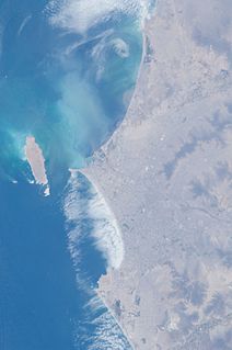
The Lima metropolitan area, is an area formed by the conurbation of the Peruvian city-provinces of Lima and Callao. It is the largest of the metropolitan areas of Peru, the seventh largest in the Americas, the fourth largest in Latin America, and among the thirty largest in the world. The conurbation process started to be evident in the 1980s. The metropolitan area is composed of six subregions. These are Lima Norte, Lima Sur, Lima Este, Residential Lima, Central Lima, and Callao. Its estimated 2018 population is 12 million according to INEI statistics.

Chinchay Suyu

Chinchasuyu was the northwestern provincial region of the Tawantin Suyu, or Inca Empire. The most populous suyu, Chinchasuyu encompassed the former lands of the Chimú Empire and much of the northern Andes. At its largest extent, the suyu extended through much of modern Ecuador and just into modern Colombia. Along with Antisuyu, it was part of the Hanan Suyukuna or "Upper Quarters" of the empire.

Huaura Province Province in Lima, Peru

Huaura is one of nine provinces of the Department of Lima on the Pacific coast of Peru. It has a population of about 180,000 inhabitants. It is bordered by the province of Barranca and the Ancash Region in the north, the provinces of Cajatambo and Oyón and the Pasco Region in the east, the province of Huaral in the south and the Pacific Ocean in the west. The capital of the province is Huacho.

Ferrocarril Central Andino

Ferrocarril Central Andino (FCCA) is the consortium which operates the Ferrovías Central railway in Peru linking the Pacific port of Callao and the capital Lima with Huancayo and Cerro de Pasco. As one of the Trans-Andean Railways it is the second highest in the world constructed by the Polish engineer Ernest Malinowski in 1871–1876.

Huaral Place in Lima, Peru

Huaral is a town in central Peru, capital of the Huaral Province in the Department of Lima.

Huaral Province Province in Lima, Peru

The Huaral Province is one of the nine provinces in the Lima Region of Peru. It was created by Law No. 21488 on May 11, 1976 by president Francisco Morales Bermúdez out of eight districts of the Canta Province and four of the Huaura Province. Geographically, its territory extends around the valley of the Chancay River from the mountainous frontier of the Pasco Region and Junín Region up to the Pacific Ocean.

Chancay District, Huaral District in Lima, Peru

Chancay District is one of twelve districts of the province Huaral in Peru.

Lima culture

The Lima culture was an indigenous civilization which existed in modern-day Lima, Peru during the Early Intermediate Period, extending from roughly 100 to 650. This pre-Incan culture, which overlaps with surrounding Paracas, Moche, and Nasca civilizations, was located in the desert coastal strip of Peru in the Chillon, Rimac and Lurin River valleys. It can be difficult to differentiate the Lima culture from surrounding cultures due to both its physical proximity to other, and better documented cultures, in Coastal Peru, and because it is chronologically very close, if not over lapped, by these other cultures as well. These factors all help contribute to the obscurity of the Lima culture, of which much information is still left to be learned.

Lake Paucarcocha is a lake in Peru located in the Lima Region, Yauyos Province, Tanta District. It is situated at a height of about 4,284 metres (14,055 ft), about 6.5 km long and 0.87 km at its widest point. It has a catchment area of 213.6 km2. Lake Paucarcocha lies south of the Pariacaca mountain range, between P'itiqucha in the northwest and Piscococha and Chuspicocha in the southeast. Moreover, the lake is located inside the valley of the Cañete River, being this river its primary inflow and outflow source.

The Ligas Provinciales del Peru are the Peruvian football lower divisions. They are administered by the Local Federations. The level immediately above is the Ligas Departamentales.

Ichma, Yschma, Ychsma, Ishma, or Ishmay was a pre-Inca indigenous polity later absorbed by Tawantinsuyu and reorganized as a wanami (province), the Ishmay Kingdom was located south of Lima, Peru in the Lurin valley; it later spread north into the Rimac valley. The Ichma culture was formed around 1100 AD following the breakup of the Wari Empire. Ishma autonomy lasted until around 1440 when they were absorbed into the Incan Empire.

Chancay culture

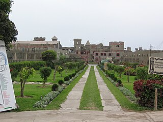
The Chancay were a pre-Columbian archeological civilization which developed between the valleys of Fortaleza, Pativilca, Supe, Huaura, Chancay, Chillón, Rimac and Lurin, on the central coast of Peru, from about CE 1000 to 1470.

Incahuasi, Lima archaeological site

Incahuasi or Incawasi is an archaeological site in Peru. It is located in the Lima Region, Cañete Province, Lunahuaná District.

Challwaqucha may refer to:

Awkin mountain in Peru

Awkin is a 5,183-metre-high (17,005 ft) mountain in the Andes of Peru. It is located in the Lima Region, Cajatambo Province, on the border of the districts of Cajatambo and Gorgor, and in the Oyón Province, Oyón District.

References

  1. Richard Lovett, "Oldest Observatory in Americas Discovered in Peru", National Geographic, May 2006, accessed 2 Nov 2010

Coordinates: 12°02′36″S77°01′42″W / 12.043333°S 77.028333°W / -12.043333; -77.028333