Aberdeenshire is one of the 32 council areas of Scotland.

The Islamabad Capital Territory is the only federal territory of Pakistan that is centred around Islamabad, the capital of Pakistan. Located on the northern edge of the Pothohar Plateau and at the foot of the Margalla Hills, in the northwestern area of the Punjab region, the territory shares borders with the province of Khyber Pakhtunkhwa in the west and with the province of Punjab in the remaining directions. It covers an area of 906.5 square kilometres (350.0 sq mi) and according to the 2023 national census, has a population of over 1 million in the city proper, while over 2 million in the whole territory. The territory is represented in the National Assembly by NA-52, NA-53, and NA-54 constituencies and by four seats in the Senate.

Islamabad is the capital city of the Islamic Republic of Pakistan. It is the country's ninth-most populous city with a population of over 1.2 million people and is federally administered by the Pakistani government as part of the Islamabad Capital Territory. Built as a planned city in the 1960s and established in 1967, it replaced Karachi as Pakistan's national capital.

Lilongwe is the capital and largest city of Malawi. It has a population of 989,318 as of the 2018 Census, up from a population of 674,448 in 2008. In 2020 that figure was 1,122,000. The city is located in the central region of Malawi, in the district of the same name, near the borders with Mozambique and Zambia, and it is an important economic and transportation hub for central Malawi. It is named after the Lilongwe River.

The province of Badajoz is a province of western Spain located in the autonomous community of Extremadura. It was formed in 1833. It is bordered by the provinces of Cáceres in the north, Toledo, Ciudad Real in the east, Córdoba in the south-east, Seville, and Huelva in the south and Portugal in the west.

Basel-Stadt or Basel-City is one of the 26 cantons forming the Swiss Confederation. It is composed of three municipalities with Basel as the capital. It is traditionally considered a "half-canton", the other half being Basel-Landschaft, its rural counterpart.

The canton of Zurich is an administrative unit (canton) of Switzerland, situated in the northeastern part of the country. With a population of 1,553,423, it is the most populous canton of Switzerland. Zurich is the de facto capital of the canton, but is not specifically mentioned in the constitution. The official language is German. The local Swiss German dialect, called Züritüütsch, is commonly spoken.

In macroeconomics, the labor force is the sum of those either working or looking for work :

Mohali, officially Sahibzada Ajit Singh Nagar, is a planned city in the Mohali district in Punjab, India, which is an administrative and a commercial hub lying south-west of Chandigarh. It is the headquarters of the Mohali district and one of the six Municipal Corporations of the State. It is officially named after Sahibzada Ajit Singh, the eldest son of Guru Gobind Singh.

Meiji Seika Pharma Co., Ltd., formerly Meiji Seika Kaisha, Ltd. is a Japanese pharmaceutical company. It is currently a subsidiary of Meiji Holdings and a Japanese leader in the area of infectious disease with 18% market share. It markets treatments for depression, obsessive-compulsive disorder, vaccines and allergy drugs. Meiji Pharma is doing research in generic anticancer drugs and biosimilars with partner organisations.

Kabaya Foods Corporation is a Japanese confectionery company founded in 1946.

Gautam Buddha Nagardistrict is a district of Uttar Pradesh, named after Gautama Buddha. It is a part of Delhi National Capital Region (NCR) and is divided into 3 sub-divisions (Tehsils) of Noida, Dadri and Jewar. Greater Noida is the administrative headquarters of Gautam Buddha Nagar district. Noida, Greater Noida, Dadri, Jewar, YEIDA city and Dankaur fall under this district.

Ziyang prefecture-level city in eastern Sichuan province, China. It is bordered by the provincial capital of Chengdu to the northwest, Deyang to the north, Suining to the northeast, Chongqing municipality to the east, and Neijiang to the west. Its development is going to be very important because of the proximity of Chengdu new Airport and economic zone. As of the 2020 Chinese census, Ziyang's total population was 2,308,631 inhabitants whom 867,119 lived in the built-up area made of Yanjiang District.

Bidhannagar, also known as Salt Lake City is a satellite city of Kolkata in North 24 Parganas district in the Indian state of West Bengal. The population within city limits was 2,18,323 at the 2011 census, it has increased since 2001 census. After a successful extension of the city limits in June 2015, Bidhannagar's population increased to 6.7 lakhs residents. It is now the fourth-most populous city in West Bengal, after Kolkata, Howrah and Asansol.
K.K. Nagar is a neighbourhood located in the southern part of Chennai, India. This is situated west of Ashok Nagar and the Chennai Airport is around 10 km southwest of this place. K.K. Nagar was a locality developed in the 1970s and early 1980s. K.K. Nagar is roughly 5 km2 in area. K.K. Nagar is organized by sectors and streets, and there are 15 sectors, and around 102 streets.

Ražanj is a village and municipality located in the Nišava District of southern Serbia. The municipality consists of 23 settlements having a total population of 9,150 inhabitants, with 1,245 inhabitants living in Ražanj itself. The municipality covers an area of 289 square kilometers and it is located 50 kilometers (31 mi) northwest of Niš.

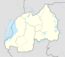
Ngororero District is a district (akarere) in Western Province, Rwanda. Its capital is the town of Ngororero.

Urbanization in India began to accelerate after independence, due to the country's adoption of a mixed economy, which gave rise to the development of the private sector. The population residing in urban areas in India, according to the 1901 census, was 11.4%, increasing to 28.53% by the 2001 census, and is now currently 34% in 2017 according to the World Bank. According to a survey by the United Nations, in 2030 40.76% of country's population is expected to reside in urban areas. As per the World Bank, India, along with China, Indonesia, Nigeria, and the United States, will lead the world's urban population surge by 2050.
The Prairie Ridge State Natural Area is a 4,101-acre (1,660 ha) collaborative natural area managed by the Illinois Department of Natural Resources. It is managed for the benefit of endangered, threatened, watch list, and area sensitive species associated with the tallgrass prairie habitat of south-central Illinois, especially the greater prairie chicken. The natural area is split between land parcels in Jasper County and Marion County, in the U.S. state of Illinois.

The Yokohama B-Corsairs are a Japanese professional basketball team that compete in the first division of the B.League. Following the team's establishment in 2010, they participated in the Eastern Conference of the bj league for five seasons and in 2013 became the first team based in the Kanto region of Japan to win the league's championship.


