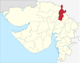
Sabarkantha district is one of the 33 districts of Gujarat state of India and is located in the northeastern part of the state. The administrative headquarters of the district are located in Himmatnagar.
Shams-ud-Dīn Muzaffar Shah II or Muzafar II, born Khalil Khan, was a ruler of the Muzaffarid dynasty, who reigned over the Gujarat Sultanate from 1511 to 1526. He subdued Idar but came in conflict with Rana Sanga of Mewar when he captured Malwa.

Idar State or Edar, was an independent state that was located in present-day Gujarat state of India. During the British Raj, it was the most important state of the Mahi Kantha Agency, within the Gujarat Division of Bombay Presidency.
The Gujarat Local Authorities Laws (Amendment) Bill, 2009 is a law passed by the Gujarat Assembly in December 2009. The bill provides for reservation of 50% seat in local government and makes voting compulsory. The bill amended the Bombay Provincial Municipal Corp Act 1949, the Gujarat Municipalities Act 1963, and the Gujarat Panchayat's Act 1993.
Bolundra is a village and former Rahevar[Rever]Rajput petty princely state and taluka in Mahi Kantha.

Punsari is a village located in Sabarkantha district in the state of Gujarat, India. Punsari is considered as India's smartest village. The village is located at about 80km from the state capital, Gandhinagar. Punsari is 20km from Parvati Hills. Parvati Hills is the largest table top land of India. The village follows the Panchayati raj system. The village has undergone a transformation under the panchayat. There has been use of new and advanced technology in education. This village has wi-fi connection for all people. Efforts have been made for the empowerment of women and increasing security in the village. Some of the facilities provided by the panchayat include local mineral water supply, sewer & drainage project, a healthcare centre, banking facilities and toll-free complaint reception service. Consequently, Punsari received the award of being the best Gram Panchayat in Gujarat. The village's model has been appreciated by delegates from Nairobi and they are keen to replicate this in Kenyan villages.
Nakhatrana Taluka is a taluka in Kutch District, Gujarat, India. Its administrative centre is the village of Nakhatrana. The taluka covers 2,135.14 square kilometres (824 sq mi).
Fulay is a panchayat village in Gujarat, India. Administratively it is under Abdasa Taluka, Kutch District, Gujarat. Fulay is 19 km by road northwest of the town of Naliya.
Mothala is a panchayat village in Gujarat, India. Administratively it is under Abdasa Taluka, Kutch District, Gujarat. Mothala is 23 km by road northeast of the village of Kothara, and 33 km by road southwest of the village of Nakhatrana. Mothala is located on the rail line from Bhuj to Naliya; formerly military only, it now carries commercial freight and passengers, and is scheduled to be upgraded from metre to broad gauge.
Bhanada is a panchayat village in Gujarat, India. Administratively it is under Abdasa Taluka, Kutch District, Gujarat. The village of Bhanada is the only village in Bhanada gram panchayat. It is 12 km by road southeast of the town of Naliya along National Highway 8A, and 11 km along the same road northwest of the village of Kothara.
Dumara is a panchayat village in Gujarat, India. Administratively it is under Abdasa Taluka, Kutch District, Gujarat. The village of Dumara sits on the left (west) bank of the Chok River, an intermittent stream. It is 20 km (12 mi) by road southeast of the village of Kothara along National Highway 8A, and 38 km (24 mi) along the same road northwest of the town of Mandvi.
Vallabhipur Taluka is a taluka of Bhavnagar District, India. It was named after the capital, Vallabhipur, of the Maitraka Dynasty who ruled in this area from 470 AD to 788 AD.

Idar railway station is a small railway station in Sabarkantha district, Gujarat. Its code is IDAR. It serves Idar city. The station consists of two platforms. The platforms are not well sheltered. It lacks many facilities including water and sanitation. Idar Lies on metre gauge track of Khed Brahma-Himmatnagar-Ahmadabad. This is one a few metre gauge lines which still runs.
Lakhapadar is a village and former non-salute princely state on Saurashtra peninsula in Gujarat, western India. About Lakhapadar
Vakhtapur is a village and former non-salute princely state in Gujarat, western India.
Mota Kotarna is a village and former petty princely state on Saurashtra peninsula, in Gujarat, western India.
Chandap is a village and former princely state on Saurashtra peninsula, in Gujarat, western India.
Derol or Dedol is a village and former princely state in Gujarat, western India.