Kaikaram RaRaju | |
|---|---|
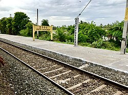 Kaikaram railway station signboard | |
 Dynamic map | |
 Kaikaram Location in Andhra Pradesh, India  Kaikaram Kaikaram (India) | |
| Coordinates: 16°48′43″N81°21′58″E / 16.812°N 81.366°E | |
| Country | |
| State | Andhra Pradesh |
| District | West Godavari |
| Talukas | Unguturu, West Godavari district |
| Government | |
| • Type | Democratic |
| • Body | Gram Panchayat |
| Languages | |
| • Official | Telugu |
| Time zone | UTC+5:30 (IST) |
| PIN | 534416 |
| Telephone code | 91-8818 |
Kaikaram is one of the major panchayats in the Unguturu mandal of West Godavari district, Andhra Pradesh, India. Kaikaram (KKRM) has its own train station connecting to major cities.