
The Helsinki Metro is a rapid transit system serving the Helsinki capital region, Finland. It is the world's northernmost metro system. It was opened to the general public on 2 August 1982 after 27 years of planning. It is operated by Helsinki City Transport and Metropolitan Area Transport Ltd for Helsinki Regional Transport Authority and carries 92.6 million passengers per year.

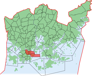
Lauttasaari is an island in Helsinki, Finland, about 3 kilometres (1.9 mi) west of the city centre. Together with some surrounding unpopulated small islands, Lauttasaari is also a district of Helsinki. With 23,226 residents as of 2017, the island is Finland's second largest by population, after Fasta Åland. Its land area is 3.85 km2.

Länsimetro is an extension to the Helsinki Metro system in Finland, which opened on 18 November 2017. Länsimetro extends the system's two lines, M1 and M2, from Central Helsinki to the neighbouring city of Espoo. The new stretch continues the lines from the existing Ruoholahti station via the island of Lauttasaari, the Aalto University Otaniemi campus and Tapiola, the terminus of line M2. Line M1 continues further west to Matinkylä. Unlike previous extensions to the Helsinki Metro system, Länsimetro runs entirely underground. The second phase opened on 3 December 2022 and continues the line further west to Kivenlahti, near the municipal border of Kirkkonummi.

Trams in Helsinki form part of the public transport system organised by Helsinki Regional Transport Authority and operated by Metropolitan Area Transport Ltd in Finland's capital city of Helsinki. The trams are the main means of transport in the city center, and 56.8 million trips were made on the system in 2019. In addition to the older tram network, there is a single light rail line that was opened in October 2023. Although technically compatible with the tram network, the light rail line is separate from the city center tram network.

Aleksanterinkatu is a street in Kluuvi, the commercial centre of Helsinki, Finland. In the city plan by Carl Ludvig Engel, it was the Decumanus Maximus, the main east–west street in the city, crossing the Cardo, Unioninkatu (Union Street) at the corner of the Senate Square.

Erottaja, Swedish: Skillnaden; Swedish:[ˈʃil.naːden]; lit. 'the difference'), is a public square near the centre of Helsinki, Finland.

Public transport in Helsinki consists of bus, tram, metro, local railway and ferry services. The system is managed by the Helsinki Regional Transport Authority and covers Helsinki, Espoo, Kauniainen, Vantaa and the outlying Kerava, Kirkkonummi, Sipoo and Tuusula.

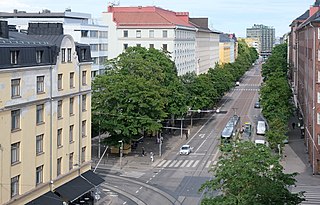
Hämeentie is the second longest street in Helsinki, Finland, and among its major thoroughfares. Hämeentie is a multi-lane street beginning at the Hakaniemi square in Siltasaari, and ending near Vanhankaupunginkoski on Koskelantie.

Jätkäsaari is a peninsula and a quarter in Helsinki, the capital city of Finland. It is part to the Kampinmalmi district and Länsisatama neighbourhood. It was the site of the main container harbour in Helsinki until late 2008, when the harbour moved to the new facilities in Vuosaari. The terminals for passenger ferries to Tallinn and Saint Petersburg remain in Jätkäsaari at the West Harbour.
Vironniemi is a district of Helsinki, Finland, forming the core part of the city centre, thus also the central location of the Finnish governmental and financial decision making, and the location of Helsinki's most important churches. Vironniemi is the location of the Presidential Palace, the Palace of the Finnish Council of State, the Senate Square, the Helsinki Cathedral, the Uspenski Cathedral and the main office of the Bank of Finland.

Nordenskiöldinkatu is a frequently trafficked street in Helsinki, Finland, going from Taka-Töölö to Alppila and Pasila. It was named after the explorer Adolf Erik Nordenskiöld.
The city of Helsinki and the neighbouring city of Vantaa have plans for a radical expansion of the Helsinki tram network within the 2020s and 2030s that would more than double the length of the network from 2021. If completed, the plans would both extend the current tram lines and build new light rail lines.

Töölöntori is an urban square and marketplace in the Töölö district of central Helsinki, Finland. It is bounded in the west by Runeberginkatu and the southern end of Topeliuksenkatu, in the north by Tykistönkatu; Töölöntorinkatu forms its eastern limit, and Sandelsinkatu its southern.

Runeberginkatu is a major street in central Helsinki, Finland. Starting from Kampintori, it runs in a sweeping arc broadly northwards for approximately 1.8 kilometres (1.1 mi) through the districts of Kamppi and Töölö, via Töölöntori square, terminating at a junction with Mannerheimintie by the Finnish National Opera.
Helsinginkatu is a two-kilometre-long east-west-running street in Helsinki, Finland. The street runs from Hämeentie to Mannerheimintie. The street separates the districts of Kallio and Alppiharju, however the part west to the railway underpass belongs to Taka-Töölö. The eastern part of the street is a 30-metre-wide avenue, with buildings on both sides. Between the avenue part and the railway underpass there are only buildings on the southern side of the street, except for the Helsinki Sports House. To the west of the railway the street runs along the shore of the Töölönlahti bay and the only buildings on it are the Finnish National Opera and Ballet and restaurant Töölönranta. Helsinginkatu is lit with lights hanging from wires and paved with asphalt throughout its length. There is also a tram track running throughout the street.

Mikonkatu is a street in central Helsinki, Finland, leading north from the Esplanadi Park to the Kaisaniemi Park, mostly converted into a pedestrian street in 1992.

Sompasaari is an island on the Kruunuvuorenselkä water area in the Sörnäinen district in Helsinki, Finland. On the southern side of the Nihdinkanava channel built in the middle of Sompasaari is the island of Nihti.

Local and regional bus services are a large part of public transport in the Helsinki region. HSL bus services include internal services in Helsinki, Espoo, Kauniainen, Vantaa, Kerava, Kirkkonummi, Sipoo, Siuntio and Tuusula and regional services between them.

Kaisantunneli is a tunnel for bicycle and pedestrian use in central Helsinki, Finland, serving as the main east–west cycling thoroughfare in the city centre.
