Kalagunan

Last updated
Kalagunan
Village
Location map New Britain and Ireland.png
Red pog.svg
Kalagunan
Location
Coordinates: 3°29′S152°5′E / 3.483°S 152.083°E / -3.483; 152.083
Country Flag of Papua New Guinea.svg  Papua New Guinea
Province New Ireland Province
District Namatanai District

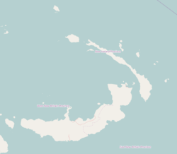
Kalagunan is a village on the west coast of New Ireland, Papua New Guinea. There is a point here known as Kalagunan Point [1] It is located in Sentral Niu Ailan Rural LLG. [2]

References

  1. Peterson, Boyd D.; Garren, William R.; Heyda, Charles M. (1982). Gazetteer of Papua New Guinea: names approved by the United States Board on Geographic Names. United States. Defense Mapping Agency, United States Board on Geographic Names. p. 210. Retrieved 30 December 2012.
  2. United Nations in Papua New Guinea (2018). "Papua New Guinea Village Coordinates Lookup". Humanitarian Data Exchange. 1.31.9.