
Demographic features of the population of Albania include population density, ethnicity, education level, health of the populace, economic status, religious affiliations and other aspects. The demography of the Albania is monitored by the Institute of Statistics of Albania. The institute has performed demographic censuses since the 1920s. The latest census in Albania was performed in April 2011, and has been deemed as unreliable both within and outside Albania.
Megalopoli is a town in the southwestern part of the regional unit of Arcadia, southern Greece. It is located in the same site as ancient Megalopolis. When it was founded in 371 BC, it was the first large urbanization in rustic Arcadia. Its theater had a capacity of 20,000 visitors, making it one of the largest ancient Greek theaters.

Western Greece Region is one of the thirteen administrative regions of Greece. It comprises the western part of continental Greece and the northwestern part of the Peloponnese peninsula. It occupies an area of 11,336 km2 (4,377 sq mi) and its population is, according to the 2011 census, at 679,796 inhabitants. The capital of the Western Greece is Patras, the third-largest-city in the country with a population of about 280,000 inhabitants. The NUTS 2 code for the region of Western Greece is EL63.

Western Macedonia is one of the thirteen administrative regions of Greece, consisting of the western part of Macedonia. Located in north-western Greece, it is divided into the regional units of Florina, Grevena, Kastoria, and Kozani. With a population of approximately 255,000 people, as of 2021, the region had one of the highest unemployment rates in the European Union.

Perama is a coastal town and a suburb of Piraeus and belongs to the Piraeus regional unit. It lies on the southwest edge of the Aegaleo mountains, on the Saronic Gulf coast. It is 8 km northwest of Piraeus, and 14 km west of the city of Athens. The municipality has an area of 14.729 km2. It forms the western terminus of the Port of Piraeus, and there is also a passenger port that provides ferry services to Salamis Island.

Peristeri is a city and a suburban municipality in the western part of the Athens agglomeration, Greece. With 133,630 inhabitants, it is the seventh-largest municipality and city of Greece by population.

Kalamata is the second most populous city of the Peloponnese peninsula, after Patras, in southern Greece and the largest city of the homonymous administrative region. As the capital and chief port of the Messenia regional unit, it lies along the Nedon River at the head of the Messenian Gulf.

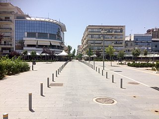
Komotini is a city in the region of East Macedonia and Thrace, northeastern Greece and its capital. It is also the capital of the Rhodope. It was the administrative centre of the Rhodope-Evros super-prefecture until its abolition in 2010, by the Kallikratis Plan. The city is home to the Democritus University of Thrace, founded in 1973. Komotini is home to a sizeable Turkish speaking Muslim minority. They were excluded from the 1923 population exchange. According to the 2021 census, the municipality of Komotini had population of 65,243 citizens.

The Greek diaspora, also known as Omogenia, are the communities of Greeks living outside of Greece and Cyprus.
Orestiada, is the northeasternmost, northernmost and newest city of Greece and the second largest town of the Evros regional unit of Thrace. Founded by Greek refugees from Edirne after the Treaty of Lausanne when the population exchange occurred between Turkey and Greece, in which the river Evros became the new border between the two countries. The population is around 20,000.

Epirus is a traditional geographic and modern administrative region in northwestern Greece. It borders the regions of Western Macedonia and Thessaly to the east, West Greece to the south, the Ionian Sea and Ionian Islands to the west and Albania to the north. The region has an area of about 9,200 km2 (3,600 sq mi). It is part of the wider historical region of Epirus, which overlaps modern Albania and Greece but lies mostly within Greek territory.

Lefkada City is a city and a former municipality on the island of Lefkada, Ionian Islands, Greece. Since the 2011 local government reform it is part of the municipality Lefkada, of which it is a municipal unit. It is the capital and main town of the island of Lefkada, located in the northern and northeastern part of the island. The city had a population of 9,253 inhabitants at the 2021 census. The municipal unit has a land area of 60.628 square kilometres (23.409 sq mi) and a population of 13,540 (2021).

Ermoupoli, also known by the formal older name Ermoupolis or Hermoupolis, is a town and former municipality on the island of Syros, in the Cyclades, Greece. Since the 2011 local government reform, it is part of the municipality Syros-Ermoupoli, of which it is the seat and a municipal unit. It is also the capital of the South Aegean region. The municipal unit has an area of 11.181 km2.

Sellana is a former municipality in the Karditsa regional unit, Thessaly, Greece, named after the ancient city of "Sellana" or "Silàna". Since the 2011 local government reform it is part of the municipality Palamas, of which it is a municipal unit. The municipal unit has an area of 89.490 km2. The seat of the municipality was in Proastio, which has 1,434 inhabitants (2021). Other communities in the municipal unit are those of Marathea, Agia Triada (548), Pedino (505) and Kalogriana (475).

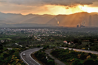
Visaltia is a municipality in the Serres regional unit, Greece. The seat of the municipality is in Nigrita. It was named after the ancient region Bisaltia. The ancient city of Berge is located here.

The Peloponnese Region is a region in southern Greece. It borders Western Greece to the north and Attica to the north-east. The region has an area of about 15,490 square kilometres. It covers most of the Peloponnese peninsula, except for the northwestern subregions of Achaea and Elis which belong to Western Greece and a small portion of the Argolid peninsula that is part of Attica.

Central Greece is one of the thirteen administrative regions of Greece. The region occupies the eastern part of the traditional region of Central Greece, including the island of Euboea. To the south it borders the regions of Attica and the Peloponnese, to the west the region of West Greece and to the north the regions of Thessaly and Epirus. Its capital city is Lamia.
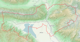
Sintiki is a municipality in the Serres regional unit, Central Macedonia, Greece. The seat of the municipality is the town Sidirokastro. The municipality has an area of 1,103.431 km2.

Argos-Mykines is a municipality in the Argolis regional unit, Peloponnese, Greece. The seat of the municipality is the city of Argos. The municipality has an area of 1002.508 km2.

