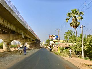
Vatluru is a village in Eluru district of the Indian state of Andhra Pradesh. It is located in Pedapadu mandal.
Vijayarai is a village in Eluru district of the Indian state of Andhra Pradesh. It is located in Pedavegi mandal of Eluru revenue division. It is located at a distance of 15 km from district headquarters Eluru city.

Denduluru is a village in the Eluru district of the Indian state of Andhra Pradesh. It is located on the north-east side of district headquarters Eluru at a distance of 11 km. It is a member of the Eluru revenue division. The Bhimalingadibba or the mounds are one of the centrally protected monuments of national importance.
Guntupalle is a village in Eluru District of the Indian state of Andhra Pradesh. It is located in Kamavarapukota mandal of Eluru revenue division. It is located at a distance of 42 km from district headquarters Eluru city. It is well known tourist destination famously known for Guntupalli caves. The nearest train station is Eluru railway station.
Tadikalapudi is a village in Eluru district of the Indian state of Andhra Pradesh. It is located in Kamavarapukota mandal of Eluru revenue division. It is located at a distance of 26 km from district headquarters Eluru city.
Mupparru is a village in Pedapadu mandal of Eluru district of the Indian state of Andhra Pradesh. It is located at a distance of 5 km from Eluru New bus station.
Epuru is a village in Eluru district of the Indian state of Andhra Pradesh. It is located in Pedapadu mandal of Eluru revenue division.
Dondapadu is a village in Eluru district of the Indian state of Andhra Pradesh. It is located in Pedavegi mandal of Eluru revenue division. It is located at a distance of 5 km from district headquarters Eluru city.
Gogunta is a village in Eluru district of the Indian state of Andhra Pradesh. It is located in Pedapadu mandal of Eluru revenue division. Nuzvid railway station is the nearest railway station.
Amrutalingampeta is a village in Eluru district of the Indian state of Andhra Pradesh. It is located in Pedapadu mandal of Eluru revenue division. The nearest railway stations are Vatlur and Nuzvid.
Borugagudem also spelled Burugu Gudem is a village in Eluru district of the Indian state of Andhra Pradesh. It is located in Pedapadu mandal of Eluru revenue division. The nearest train station is Bhadrachalam (BDCR) located at a distance of 31.2 KM.
Edulakunta is a village in Eluru district of the Indian state of Andhra Pradesh. It is located in Pedapadu mandal of Eluru revenue division. Kamareddi railway Station is the nearest train station located at a distance of more than 10Km.
Kokkirapadu is a village in Eluru district of the Indian state of Andhra Pradesh. It is located in Pedapadu mandal of Eluru revenue division. The nearest railway station is at Vatlur (VAT) located at a distance of 4.4 km.
Koniki is a village in Eluru district of the Indian state of Andhra Pradesh. It is located in Pedapadu mandal of Eluru revenue division. The nearest railway station is located at Chirala which is more than 10 km from Koniki.
Kothuru is a village in Eluru district of the Indian state of Andhra Pradesh. It is located in Pedapadu mandal of Eluru revenue division.
Nandikeswarapuram is a village in Eluru district of the Indian state of Andhra Pradesh. It is located in Pedapadu mandal of Eluru revenue division.
Rajupeta is a village in Eluru district of the Indian state of Andhra Pradesh. It is located in Pedapadu mandal of Eluru revenue division. The nearest train station is Vinnamangalam (VGM) located at a distance of 20.21 km.
Sakalakothapalle is a village in Eluru district of the Indian state of Andhra Pradesh. It is located in Pedapadu mandal of Eluru revenue division.
Satyavolu is a village in Eluru district of the Indian state of Andhra Pradesh. It is located in Pedapadu mandal of Eluru revenue division.
Tallagudem is a village in Eluru district of the Indian state of Andhra Pradesh. It is located in Pedapadu mandal of Eluru revenue division.


