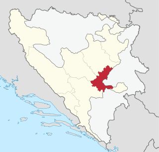
The Sarajevo Canton, officially the Canton of Sarajevo, is one of 10 cantons of the Federation of Bosnia and Herzegovina in Bosnia and Herzegovina. Its cantonal seat is the city of Sarajevo, also the capital city of Bosnia and Herzegovina.

Zavidovići is a town and municipality located in Zenica-Doboj Canton of the Federation of Bosnia and Herzegovina, an entity of Bosnia and Herzegovina. It is situated in central Bosnia and Herzegovina, located between Doboj and Zenica on the confluence of rivers Bosna, Krivaja and Gostović. It sits in a valley surrounded by many mountains of which the largest is Klek. As of 2013, the municipality had a population of 35,988 inhabitants and the town itself 8,174.

Šamac, formerly Bosanski Šamac is a town and municipality located in the northeastern part of Republika Srpska, an entity of Bosnia and Herzegovina. There are also small, uninhabited, parts located in Odžak municipality and in Domaljevac-Šamac municipality, Federation of Bosnia and Herzegovina.

The Serbian Autonomous Oblast of Bosanska Krajina was a self-proclaimed Serbian Autonomous Oblast within today's Bosnia and Herzegovina. It was sometimes called the Autonomous Oblast of Krajina, or the Autonomous Region of Krajina (ARK). SAO Bosanska Krajina was located in the geographical region named Bosanska Krajina. Its capital was Banja Luka. The region was subsequently included into Republika Srpska.

The SAO of Herzegovina was a self-proclaimed Serbian Autonomous Oblast within today's Bosnia and Herzegovina. It was proclaimed by the Assembly of the Association of Municipalities of Bosnian Krajina in 1991 and was subsequently included into Republika Srpska. SAO Herzegovina was located in the geographical region of Herzegovina. It was also known as SAO Eastern Herzegovina.

Prozor-Rama is a municipality located in Herzegovina-Neretva Canton of the Federation of Bosnia and Herzegovina, an entity of Bosnia and Herzegovina. Its seat is Prozor. Also, Ramsko lake is located in the municipality.

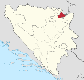
Brčko District, officially the Brčko District of Bosnia and Herzegovina, is a self-governing administrative unit in north-eastern Bosnia and Herzegovina.

This article is about the Demographic history of Bosnia and Herzegovina, and deals with the country's documented demographics over time. For an overview of the various ethnic groups and their historical development, see Ethnic groups in Bosnia and Herzegovina.

Čelić is a town and municipality located in Tuzla Canton of the Federation of Bosnia and Herzegovina, an entity of Bosnia and Herzegovina.
Vranovina is a village in the municipality of Bosanski Petrovac, Bosnia and Herzegovina.
Blagojevići is a village in the municipalities of Novo Goražde, Republika Srpska and Goražde, Bosnia and Herzegovina.
Bučje is a village in the municipalities of Novo Goražde, Republika Srpska and Goražde, Bosnia and Herzegovina.
Odžak is a village is a village in the municipalities of Novo Goražde, Republika Srpska and Goražde, Bosnia and Herzegovina.
Podhomara is a village in the municipalities of Novo Goražde, Republika Srpska and Goražde, Bosnia and Herzegovina.
Podkozara Donja is a village in the municipality of Novo Goražde, Republika Srpska, Bosnia and Herzegovina.
Radijevići is a village in the municipalities of Novo Goražde, Republika Srpska and Goražde, Bosnia and Herzegovina.
Ćesim is a village in the municipalities of Konjic and Nevesinje, Bosnia and Herzegovina.
Hrušta is a village in the municipality of Nevesinje, Republika Srpska and for a small part also in the City of Mostar, Bosnia and Herzegovina.
Veruša is a village in the municipality of Visoko, Bosnia and Herzegovina.


