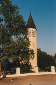
Hardap is one of the fourteen regions of Namibia, its capital is Mariental. Hardap contains the municipality of Mariental, the towns Rehoboth and Aranos, and the self-governed villages Gibeon, Gochas, Kalkrand, Stampriet and Maltahöhe. It is home to the Hardap Dam.

Keetmanshoop is a town in the ǁKaras Region of southern Namibia, lying on the Trans-Namib Railway from Windhoek to Upington in South Africa. It is named after Johann Keetman, a German industrialist and benefactor of the city.

Mariental is a town of 10,000 inhabitants in south-central Namibia, lying on the B1 national road 232 kilometres (144 mi) north of Keetmanshoop and 274 kilometres (170 mi) southeast of Windhoek. It lies at an elevation of 1,090 metres (3,580 ft). Mariental is connected to the TransNamib railway line from Windhoek to Keetmanshoop. The town and the surrounding area are situated in a hot, arid region.

Karasburg is a town with 4,000 inhabitants in the ǁKaras Region of southern Namibia and the district capital of the Karasburg electoral constituency. It lies at the heart of the southern Namibian sheep farming industry.

Berseba is a village in the ǁKaras Region of southern Namibia and the district capital of the Berseba electoral constituency. It is situated 100 km (62 mi) north-west of Keetmanshoop near the Brukkaros Mountain, a famous tourist destination.

Khorixas is a town with about 9,000 inhabitants in the southern part of the Kunene Region, Namibia. It was the capital of the Damaraland bantustan before Namibia's independence. It is the administrative capital of Khorixas Constituency. Most of the inhabitants are from the Damara ethnic group. The town is located near the Petrified Forest, Khorixas - a deposit of petrified wood and well known tourist attraction of Namibia. The Twyfelfontein valley, known for its rock art, is also accessible from Khorixas.

Maltahöhe is a village in southern central Namibia close to the Swartrand escarpment, about 110 km west of Mariental in the Hardap Region. It has about 6,000 inhabitants and owns about 17,000 hectares of land. Maltahöhe has two suburbs, the Andreville location and the Blikkiesdorp informal settlement which has neither sewerage nor electricity supply.
Gibeon is a village in Gibeon Constituency in the Hardap Region of Namibia. The village had 4,120 inhabitants in 2023.

Rehoboth Urban West is an electoral constituency in the Hardap region of Namibia, comprising the suburbs of Rehoboth that are situated to the west of the national road B1. It had a population of 11,197 in 2011, up from 9,238 in 2001. As of 2020 the constituency had 8,324 registered voters.

Mariental Urban is a constituency in the Hardap region of Namibia. It comprises the town of Mariental and the surrounding area. Mariental Urban had a population of 15,557 in 2011, up from 13,109 in 2001. As of 2020 the constituency had 10,480 registered voters.

Mariental Rural is a constituency in the Hardap region of Namibia. Its constituency office is situated in Stampriet. It had a population of 15,308 in 2011, up from 13,946 in 2001.

Otavi is a town with 10,000 inhabitants in the Otjozondjupa Region of Namibia. Situated 360 km north of Windhoek, it is the district capital of the Otavi electoral constituency.

Arandis is a mining town in the Erongo Region of western central Namibia. The town has 5,726 inhabitants. Originally a camp for workers of the nearby Rössing uranium mine, Arandis was declared a town in 1994.

Aroab is a village with a population of approximately 5,000 in the ǁKaras Region of southern Namibia. It is situated about 170 kilometres (110 mi) south-east of Keetmanshoop on the edge of the Kalahari desert; the average annual rainfall is about 150–200 mm. Aroab is the district centre of the Keetmanshoop Rural electoral constituency.
Okakarara is a town in Otjozondjupa Region, Namibia, located 50 kilometres (31 mi) southeast of Waterberg National Park. It has an estimated population of 7,000 and is currently growing by 1,500 inhabitants annually.
Tses is a village in the ǁKaras Region of southern Namibia with a population of approximately 1000; probably 1000 more live in the surrounding semi-desert farming hinterland. It is situated one kilometre off the main B1 highway from Windhoek to Noordoewer, opposite the turning to Berseba and the Brukkaros Mountain. Tses in Khoekhoegowab means 'place of daylight'.

Stampriet is a village in Hardap Region, Namibia. It is located 64 km north-east of Mariental and 1,177 metres (3,862 ft) above sea level, in a barren area on the upper reaches of the Auob River where humans and animals alike depend on borehole water. Stampriet is the administrative center of the Mariental Rural electoral constituency.

Aranos is a town in the Hardap Region of central Namibia, situated in the Nossob River basin in the Kalahari Desert. The town had 5,493 inhabitants in 2023.

Gochas is a village in the Hardap Region of Namibia. The village had 1,868 inhabitants in 2023.

Koës is a village in the ǁKaras Region of south-eastern Namibia. It is situated on the edge of the Kalahari desert and belongs to the Keetmanshoop Rural electoral constituency. The average annual rainfall is about 150-200 mm.


