B1 road (Namibia)

Last updated
Schild B1 NA.svg
B1 road
Map NAM B1.svg
Map of the B1.
Route information
Maintained by Roads Authority Namibia
Length1,467 km (912 mi)
Excluding the 74-kilometre (46 mi) central section designated Schild A1 NA.svg A1 since 2017.
Southern section
Length802 km (498 mi)
South endSA road N7.svg N7 at the South African border at Noordoewer
Major intersectionsSchild B3 NA.svg B3 at Grünau
Schild B4 NA.svg B4 near Keetmanshoop
North endSchild A1 NA.svgSchild B6 NA.svg A1  / B6 in Windhoek
Northern section
Length665 km (413 mi)
South endSchild A1 NA.svgSchild B2 NA.svg A1  / B2 near Okahandja
Major intersectionsSchild B8 NA.svg B8 at Otavi
Schild B15 NA.svg B15 at Tsumeb
Schild B10 NA.svg B10 near Oshikango
North end EN 120 at the Angolan border at Oshikango
Location
Country Namibia
Major cities
Towns
Highway system
Schild A1 NA.svg A1 Schild B2 NA.svg B2

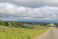
The B1 is a national highway of Namibia, and is the country's longest and most significant road, running the length of the country from south to north. It connects Noordoewer in the south on the South African border with Oshikango in the north on the Angolan border via Namibia's capital city Windhoek.

Contents

The route exists in two discontinuous sections: a southern 802-kilometre (498 mi) section from Noordoewer to Windhoek, and a northern 665-kilometre (413 mi) section from Okahandja to Oshikango. The central 74-kilometre (46 mi) section between Windhoek and Okahandja, previously part of the B1, was upgraded to freeway standard beginning in the 1970s and continuing to 2022, with the freeway sections now carrying the designation of A1.

The entirety of the B1, together with the former section of B1 now designated A1, forms part of the Tripoli-Cape Town Highway. The section between Okahandja and Otavi is part of the Walvis Bay-Ndola-Lubumbashi Development Road, and the former section of B1 now designated A1 from Okahandja to Windhoek forms part of the Trans-Kalahari Corridor.

Route

Important cities that the B1 passes through in a north–south direction include Oshikango, Ondangwa, Tsumeb, Otavi, Otjiwarongo, Okahandja, Windhoek, Rehoboth, Mariental, Keetmanshoop and Noordoewer.

Southern section: Noordoewer to Windhoek

The B1 begins on the South African border at a bridge over the Orange River near the town of Noordoewer, as a continuation of South Africa's N7 national route. It heads north to Grünau, where it meets the B3 from Karasburg (and Upington from continuing on South Africa's N10 national route) and the Nakop-Windhoek railway line. From there, it continues north to the city of Keetmanshoop; on the southern outskirts, it intersects by means of a traffic circle with the B4 to Lüderitz.

From Keetmanshoop, the route continues north along the western fringes of the Kalahari Desert, passing through Mariental, Kalkrand and Rehoboth. The route then passes through a mountainous region and emerges in the southern suburbs of Namibia's capital city Windhoek near Eros Airport.

Central section: Windhoek to Okahandja

Most of the 74-kilometre (46 mi) section between Windhoek and Okahandja has been upgraded to freeway standard (beginning with a western bypass of Windhoek built in the 1970s), and since April 2017, the freeway sections have been redesignated by the Roads Authority Namibia as the A1. [1] Remaining sections of the B1 just south of Okahandja are expected to be upgraded to freeway standard by 2022. [2] At Okahandja, it meets the B2, which connects to Walvis Bay.

Northern section: Okahandja to Oshikango

From Okahandja, the B1 resumes and heads north for approximately 175 kilometres (109 mi) to Otjiwarongo; this section is considered one of the deadliest roads in Namibia with a high crash fatality rate. [3] From Otjiwarongo, the B1 heads in a more north-easterly direction to avoid the Etosha National Park, passing through Otavi (where the B8 provides a route to the Caprivi Strip and the border with Zambia) before reaching Tsumeb.

At Tsumeb, the route makes a hard turn to the north-west at the intersection with the B15 and skirts the Etosha Pan to reach Oshivelo and thence Ondangwa, from where it resumes a northerly path and heads to Oshikango. At Oshikango, the route crosses the border into Angola and becomes the EN 120.

History

The northern stretch of the road from Tsumeb to Ondangwa via Namutoni was built in 1957–58. Ca. a decade later it was paved, but now it went through Oshivelo, and the paved section went from Ondangwa to Oshakati. The stretch from Ondangwa to Oshikango was still a gravel road. [4]

In 2007 the B1 lent its name to the B1 Butcher, a serial killer who professionally dismembered his victims and deposited body parts of at least five women near the road. [5] The murderer has never been identified. [6]

See also

Related Research Articles

This article deals with the system of transport in Namibia, both public and private.

<span class="mw-page-title-main">Tsumeb</span> City in Oshikoto Region, Namibia

Tsumeb is a city of 15,000 inhabitants and the largest town in Oshikoto region in northern Namibia. Tsumeb is known as the "gateway to the north" of Namibia. It is the closest town to the Etosha National Park. Tsumeb used to be the regional capital of Oshikoto until 2008 when Omuthiya was proclaimed a town and the new capital. The area around Tsumeb forms its own electoral constituency and has a population of 44,113. The town is the site of a deep mine that in its heyday was known as "TCL", but has since been renamed the Ongopolo Mine.

<span class="mw-page-title-main">South West Africa Territorial Force</span> Military unit

The South West Africa Territorial Force (SWATF) was an auxiliary arm of the South African Defence Force (SADF) and comprised the armed forces of South West Africa from 1977 to 1989. It emerged as a product of South Africa's political control of the territory which was granted to the former as a League of Nations mandate following World War I.

<span class="mw-page-title-main">Walvis Bay-Ndola-Lubumbashi Development Road</span> Road in Southern Africa

The Walvis Bay-Ndola-Lubumbashi Development Road runs from Walvis Bay, through Rundu in north eastern Namibia, along the Caprivi Strip to Katima Mulilo on the Zambezi River, which forms the border between Namibia and Zambia. The Katima Mulilo Bridge spans the river to the Zambian town of Sesheke from where a recently upgraded paved road runs to Livingstone joining the main north–south highway to Lusaka, connecting onwards to the Copperbelt.

<span class="mw-page-title-main">TransNamib</span> Railway operator in Namibia

TransNamib Holdings Limited, commonly referred to as TransNamib, is a state-owned railway company in Namibia. Organised as a holding company, it provides both rail and road freight services, as well as passenger rail services. Its headquarters are in the country’s capital Windhoek.

<span class="mw-page-title-main">Namibia Premier League</span> Football league

The Namibia Premier League (NPL), also known as MTC Namibia Premier League due to sponsorship reasons, was the highest level of domestic association football in Namibia. The league was established in 1990 and was trimmed to 12 teams from the traditional 16 in 2005. It was folded in 2020 after ongoing problems with the Namibia Football Association, which finally ended the relationship. Meanwhile, the NFA founded the Namibia Football Premier League.

Articles related to Namibia include:

Tsumeb railway station is a station located in the mining town of Tsumeb in northeastern Namibia.

<span class="mw-page-title-main">Vehicle registration plates of Namibia</span> Namibia vehicle license plates

Vehicle registration plates of Namibia are yellow fluorescent metal plates with imprints in black. The standard version is uniform throughout the country, and carries one of the following forms:

<span class="mw-page-title-main">Telephone numbers in Namibia</span> Namibia telephone calling codes

Namibia's telephone numbering plan was originally devised when the country, then known as South West Africa, was under South African administration, and integrated into the South African telephone numbering plan.

<span class="mw-page-title-main">1950 South West African legislative election</span>

Legislative elections were held in South West Africa on 30 August 1950. The whites-only election saw a victory for the National Party of South West Africa, which won 15 of the 18 seats in the Legislative Assembly.

<span class="mw-page-title-main">1955 South West African legislative election</span>

Legislative elections were held in South West Africa on 16 November 1955. The whites-only election saw a victory for the National Party of South West Africa, which won 16 of the 18 seats in the Legislative Assembly.

<span class="mw-page-title-main">Rail transport in Namibia</span>

Rail service in Namibia is provided by TransNamib. The Namibian rail network consists of 2,687 route-km of tracks (2017).

<span class="mw-page-title-main">History of rail transport in Namibia</span>

The history of rail transport in Namibia began with a small mining rail line at Cape Cross in 1895. The first major railway project was started in 1897 when the German Colonial Authority built the 600 mm gauge Staatsbahn from Swakopmund to Windhoek. By 1902 the line was completed.

<span class="mw-page-title-main">1965 South West African legislative election</span>

Legislative elections were held in South West Africa on 15 September 1965. The whites-only election saw a victory for the National Party of South West Africa, which won all 18 seats in the Legislative Assembly.

<span class="mw-page-title-main">1961 South West African legislative election</span>

Legislative elections were held in South West Africa on 8 March 1961. The whites-only election saw a victory for the National Party of South West Africa, which won 16 of the 18 seats in the Legislative Assembly. It marked the last time during the apartheid era that any other party won seats.

Otavi railway station is located in the mining town of Otavi in Namibia's central Otjozondjupa Region. It is served by a mostly freight railway and limited number of passenger service. The extension of the railway towards the east to Grootfontein is exclusively for freight service.

The Gobabis Reformed Church is a congregation of the Dutch Reformed Church in South Africa (NGK) in Gobabis in eastern Namibia. In 1961, the Gobabis-South daughter congregation was founded, which was reincorporated into the mother church on October 21, 2012, making Gobabis the seventh city in Namibia to have two NGK congregations.

<span class="mw-page-title-main">A1 road (Namibia)</span> National highway of Namibia

The A1 is a national highway in Namibia. The 76 kilometres (47 mi) stretch of road between Windhoek and Okahandja is the only A-rated road in Namibia. Consisting of freeway for its entire length, it came into existence in 2017 when freeway sections of the B1 were redesignated A1 in accordance with new standards of the Roads Authority Namibia. The entirety of the A1 forms part of the Trans-Kalahari Corridor and, together with the B1, also forms part of the Tripoli-Cape Town Highway.

References

  1. "New road, new name". Windhoek Express. 27 April 2017. Retrieved 1 July 2020. The Roads Authority (RA) of Namibia's chief executive officer, Conrad Lutombi, told a media briefing last week the completed section was renamed from B1 to A1 in accordance with the RA and ministry of works and transport standards.
  2. Lunyangwe, Strauss (7 March 2019). "Dual carriageway to be completed by 2022". New Era Live. Retrieved 1 July 2020. Roads Authority (RA), says 37 kilometres of the Windhoek - Okahandja dual carriageway will be completed by September this year and the remaining 21 kilometres stretching towards Okahandja to be completed by 2022.
  3. Shapwanale, Ndapewoshali (3 May 2017). "178km stretch of death". The Namibian. Retrieved 1 July 2020. The 178km stretch of road between Okahandja and Otjiwarongo has claimed more than 20 lives this year alone, making it one of the deadliest roads in the country.
  4. Eriksson, Olle (January 2017). "Matkantekoa 'vanhaan hyvään aikaan'" [Travelling in the good old days]. Namibia. Newsletter of the Finnish-Namibia Society (in Finnish). Helsinki: Finnish-Namibia Society. pp. 28–30.
  5. Body-parts find sparks hope in murder case IOL News
  6. Menges, Werner (29 April 2008). "B-1 Butcher: DNA evidence in spotlight". The Namibian .