Upington

Last updated

Upington
//Khara hais (Nama)
Upington.jpg
Aerial view of Upington's Central Business District
South Africa Northern Cape location map.svg
Red pog.svg
Upington
South Africa adm location map.svg
Red pog.svg
Upington
Africa location map.svg
Red pog.svg
Upington
Coordinates: 28°27′S21°15′E / 28.45°S 21.25°E / -28.45; 21.25
Country South Africa
Province Northern Cape
District ZF Mgcawu
Municipality Dawid Kruiper
Established1873 [1]
Government
  TypeLocal Municipality
  MayorLimakatso Koloi [2] (ANC)
Area
[3]
  Total580.8 km2 (224.2 sq mi)
Elevation
835 m (2,740 ft)
Population
 (2011) [3]
  Total74,834
  Density130/km2 (330/sq mi)
Racial makeup (2011)
[3]
   Black African 25.6%
   Coloured 62.6%
   Indian/Asian 0.6%
   White 10.1%
  Other1.1%
First languages (2011)
[3]
   Afrikaans 85.5%
   Xhosa 6.1%
   Tswana 3.2%
   English 2.1%
  Other3.1%
Time zone UTC+2 (SAST)
Postal code (street)
8800
PO box
8800
Area code +27 (0)54
Website www.kharahais.gov.za
www.greenkalahari.co.za

Upington (Khoekhoe : //Khara hais) is a town founded in 1873 and located in the Northern Cape province of South Africa, on the banks of the Orange River. The town was originally called Olijvenhoutsdrift ('Olive wood drift'), due to the abundance of olive wood trees[ clarification needed ] in the area, but later renamed after Sir Thomas Upington, Attorney-General and then Prime Minister of the Cape. It originated as a mission station established in 1871 and run by Reverend Christiaan Schröder. The mission station now houses the Kalahari Orange Museum. The museum is also the home of a donkey statue, which recognises the enormous contribution that this animal made to the development of the region during the pioneering days of the 19th century.

Contents

The elevation of Upington is 2,742 feet (835 metres). It is the closest large centre to the Augrabies Falls (arguably the greatest of South African waterfalls) and the Kgalagadi Transfrontier Park. The landscape is very arid but the soil is fertile and crops such as fruit are grown in irrigated fields. The area is best known for its export-quality grapes, raisins and wines, which are cultivated on the rich flood plains of the Orange River.

The Upington 26

On 13 November 1985, a black policeman was killed following a disturbance at a political meeting in Paballelo, a black township on the outskirts of Upington. Twenty-six people were charged with the killing, of whom twenty-five were convicted of murder on the basis of common purpose, and one convicted of attempted murder. Fourteen were sentenced to death, although the death sentences were later overturned on appeal. [4] [5] [6] [7] In 2011, a memorial in honour of the Upington 26 was unveiled in Upington by Hazel Jenkins, the Premier of the Northern Cape. [8] In 2014, the Australian film A Common Purpose was made about the case. [9] [10]

Wine industry

Upington's most famous wines are produced by an organisation known as Orange River Cellars. The organisation has six depots in the area (all of them on the banks of the Orange River) at Upington, Kanoneiland, Grootdrink, Kakamas, Keimoes and Groblershoop. Their wines are exported, inter alia, to Europe and the USA.

Transportation

Passenger train in Upington station Station Upington W2.JPG
Passenger train in Upington station

Upington Airport has scheduled flights provided by SA Airlink. [11] Due to the combination of high elevation and temperature, one of the airport's runways is 4,900 m long [12] (the fourth longest in the world), and thus allows Boeing 747 and other heavy aircraft to use the airport without limitations on take-off weight.

Nelson Mandela Drive in the Upington CBD Nelson Mandela drive in the upington cbd (cropped).jpg
Nelson Mandela Drive in the Upington CBD

In the first half of the 20th century, there was a passenger train service from Cape Town to Upington. Until the 1950s, a narrow-gauge railway line (two-foot gauge) ran from Upington to Kakamas and Keimoes, two nearby towns. The trains carried passengers and freight, being mainly dried fruit. The line to Kakamas was still in use during the November 2010 grape harvest season. [13]

Shopping

Shopping in Upington is characterised by High Street shopping, with most stores located along Scott, Schroder, Nelson Mandela and Mark Streets. Upington has a mall, which is the area's first super-regional mall. The Kalahari mall is anchored by Game, Checkers, Spar, Woolworths, Tiger Wheel & Tyre and clothing stores, banks and restaurants. It is located on the corner of Van Riebeeck and Malherbe Streets. Pick n Pay Upington is in the Kgalagadi Pick n Pay Centre, on the corner of River and Dr. Nelson Mandela Road.

Public institutions

There are four libraries that serve the community in Upington, viz, Rosedale Library, Upington Library, Korrektiewe and Forum Library. [14]

Geography and climate

Upington
Climate chart (explanation)
J
F
M
A
M
J
J
A
S
O
N
D
 
 
24
 
 
36
20
 
 
35
 
 
34
20
 
 
37
 
 
32
18
 
 
26
 
 
28
13
 
 
10
 
 
24
8
 
 
4
 
 
21
5
 
 
2
 
 
21
4
 
 
4
 
 
23
6
 
 
4
 
 
27
9
 
 
9
 
 
30
13
 
 
17
 
 
33
16
 
 
17
 
 
35
19
Average max. and min. temperatures in °C
Precipitation totals in mm
Source: SAWS [15]
Imperial conversion
JFMAMJJASOND
 
 
0.9
 
 
97
68
 
 
1.4
 
 
93
68
 
 
1.5
 
 
90
64
 
 
1
 
 
82
55
 
 
0.4
 
 
75
46
 
 
0.2
 
 
70
41
 
 
0.1
 
 
70
39
 
 
0.2
 
 
73
43
 
 
0.2
 
 
81
48
 
 
0.4
 
 
86
55
 
 
0.7
 
 
91
61
 
 
0.7
 
 
95
66
Average max. and min. temperatures in °F
Precipitation totals in inches

Upington is located on the northern banks of the Orange River and is surrounded by irrigated vineyards. [16] The hottest month of the year is January, with average daily temperatures swinging from 36 °C (97 °F) to 20 °C (68 °F), while in the coolest month of July temperatures range between 21 °C (70 °F) and 4 °C (39 °F). [15] Also the driest month of the year, July sees an average rainfall of only 2 millimetres (0.079 in), while the wettest month of March sees 37 millimetres (1.5 in). Upington has been noted as being the sunniest location on the planet for three months of the year, from November through January. [17]

Upington has a hot desert climate (BWh) with long, hot summers and short, mild winters. Precipitation peaks during late summertime.

Climate data for Upington (1991−2020, extremes 1951–1990)
MonthJanFebMarAprMayJunJulAugSepOctNovDecYear
Record high °C (°F)42.3
(108.1)
44.1
(111.4)
42.3
(108.1)
38.1
(100.6)
33.7
(92.7)
30.4
(86.7)
29.5
(85.1)
33.6
(92.5)
39.3
(102.7)
40.5
(104.9)
42.0
(107.6)
44.4
(111.9)
44.4
(111.9)
Mean daily maximum °C (°F)36.4
(97.5)
35.7
(96.3)
33.6
(92.5)
29.3
(84.7)
25.6
(78.1)
21.8
(71.2)
21.7
(71.1)
23.9
(75.0)
28.0
(82.4)
31.2
(88.2)
33.4
(92.1)
35.7
(96.3)
29.7
(85.5)
Daily mean °C (°F)28.3
(82.9)
27.9
(82.2)
25.8
(78.4)
21.4
(70.5)
17.1
(62.8)
13.1
(55.6)
12.9
(55.2)
14.7
(58.5)
18.6
(65.5)
22.4
(72.3)
24.7
(76.5)
27.2
(81.0)
21.2
(70.2)
Mean daily minimum °C (°F)20.2
(68.4)
20.0
(68.0)
17.9
(64.2)
13.4
(56.1)
8.6
(47.5)
4.3
(39.7)
4.1
(39.4)
5.4
(41.7)
9.2
(48.6)
13.5
(56.3)
16.0
(60.8)
18.6
(65.5)
12.6
(54.7)
Record low °C (°F)6.7
(44.1)
7.6
(45.7)
4.7
(40.5)
−1.7
(28.9)
−5.2
(22.6)
−7.9
(17.8)
−7.8
(18.0)
−7.0
(19.4)
−3.5
(25.7)
−1.7
(28.9)
4.4
(39.9)
5.7
(42.3)
−7.9
(17.8)
Average precipitation mm (inches)39.5
(1.56)
38.8
(1.53)
44.7
(1.76)
18.5
(0.73)
10.1
(0.40)
5.1
(0.20)
3.3
(0.13)
1.2
(0.05)
3.5
(0.14)
15.1
(0.59)
13.9
(0.55)
21.9
(0.86)
215.6
(8.49)
Average precipitation days (≥ 1.0 mm)4.14.04.42.61.20.60.60.40.61.82.22.625.0
Average relative humidity (%)33394449495045393533313040
Mean monthly sunshine hours 344.3292.3302.3285.4285.7268.6285.7298.6299.5326.5332.1351.83,672.9
Source 1: NOAA (humidity 1961-1990), [18] [19] Deutscher Wetterdienst (extremes) [20]
Source 2: South African Weather Service [15]

Notable natives and residents

Sport

Upington have a professional football club named Upington City F.C.

See also

Related Research Articles

<span class="mw-page-title-main">Geography of Botswana</span> The Botswana geography

Botswana is a landlocked country located in Southern Africa, north of South Africa. Botswana occupies an area of 581,730 square kilometres (224,610 sq mi), of which 566,730 km2 (218,820 sq mi) are land. Botswana has land boundaries of combined length 4,347.15 kilometres (2,701.19 mi), of which the constituent boundaries are shared with Namibia, for 1,544 km (959 mi); South Africa 1,969 km (1,223 mi); Zimbabwe, 834 km (518 mi) and Zambia, 0.15 km (0.093 mi). Much of the population of Botswana is concentrated in the eastern part of the country.

<span class="mw-page-title-main">Kalahari Desert</span> Semi-arid sandy savanna in Southern Africa

The Kalahari Desert is a large semi-arid sandy savanna in Southern Africa extending for 900,000 square kilometres (350,000 sq mi), covering much of Botswana, as well as parts of Namibia and South Africa.

<span class="mw-page-title-main">Orange River</span> Major river in southern Africa

The Orange River is a river in Southern Africa. It is the longest river in South Africa. With a total length of 2,432 km (1,511 mi), the Orange River Basin extends from Lesotho into South Africa and Namibia to the north. It rises in the Drakensberg mountains in Lesotho, flowing westwards through South Africa to the Atlantic Ocean. The river forms part of the international borders between South Africa and Lesotho and between South Africa and Namibia, as well as several provincial borders within South Africa. Except for Upington, it does not pass through any major cities. The Orange River plays an important role in the South African economy by providing water for irrigation and hydroelectric power. The river was named the Orange River in honour of the Dutch ruling family, the House of Orange, by the Dutch explorer Robert Jacob Gordon. Other names include simply the word for river, in Khoekhoegowab orthography written as !Garib, which is rendered in Afrikaans as Gariep River with the intrusion of a velar fricative in place of the alveolar click, Groote River or Senqu River, derived from ǂNū "Black". It is known in isiZulu as isAngqu.

Upington Airport is an airport located in Upington, Northern Cape, South Africa. At 4,900 metres (16,100 ft), runway 17/35 is one of the longest runways in the world. The high elevation of the airport, extremely high summer temperatures and the fact that it was designed for the Boeing 747 necessitated the extreme length of the main runway.
<span class="mw-page-title-main">Northern Cape</span> Province in South Africa

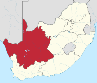
The Northern Cape is the largest and most sparsely populated province of South Africa. It was created in 1994 when the Cape Province was split up. Its capital is Kimberley. It includes the Kalahari Gemsbok National Park, part of the Kgalagadi Transfrontier Park and an international park shared with Botswana. It also includes the Augrabies Falls and the diamond mining regions in Kimberley and Alexander Bay.

<span class="mw-page-title-main">Kuruman</span> Place in Northern Cape, South Africa

Kuruman is a small town in the Northern Cape province of South Africa. It is known for its scenery and the Eye of Kuruman, a geological feature that brings water from deep underground. The abundance of water produces an unexpected swathe of green amidst the barren plains and is known as the "Oasis of the Kalahari". It was at first a mission station of the London Missionary Society founded by Robert Moffat in 1821. It was also the place where David Livingstone arrived for his first position as a missionary in 1841. The Kuruman River, which is dry except for flash floods after heavy rain, is named after the town.

<span class="mw-page-title-main">Nossob River</span> River in Botswana, Namibia and South Africa

The NossobRiver is a dry river bed in eastern Namibia and the Kalahari region of South Africa and Botswana. It covers a distance of 740 km and last flooded in 1989. The river also lends its name to Nossob camp 25°25′18″S20°35′47″E in the Kgalagadi Transfrontier Park.

<span class="mw-page-title-main">R27 (South Africa)</span> Road in South Africa

The R27 is a provincial route in South Africa that consists of two disjoint segments. The first segment, also known as the West Coast Highway, connects Cape Town with Velddrif along the West Coast. The second runs from Vredendal via Vanrhynsdorp, Calvinia, Brandvlei and Kenhardt to Keimoes on the N14 near Upington. The connection between Velddrif and Vredendal has never been built, although it can be driven on various gravel roads.

The R359 is a regional route in the Northern Cape province of South Africa that runs along the south bank of the Orange River from Augrabies Falls through Augrabies and Kakamas to Upington.

The R360 is a Regional Route in the Northern Cape of South Africa that connects Upington with the Kalahari Gemsbok National Park and the Namibian border. It passes through Askham and Andriesvale.

<span class="mw-page-title-main">Kgalagadi Transfrontier Park</span> Transfrontier conservation area in Botswana and South Africa

Kgalagadi Transfrontier Park is a large wildlife preserve and conservation area in southern Africa.

<span class="mw-page-title-main">Roman Catholic Diocese of Keimoes–Upington</span> Roman Catholic diocese in South Africa

The Roman Catholic Diocese of Keimoes–Upington is a South African diocese located around the towns of Keimoes and Upington in the ecclesiastical province of Bloemfontein.

The Vicariate Apostolic of Orange River was a Roman Catholic missionary jurisdiction located in part of South Africa.

<span class="mw-page-title-main">Kakamas</span> Place in Northern Cape, South Africa

Kakamas is a town founded in 1898 and located in the Northern Cape province of South Africa, on the banks of the Orange River.

<span class="mw-page-title-main">N14 (South Africa)</span> National road in South Africa

The N14 is a national route in South Africa which runs from Springbok in the Northern Cape to Pretoria in Gauteng. It passes through Upington, Kuruman, Vryburg, Krugersdorp and Centurion. The section between Pretoria and Krugersdorp is maintained by the Gauteng Provincial government and is also designated the P158.

<span class="mw-page-title-main">Kenhardt</span> Place in Northern Cape, South Africa

Kenhardt is a small town in the Northern Cape province of South Africa. This little town is about 120 km from Upington, the largest town in the area.

<span class="mw-page-title-main">//Khara Hais Local Municipality</span> Local municipality in Northern Cape, South Africa

//Khara Hais Local Municipality was a local municipality in the Northern Cape province of South Africa. It fell within the ZF Mgcawu District Municipality and governed the town of Upington and surrounding rural areas. As of 2011 the municipality had a population of approximately 93,500 people, and covered an area of 21,780 square kilometres (8,410 sq mi). The unusual spelling of the name comes from the original transcription of the Khwe language name, where the click consonant became "//".

The battle of Kakamas took place in Kakamas, Northern Cape Province of South Africa on 4 February 1915. It was a skirmish for control of two river fords over the Orange River between contingents of a German invasion force and South African armed forces. The South Africans succeed in preventing the Germans gaining control of the fords and crossing the river.

<span class="mw-page-title-main">Keimoes</span> Place in Northern Cape, South Africa

Keimoes is a town in the Northern Cape province of South Africa. It lies on the Orange River and is about halfway between Upington and Kakamas.

References

  1. "Upington". Archived from the original on 14 March 2010. Retrieved 27 March 2009.
  2. Dawid Kruiper Municipality website
  3. 1 2 3 4 Sum of the Main Places Upington and Paballelo from Census 2011.
  4. Wren, Christopher S. (27 May 1989). "Judge Condemns 14 South Africa Blacks". The New York Times .
  5. Dicker, Richard (23 June 1989). "South African Justice". The Christian Science Monitor . Boston.
  6. Carlin, John (4 December 2004). "Justice served". The Independent . London.
  7. "Upington 26". Truth Commission Special Report. SABC . Retrieved 4 September 2020.
  8. "Premier Hazel Jenkins and MEC Pauline Williams to unveil the Memorial in honour of the Upington 26". South African Government. 18 March 2011.
  9. "A Common Purpose". Icarus Films. Retrieved 4 September 2020.
  10. O'Hara, Marguerite (2013). "A Common Purpose - Study Guide" (PDF). Australian Teachers of Media.
  11. "flyairlink". flyairlink. Retrieved 20 March 2023.
  12. "Upington". World Aero Data. Aviation Networks, Inc. Archived from the original on 19 July 2012. Retrieved 26 March 2008.{{cite web}}: CS1 maint: unfit URL (link)
  13. "FLOOD AT UPINGTON | Railways Africa". Archived from the original on 3 April 2012.
  14. "Library Directory". Library Directory. National Library of South Africa. Archived from the original on 11 May 2023. Retrieved 2 June 2023.
  15. 1 2 3 "Climate data for Upington". South African Weather Service. Archived from the original on 4 March 2012. Retrieved 7 March 2010.
  16. Pinchuck, Tony; Barbara McCrea; Donald Reid (July 2002). Rough guide to South Africa, Lesotho & Swaziland. Rough Guides. pp. 319, 322. ISBN   978-1-85828-853-6 . Retrieved 28 May 2010.
  17. Osborn, Liz. "Sunniest Places and Countries in the World". Current Results. Retrieved 16 November 2012.
  18. "Upington Climate Normals 1961−1990". National Oceanic and Atmospheric Administration. Retrieved 21 November 2013.
  19. "Climate Normals 1991-2020". NOAA . Retrieved 18 September 2018.
  20. "Klimatafel von Upington/Oranjefluß, Kapland / Südafrika" (PDF). Baseline climate means (1961–1990) from stations all over the world (in German). Deutscher Wetterdienst. Retrieved 7 February 2016.