Gannaput | |
|---|---|
| Coordinates: 28°45′10″S21°50′33″E / 28.7527°S 21.8425°E Coordinates: 28°45′10″S21°50′33″E / 28.7527°S 21.8425°E | |
| Country | South Africa |
| Province | Northern Cape |
| District | ZF Mgcawu |
| Municipality | !Kheis |
| Area | |
| • Total | 2.68 km2 (1.03 sq mi) |
| Population (2011) [1] | |
| • Total | 1,398 |
| • Density | 520/km2 (1,400/sq mi) |
| Racial makeup (2011) | |
| • Black African | 15.9% |
| • Coloured | 80.8% |
| • Indian/Asian | 1.6% |
| • White | 1.7% |
| First languages (2011) | |
| • Afrikaans | 92.3% |
| • Tswana | 3.0% |
| • Sotho | 1.6% |
| • Xhosa | 1.4% |
| • Other | 1.6% |
| Time zone | UTC+2 (SAST) |
Gannaput is a village, lying next to the Orange River in ZF Mgcawu District Municipality in the Northern Cape province of South Africa.

The Orange River is the longest river in South Africa and the Orange River Basin extends extensively into Namibia and Botswana to the north. It rises in the Drakensberg mountains in Lesotho, flowing westwards through South Africa to the Atlantic Ocean. The river forms part of the international borders between South Africa and Namibia and between South Africa and Lesotho, as well as several provincial borders within South Africa. Except for Upington, it does not pass through any major cities. The Orange River plays an important role in the South African economy by providing water for irrigation and hydroelectric power. The river was named the Orange River in honour of the Dutch ruling family, the House of Orange, by the Dutch explorer Robert Jacob Gordon. Other names include Gariep River, Groote River or Senqu River.

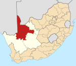
The ZF Mgcawu District Municipality is one of the 5 districts of the Northern Cape province of South Africa. The seat of ZF Mgcawu is Upington. The majority (76%) of its 236,783 people speak Afrikaans. The district code is DC8.

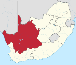
The Northern Cape is the largest and most sparsely populated province of South Africa. It was created in 1994 when the Cape Province was split up. Its capital is Kimberley. It includes the Kalahari Gemsbok National Park, part of the Kgalagadi Transfrontier Park, an international park shared with Botswana. It also includes the Augrabies Falls and the diamond mining regions in Kimberley and Alexander Bay. The Namaqualand region in the west is famous for its Namaqualand daisies. The southern towns of De Aar and Colesberg, in the Great Karoo, are major transport nodes between Johannesburg, Cape Town and Port Elizabeth. In the northeast, Kuruman is known as a mission station and also for its artesian spring, the Eye of Kuruman. The Orange River flows through the province, forming the borders with the Free State in the southeast and with Namibia to the northwest. The river is also used to irrigate the many vineyards in the arid region near Upington.


