
Namibia, officially the Republic of Namibia, is a country in Southern Africa. Its western border is the Atlantic Ocean; it shares land borders with Zambia and Angola to the north, Botswana to the east and South Africa to the south and east. Although it does not border Zimbabwe, less than 200 metres of the Zambezi River separates the two countries. Namibia gained independence from South Africa on 21 March 1990, following the Namibian War of Independence. Its capital and largest city is Windhoek. Namibia is a member state of the United Nations (UN), the Southern African Development Community (SADC), the African Union (AU), and the Commonwealth of Nations.
This article deals with the system of transport in Namibia, both public and private.

East London is a city on the southeast coast of South Africa in the Buffalo City Metropolitan Municipality of the Eastern Cape province. The city lies on the Indian Ocean coast, largely between the Buffalo River and the Nahoon River, and hosts the country's only river port. As of 2011, East London had a population of over 267,000 with over 755,000 in the metropolitan area.
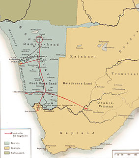
The South West Africa Campaign was the conquest and occupation of German South West Africa by forces from the Union of South Africa acting on behalf of the British Imperial Government at the beginning of the First World War.

Namaqualand is an arid region of Namibia and South Africa, extending along the west coast over 1,000 kilometres (600 mi) and covering a total area of 440,000 square kilometres (170,000 sq mi). It is divided by the lower course of the Orange River into two portions – Little Namaqualand to the south and Great Namaqualand to the north.

National routes in South Africa are a class of trunk roads and freeways which connect major cities. They form the highest category in the South African route numbering scheme, and are designated with route numbers beginning with "N", from N1 to N18. Most segments of the national route network are officially proclaimed National Roads that are maintained by the South African National Roads Agency (SANRAL), but some segments are maintained by provincial or local road authorities.

The Cape to Cairo Road or Pan-African Highway, sometimes called the Great North Road in sub-Saharan Africa, was a proposed road that would stretch the length of Africa, from Cape Town to Cairo, through the Cape to Cairo Red Line of British colonies. The proposal was similar to the Cape to Cairo Railway, another proposed infrastructure project through the same colonies. Neither were completed before British colonial rule ended in the colonies.
The Maritz rebellion, also known as the Boer revolt or Five Shilling rebellion was an armed insurrection which occurred in South Africa in 1914 at the start of World War I, led by Boers who supported the reestablishment of the South African Republic in the Transvaal. Many members of the South African government were themselves former Boers who had fought with the Maritz rebels against the British in the Second Boer War, which had ended twelve years earlier. The rebellion failed, and the ringleaders received heavy fines and terms of imprisonment.

The Cape Town Highlanders Regiment is a mechanised infantry regiment of the South African Army. As a reserve unit, it has a status roughly equivalent to that of a British Army Reserve or United States Army National Guard unit.

The Cape Field Artillery/ Nelson Mandela Artillery Regiment (CFA) is a reserve artillery regiment of the South African Army and part of the South African Army Artillery Formation. As a reserve unit, it has a status roughly equivalent to that of a British Army Reserve or United States Army National Guard unit.

Transnet Freight Rail is a South African rail transport company, formerly known as Spoornet. It was part of the South African Railways and Harbours Administration, a state-controlled organisation that employed hundreds of thousands of people for decades from the first half of the 20th century and was widely referred to by the initials SAR&H. Customer complaints about serious problems with Transnet Freight Rail's service were reported in 2010. Its head office is in Inyanda House in Parktown, Johannesburg.

Grünau is a settlement in the ǁKaras Region of southern Namibia, west of Karasburg. It is linked to the South African border posts near Noordoewer via the B1 and Nakop via the B3. Grünau belongs to the Karasburg electoral constituency.

Ariamsvlei is a settlement of about 500 people in the ǁKaras Region of southern Namibia and a small border post between Namibia and South Africa, located 180 kilometres (110 mi) south-east of Karasburg on the national road B3. It lies at 804 metres (2641 ft) above sea level. The border post on the South African side is called Nakop.

The N10 is a national route in South Africa connecting Port Elizabeth on the Eastern Cape coast with the Namibian border at Nakop, via Cradock, De Aar and Upington.
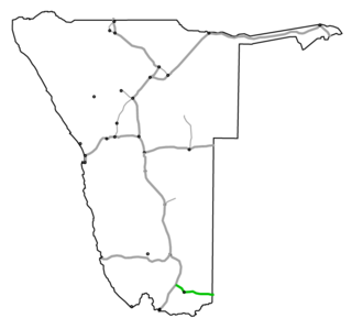
B3 is a national highway of Namibia. It passes through the ǁKaras Region of Namibia in the south for 160 kilometres, connecting the B1 at Grünau to the South African border at Nakop via the town of Karasburg. In South Africa the highway continues as the N10 towards Upington.

Rail service in Namibia is provided by TransNamib. Namibia's rail network consists of 2,382 route-km of tracks, however this number continues to increase as the rail infrastructure continues to grow.

The history of rail transport in Namibia began with a small mining rail line at Cape Cross in 1895. The first major railway project was started in 1897 when the German Colonial Authority built the 600 mm gauge Staatsbahn from Swakopmund to Windhoek. By 1902 the line was completed.

The border between Namibia and South Africa is 967 kilometres (601 mi) long. It runs along the Orange River from its mouth on the Atlantic Ocean to the 20th meridian east, and then northwards along that meridian to the tripoint with Botswana at the Nossob River.
Andries Gerhardus de Wet was a South African soldier and founder of the Vrykorps in German South West Africa which tried to overthrow the British-aligned government of the Union of South Africa to establish German rule.


