N10 (South Africa)

Last updated

SA road N10.svg
National route N10
Map of the N10 (South Africa) with labels.svg
South Africa-N10-001.jpg
The N10 in the Northern Cape
Route information
Maintained by SANRAL
Length1,000 km (620 mi)
Major junctions
Northwest endSchild B3 NA.svg B3 at the Namibian border at Nakop
Major intersectionsSA road N14 jct.svg N14 in Upington
SA road N8 jct.svg N8 at Groblershoop
SA road N12 jct.svg N12 at Britstown
SA road N1 jct.svg N1 at Hanover
SA road N9 jct.svg N9 near Middelburg
Southeast endSA road N2 jct.svg N2 near Coega
Location
Country South Africa
Provinces Northern Cape, Eastern Cape
Major cities
Highway system
SA road N9.svg N9 SA road N11.svg N11

The N10 is a national route in South Africa connecting Gqeberha on the Eastern Cape coast with the Namibian border at Nakop, via Cradock, De Aar and Upington. [1]

Contents

Route

Northern Cape

The N10 begins at Nakop in the Northern Cape, on the border with Namibia. On the Namibian side the road is known as the B3 road and the border settlement is known as Ariamsvlei. It begins by running east for 130 km to the city of Upington. After its intersection with the R360 (which provides a shorter and faster route south into Upington Central), the N10 continues eastwards up to the Upington Airport entrance (a t-junction), where it turns south and enters the Upington City Centre to meet the R360 again. At the Brug Street junction, the N10 meets the N14 and they are concurrent on Brug Street south-eastwards. At the junction with Scott Street, the N14 turns eastwards while the N10 turns southwards to cross the Orange River. [1]

From Upington, the N10 follows the Orange River for 114 km east-south-east, through Grootdrink, to the town of Groblershoop, where it meets the western end of the N8 national route from Kimberley. From the N8 junction, the N10 continues following the Orange River south-east for 133 km, through Marydale, to the town of Prieska. [1]

From Prieska, the N10 continues south-east for 126 kilometres to Britstown, where it meets the N12 national route. The N10 and N12 routes are one road southwards for 3 km before the N10 becomes its own road south-eastwards just north of the Britstown city centre. The N10 proceeds eastwards for 43 km to bypass the town of De Aar, where it meets the southern terminus of the R48 road. From De Aar, the N10 continues south-east for 59 km to reach the town of Hanover, where it meets the N1 national route. The N10 continues east-south-east for 62 km to enter the Eastern Cape and meet the N9 national route south of Noupoort. [1]

Eastern Cape

The N9 and N10 routes are one road southwards for 24 kilometres into the town of Middelburg (bypassing the town centre to the east) before splitting south of the town centre, where the N10 continues south-eastwards. The N10 continues south-east for 95 kilometres, crossing the Great Fish River and following it, to the town of Cradock, where it meets the R61 road. The R61 and the N10 enter the town as one road, crossing the Great Fish River again, turning south as J.A. Calata Street, then east as Commissioner Street, then south-east as Hospital Street, before splitting north of the Lingelihle suburb. From Cradock, the N10 continues southwards for 80 km as the Daggaboers Nek, still following the Great Fish River, to the town of Cookhouse. Before Cookhouse, it meets the R63 road and they are one road into Cookhouse, before splitting east of the town centre. [1]

From Cookhouse, the N10 follows the Great Fish River southwards for another 24 km as the Olifantskop Pass to the town of Middleton. The N10 continues southwards for another 88 km, through Paterson, to reach its southern terminus at an intersection with the N2 national route and the R72 road about 45 km north-east of Gqeberha (35 kilometres north-east of Coega; 12 kilometres north-east of Colchester). [1]

Related Research Articles

<span class="mw-page-title-main">Britstown</span> Place in Northern Cape, South Africa

Britstown is a small farming town situated in the Northern Cape province of South Africa, in the Pixley ka Seme District Municipality, Emthanjeni Local Municipality. The town is named after Hans Brits who settled here after he accompanied David Livingstone on a venture into the interior.

<span class="mw-page-title-main">R27 (South Africa)</span> Road in South Africa

The R27 is a provincial route in South Africa that consists of two disjoint segments. The first segment, also known as the West Coast Highway, connects Cape Town with Velddrif along the West Coast. The second runs from Vredendal via Vanrhynsdorp, Calvinia, Brandvlei and Kenhardt to Keimoes on the N14 near Upington. The connection between Velddrif and Vredendal has never been built, although it can be driven on various gravel roads.

<span class="mw-page-title-main">R28 (South Africa)</span>

The R28 is a provincial route in Gauteng, South Africa that connects Krugersdorp with Vereeniging via Randfontein. The R28 used to connect with Pretoria, but that section of the road is now part of the N14.

<span class="mw-page-title-main">R31 (South Africa)</span>

The R31 is a provincial route in the Northern Cape of South Africa that connects Kimberley with the Namibian border at Rietfontein via Kuruman and Hotazel. It is co-signed with the R360 between Askham and Andriesvale.

<span class="mw-page-title-main">R34 (South Africa)</span> Road in South Africa

The R34 is a long provincial route in South Africa that connects Vryburg with Richards Bay via Kroonstad and Newcastle. It passes through three provinces, North West, the Free State and KwaZulu-Natal.

<span class="mw-page-title-main">R48 (South Africa)</span>

The R48 is a provincial route in South Africa that connects De Aar with Petrusburg on the N8 via Petrusville and Koffiefontein.

<span class="mw-page-title-main">R53 (South Africa)</span> Road in South Africa

The R53 is a provincial route in South Africa that connects Swartruggens with Parys via Ventersdorp and Potchefstroom.

<span class="mw-page-title-main">R56 (South Africa)</span> Road in South Africa

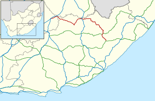
The R56 is a provincial route in South Africa that connects Middelburg with Pietermaritzburg via Molteno, Maclear and Kokstad. It is co-signed with the N2 between Kokstad and Stafford's Post for 39 kilometres.

<span class="mw-page-title-main">R58 (South Africa)</span>

The R58 is a provincial route in South Africa that connects Colesberg with Ngcobo via Aliwal North, Barkly East and Khowa.

<span class="mw-page-title-main">R61 (South Africa)</span> Road in South Africa

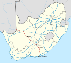
The R61 is a long provincial route in South Africa that connects Beaufort West with Port Shepstone via Graaff-Reinet, Komani, Mthatha and Port Edward.

<span class="mw-page-title-main">R63 (South Africa)</span> Road in South Africa

The R63 is a tarred provincial route in South Africa that connects Calvinia with Komga via Carnarvon, Victoria West, Graaff-Reinet, Somerset East and King William's Town. It is cosigned with the N10 between Eastpoort and Cookhouse for 24 kilometres.

<span class="mw-page-title-main">R72 (South Africa)</span>

The R72 is a provincial route in Eastern Cape, South Africa that connects the N2 north-east of Gqeberha with East London via Port Alfred. It provides an alternative to the N2 for travel between Gqeberha and East London.

The R360 is a Regional Route in the Northern Cape of South Africa that connects Upington with the Kalahari Gemsbok National Park and the Namibian border. It passes through Askham and Andriesvale.

The R385 is a regional route in South Africa that connects Olifantshoek with Hopetown via Postmasburg and Douglas.

<span class="mw-page-title-main">N2 (South Africa)</span> National road in South Africa

The N2 is a national route in South Africa that runs from Cape Town through George, Gqeberha, East London, Mthatha, Port Shepstone and Durban to Ermelo. It is the main highway along the Indian Ocean coast of the country. Its current length of 2,255 kilometres (1,401 mi) makes it the longest numbered route in South Africa.

<span class="mw-page-title-main">N12 (South Africa)</span> National road in South Africa

The N12 is a national route in South Africa which runs from George through Beaufort West, Kimberley, Klerksdorp and Johannesburg to eMalahleni.

<span class="mw-page-title-main">N8 (South Africa)</span> National road in South Africa

The N8 is a national route in South Africa that connects Groblershoop with Maseru in Lesotho via Kimberley and Bloemfontein. It is maintained by the South African National Roads Agency.

<span class="mw-page-title-main">N14 (South Africa)</span> National road in South Africa

The N14 is a national route in South Africa which runs from Springbok in the Northern Cape to Pretoria in Gauteng. It passes through Upington, Kuruman, Vryburg, Krugersdorp and Centurion. The section between Pretoria and Krugersdorp is maintained by the Gauteng Provincial government and is also designated the P158.

The R500 is a Regional Route in South Africa that connects Magaliesburg with Parys via Carletonville and Fochville.

The R505 is a Regional Route in South Africa. It connects Ottoshoop, North West Province in the north with Wesselsbron, Free State Province to the south.

References

  1. 1 2 3 4 5 6 Falkner, John (May 2012). South African Numbered Route Description and Destination Analysis (Report). National Department of Transport. p. 24. Archived from the original on 6 June 2014. Retrieved 12 August 2014.

28°24′46″S21°11′11″E / 28.412691°S 21.186361°E / -28.412691; 21.186361