Kuruman

Last updated

Kuruman
South-Africa - Kuruman - Eye.jpg
The Eye
South Africa Northern Cape location map.svg
Red pog.svg
Kuruman
South Africa adm location map.svg
Red pog.svg
Kuruman
Africa location map.svg
Red pog.svg
Kuruman
Coordinates: 27°27′S23°26′E / 27.450°S 23.433°E / -27.450; 23.433
Country South Africa
Province Northern Cape
District John Taolo Gaetsewe
Municipality Ga-Segonyana
Established1887;136 years ago (1887) [1]
Area
[2]
  Total93.39 km2 (36.06 sq mi)
Population
 (2011) [2]
  Total13,057
  Density140/km2 (360/sq mi)
Racial makeup (2011)
[2]
   Black African 43.7%
   Coloured 23.5%
   Indian/Asian 1.3%
   White 30.3%
  Other1.2%
First languages (2011)
[2]
   Afrikaans 76.9%
   Tswana 14.9%
   English 4.0%
  Other4.2%
Time zone UTC+2 (SAST)
Postal code (street)
8460
PO box
8460
Area code 053

Kuruman is a small town in the Northern Cape province of South Africa. It is known for its scenery and the Eye of Kuruman, a geological feature that brings water from deep underground. The abundance of water produces an unexpected swathe of green amidst the barren plains and is known as the "Oasis of the Kalahari". [3] It was at first a mission station of the London Missionary Society founded by Robert Moffat in 1821. [4] It was also the place where David Livingstone arrived for his first position as a missionary in 1841. The Kuruman River, which is dry except for flash floods after heavy rain, is named after the town.

Contents

A residential street in Kuruman Residential street Kuruman.JPG
A residential street in Kuruman

Origins

Kuruman is regarded as the "Oasis of the Kalahari". It is set out on the Ghaap Plateau and receives its water source from a spring called "The Eye" which rises in a cave in the semidesert thornveld area in the Kalahari region. Kuruman is the main town in the area and the spring gives about 20 to 30 million litres of water daily to approximately 10 000 inhabitants. It is also known as "Die Oog" or "Gasegonyane" in the Kalahari region. [5]

The name Kuruman is derived from the Chief who lived in the area, named Kudumane. Robert Moffat, a missionary from the London Missionary Society, also lived there from 1820 to 1870. Moffat helped build the Moffat Church which was completed in 1838 and is still used for regular church services. While living in Kuruman, Moffat translated the bible into the Tswana language: this was the first bible in an indigenous southern African language. [5] [6]

Location and climate

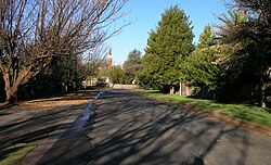
Kuruman is situated on the main route between Gauteng and Namibia/Cape Town via Upington. The route is growing in popularity because of its beautiful nature and various tourist attractions. [5] Kuruman lies virtually on the edge of the Kalahari at the foot of a range of low hills. [7] It has relatively mild weather patterns compared to other Northern Cape towns, such as Upington and Springbok, and is surrounded by more vegetation than Upington and Springbok, which are mostly semi-arid to desert environments.

Economy

Mining and agriculture (cattle and game) support Kuruman's thriving economy. Minerals mined in Kuruman include manganese, iron ore, tiger's eye and crocidolite. The richest deposits of crocidolite in the world are found in the Kuruman district. [5]

Demographics

According to the 2001 census, Kuruman had a population of 9,824, of which 4,267 (43.4%) were Coloured, 3,549 (36.1%) were White and 1,969 (20.0%) were Black. The most spoken language at home was Afrikaans with a percentage of 80.68%, followed by Tswana language with 14.8%. Males make up 50.58% of the population and females, 49.42%. [8]

Notable residents and media

Kuruman is home to local author and Sanusi or Zulu traditional healer, Credo Mutwa.[ citation needed ]

The Kalahari Meerkat Project, made famous by the television series Meerkat Manor, is located nearby.

Kuruman is one of the more noted Peace Corps outposts in the northern regions of the country. [9] From 2007 to 2009, it was home to former Peace Corps volunteer and published author and playwright Stefanie DeLeo. [10]

In 2010, Hilda Coetzee, now known as Hilda Williamson, was the underchairman of the A.T.K.V. in the Northern Cape area (The Afrikaans Language and Culture Association (Afrikaans: Afrikaanse Taal- en Kultuurvereniging)), of Kuruman, South Africa. The A.T.K.V. is a society that aims to promote the Afrikaans language and culture. [11] [ circular reference ] This society was founded in Cape Town and its membership was open to include all people sharing the same values of the Christian faith.

Attractions

The Eye of Kuruman

This is a natural fountain delivering approximately 20 to 30 million litres (4,400,000 to 6,600,000 imp gal; 5,300,000 to 7,900,000 US gal) of crystal clear water daily which supplies domestic water, feeds the Kuruman River and spills more water into two irrigation canals which are 7 kilometres (4.3 mi) in length. The Eye was claimed to have been discovered in 1801 and this led to the establishment of the mission station in the early 19th century. The Eye then came to be described as "The fountain of Christianity". It is the biggest natural fountain in the Southern Hemisphere. In the early years, Tswana people called this fountain Gasegonyane which means "small water calabash with bubbling water". [12]

Other attractions

See also

Related Research Articles

<span class="mw-page-title-main">Mafikeng</span> Capital city of the North-West Province, South Africa

Mahikeng, formerly known as Mafikeng and alternatively known as Mafeking, is the capital city of the North West province of South Africa.

<span class="mw-page-title-main">Northern Cape</span> Province in South Africa

The Northern Cape is the largest and most sparsely populated province of South Africa. It was created in 1994 when the Cape Province was split up. Its capital is Kimberley. It includes the Kalahari Gemsbok National Park, part of the Kgalagadi Transfrontier Park and an international park shared with Botswana. It also includes the Augrabies Falls and the diamond mining regions in Kimberley and Alexander Bay.

Kathu is a town in South Africa, and the iron ore capital of the Northern Cape province. Its name means "town under the trees", after the Camel Thorn forest it is situated in. The phrase "the town under the trees" was coined by an engineer working in the town in the early-1990s as part of a tourist marketing drive, together with the accompanying graphic. It was intended to be a marketing slogan. The meaning of the word "Kathu" has anecdotically been attributed to a porridge brewed by the local population from the powder found in the pods of the Camel Thorn trees.

<span class="mw-page-title-main">Vryburg</span> Place in North West, South Africa

Vryburg is a large agricultural town with a population of 48,400 situated in the Dr Ruth Segomotsi Mompati District Municipality of the North West Province of South Africa. It is the seat and the industrial and agricultural heartland of the district of the Bophirima region.

<span class="mw-page-title-main">Campbell, South Africa</span> Place in Northern Cape, South Africa

Campbell is a small town situated on the edge of the Ghaap Plateau in the Northern Cape province of South Africa. It is located 48 km east of Griquatown on the N8 road. It was originally known as Knovel Valley and then Groote Fontein, but was renamed in honour of the Reverend John Campbell who visited the Cape Colony in 1813.

<span class="mw-page-title-main">Griekwastad</span> Place in Northern Cape, South Africa

Griekwastad is a country town in South Africa. It is sometimes still called Griquatown, a name which is now considered historical. The town is on the N8 road in the Northern Cape Province of South Africa 168 kilometres (104 mi) by road west from the city of Kimberley. It was the first town to be established in the country north of the Orange River.

The R360 is a Regional Route in the Northern Cape of South Africa that connects Upington with the Kalahari Gemsbok National Park and the Namibian border. It passes through Askham and Andriesvale.

<span class="mw-page-title-main">Robert Moffat (missionary)</span> Scottish missionary

Robert Moffat was a Scottish Congregationalist missionary to Africa, father of Mary Moffat Livingstone and father-in-law of David Livingstone, and first translator of the Bible into Setswana.

<span class="mw-page-title-main">Harts River</span> River in South Africa

The Harts River is a northern tributary of the Vaal River, which in turn is the largest tributary of the Orange River. Its source is in the North West Province, but the greater part of its basin is located in the Northern Cape Province, which it enters a few kilometers downstream from the Taung Dam.

<span class="mw-page-title-main">Kenhardt</span> Place in Northern Cape, South Africa

Kenhardt is a small town in the Northern Cape province of South Africa. This little town is about 120 km from Upington, the largest town in the area.

<span class="mw-page-title-main">Dithakong</span> Place in Northern Cape, South Africa

Dithakong is the name of a place east of Kuruman in the Northern Cape, South Africa, which had been a major destination for several of the earliest nineteenth century expeditions from the Cape to the interior of the subcontinent. In colonial literature the name is often rendered in such ways as Litakun, also Litakoo or Lattakoo.

<span class="mw-page-title-main">//Khara Hais Local Municipality</span> Local municipality in Northern Cape, South Africa

//Khara Hais Local Municipality was a local municipality in the Northern Cape province of South Africa. It fell within the ZF Mgcawu District Municipality and governed the town of Upington and surrounding rural areas. As of 2011 the municipality had a population of approximately 93,500 people, and covered an area of 21,780 square kilometres (8,410 sq mi). The unusual spelling of the name comes from the original transcription of the Khwe language name, where the click consonant became "//".

<span class="mw-page-title-main">Asbestos Mountains</span>

The Asbestos Mountains is a range of hills in the Northern Cape province of South Africa, stretching south-southwest from Kuruman, where the range is known as the Kuruman Hills, to Prieska. It passes Boetsap, Danielskuil, Lime Acres, Douglas and Griekwastad. The range lies about 150 km west of Kimberley and rises from the Ghaap Plateau.

<span class="mw-page-title-main">Ga-Segonyana Local Municipality</span> Local municipality in Northern Cape, South Africa

Ga-Segonyana Municipality is a local municipality within the John Taolo Gaetsewe District Municipality, in the Northern Cape province of South Africa.

The Eye of Kuruman is a spring in the town of Kuruman in the province of Northern Cape, South Africa. Currently, it is known as the largest natural spring in the Southern Hemisphere; although the Te Waikoropupū Springs in Golden Bay, New Zealand has been reliably measured at an average flow some 60 times greater.

Alan John Butler, a Director of the Kuruman Moffat Mission in Kuruman, South Africa, and Canon of Kimberley Cathedral, was a priest who served in the Diocese of Kimberley and Kuruman for a major part of the second half of the twentieth century. He was responsible for the restoration of the historic Moffat Mission precinct which became renowned as a conservation area and as a beacon of hope in the troubled last years of Apartheid. He was born in the United Kingdom in 1930 and died at Wimborne on 13 January 2011.

Olifantshoek is a town in John Taolo Gaetsewe District Municipality in the Northern Cape Province of South Africa.

<span class="mw-page-title-main">Mary Moffat Livingstone</span> Wife of explorer David Livingstone

Mary Livingstone was the wife of the Scottish Congregationalist missionary David Livingstone. She was a linguist, an experienced traveller, and managed the household affairs including missionary stations and infant school.

<span class="mw-page-title-main">Askham, South Africa</span> Place in Northern Cape, South Africa

Askham is a village in the Dawid Kruiper Local Municipality in the ZF Mgcawu District Municipality in the Northern Cape province of South Africa. Askham lies not far from the confluence of the mostly dry Molopo and Kuruman Rivers in the Red Kalahari Desert, about 200 km north of Upington at the junction of the R31 and the R360 roads.

<span class="mw-page-title-main">Mary Moffat</span>

Mary Moffat born Mary Smith was a British missionary who became a role model for women involved in missionary work. She was the wife of Robert Moffat, the mother of Mary Moffat Livingstone and David Livingstone was her son-in-law. She was seen by Victorian Britain as an ideal missionary wife and role model for Tswana women, but it is unproven whether Africans saw her in this role.

References

  1. Raper, R.E. (1987). Dictionary of Southern African Place Names. HSRC. p. 265.
  2. 1 2 3 4 Main Place Kuruman from Census 2011.
  3. "South Africa Accommodation | Game Lodges & Parks and National Parks". www.places.co.za. Retrieved 2020-10-28.
  4. Chisholm, Hugh, ed. (1911). "Kuruman"  . Encyclopædia Britannica . Vol. 15 (11th ed.). Cambridge University Press.
  5. 1 2 3 4 5 "Kuruman – Oasis of the Kalahari". SA Places. SA Places. Retrieved 6 January 2018.
  6. South African History Online (16 March 2011). "Kuruman Missionary Robert Moffat is born". South African History Online. SAHO. Retrieved 6 January 2018.
  7. "South Africa Accommodation, Hotels and Travel". www.sa-venues.com. Retrieved 2020-10-28.
  8. "Main Place 'Kuruman Part 2'". Census 2001. Retrieved 10 January 2012.
  9. Peace Corps Northern Cape
  10. Stefanie DeLeo: Books, Biography, Blog, Audiobooks, Kindle.
  11. ATKV
  12. "The eye of Kuruman". Experience Northern Cape. Retrieved 6 January 2018.
  13. "Boesmansgat - Sinkhole". SA Venues. SA Venues. Retrieved 6 January 2018.
  14. "Meerkat Research". kalahariresearchcentre.org.