Alberton is a city situated on the southern part of the East Rand of Johannesburg and it is situated very close to the major urban centre of Johannesburg, in the Gauteng province of South Africa. It was incorporated into the Ekurhuleni metropolitan municipality in the year 2000 and celebrated its centenary year in 2005. According to the 2011 census conducted by Statistics South Africa, it has a population of 121,536; but this figure excludes the black township of Thokoza, which has a population of 105,827. Alberton is described as a typical bedroom community, one which is primarily residential in character, with most of its workers commuting to work in nearby suburbs or cities. The city has multiple access roads to all major freeways in Gauteng and is situated on the banks of the Natal Spruit close to the major urban centres of Johannesburg, which lies 15 km (9 mi) to the northwest - and Pretoria - which is 76 km (47 mi) to the north. Alberton has an elevation of approximately 1,570 m (5,150 ft) above sea level.

Reitz is a small maize, wheat and cattle farming town located in the east of the Free State province of South Africa.

Warden is a town situated in the Free State province of South Africa on the N3 highway between Johannesburg and Durban.

Delmas is a small maize farming town situated east of Johannesburg in Mpumalanga, South Africa. The town is located some 19 km north-east of Springs and 73 km south-east of Pretoria.

Lichtenburg is a town situated in North West Province of South Africa. It is the administrative centre of Ditsobotla Local Municipality.

Koster is a small farming town situated on the watershed between the Orange and Limpopo Rivers in North West Province of South Africa.

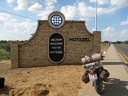
The R31 is a provincial route in South Africa that connects Kimberley with the Namibian border at Rietfontein via Kuruman and Hotazel. It is co-signed with the R360 between Askham and Andriesvale.

Somerset West is a town in the Western Cape, South Africa. Organisationally and administratively it is included in the City of Cape Town metropolitan municipality as a suburb of the Helderberg region . The vehicle registration code for Somerset West is CFM and the post code is 7130 for street addresses, and 7129 for post office boxes.

Noordhoek is a seaside town in the Western Cape, South Africa, located below Chapman's Peak on the west coast of the Cape Peninsula and is approximately 35 kilometres (22 mi) to the south of Cape Town. The name "Noordhoek" was taken from Dutch and literally means "north corner". It was given this name in 1743 as being the northern corner of the Slangkop farm. The first permanent resident of European origin is Jaco Malan who built his house there. In 1857, the region was divided into six plots, most of which were bought by a single family, that of the de Villiers. Noordhoek nevertheless remains a predominantly rural area where farmers grow vegetables to supply ships calling at Simon's Town. It is best known for its shoreline and its long, wide, sandy beach, which stretches south to the neighbouring village of Kommetjie. Near the southern end of this beach is the wreck of the steamship "Kakapo", which ran aground in 1900, when the captain mistook Chapman's Peak for the Cape of Good Hope and put the helm over to port.

Linden is a suburb of Johannesburg, South Africa - situated towards the north western suburbs of the city on the border of the former independent town of Randburg. This established up-market suburb between 5 km (3.1 mi) to 8 km (5.0 mi) north-west of the Johannesburg CBD was designed so that most of the streets and avenues form similar sized blocks. A number of shops, churches and schools can be found on 3rd Avenue and 4th Avenue. Attractions include arts, crafts, studios, coffee shops, pubs, restaurants and small shops. Bordering suburbs include Northcliff, Blairgowrie, Victory Park, Greenside and Cresta.

Bredasdorp is a town in the Southern Overberg region of the Western Cape, South Africa, and the main economic and service hub of that region. It lies on the northern edge of the Agulhas Plain, about 160 kilometres (100 mi) south-east of Cape Town and 35 kilometres (22 mi) north of Cape Agulhas, the southernmost tip of Africa.

Vosburg is a town 61 km west of Britstown, in the Northern Cape province of South Africa. The town has relatively low crime rate and features many 18th century buildings.

Strydenburg is a town in the east of the Northern Cape province in South Africa. Seventy-seven km north of Britstown, it was laid out by the Dutch Reformed Church on the farm Roodepan in 1892. It also lies on the N12, which separates the actual town from its township.

Bothasig is a suburban area of the City of Cape Town in Western Cape, South Africa. It is located north of Edgemead and east of Milnerton. It is located approximately 15 km north-east of the Cape Town city centre.

Hopefield is a settlement in West Coast District Municipality in the Western Cape province of South Africa on the R45 between Malmesbury and Vredenburg. The town is east of Saldanha Bay and Langebaan, 40 km (25 mi) southeast of Vredenburg and 120 km (75 mi) north of Cape Town.
Hendrina is a town in Nkangala District Municipality, in the Mpumalanga province of South Africa, between Johannesburg and Kruger National Park. The town is 5.3 km (3.3 mi) northwest of Ermelo, 40 km (24.8 mi) southwest of Carolina, and 53 km (32.9 mi) southeast of Middelburg.

Willowmore is a town in Sarah Baartman District Municipality in the Eastern Cape province of South Africa.

Bodiam is a town in Amathole District Municipality in the Eastern Cape province of South Africa.
Marikana, formerly known as Rooikoppies, is a town in the Rustenburg local municipality, Bojanala Platinum District Municipality district in the North West province of South Africa.

Koopmansfontein is a village 61 km north-west of Barkly West, 115 km east of Postmasburg, between Kimberley and Hotazel. Said to have been named after a Griqua called Koopman, who lived at the fountain.