Kimberley is the capital and largest city of the Northern Cape Province of South Africa. It is located approximately 110 km east of the confluence of the Vaal and Orange Rivers. The city has considerable historical significance due to its diamond mining past and the siege during the Second Anglo-Boer war. British businessmen Cecil Rhodes and Barney Barnato made their fortunes in Kimberley, and Rhodes established the De Beers diamond company in the early days of the mining town.
The term Batlôkwa refers to several Kgatla communities that reside in Botswana, Lesotho and South Africa. It comprises the followers of Tlôkwa kings and the members of clans identified as Tlôkwa, or individuals who identify themselves as of Tlôkwa descent. Most of the Batlôkwa clans trace their royal lineages to Kgwadi son of King Tabane, who was the father and founder of the Batlokwa nation. The Tlôkwa considers the Tlokwe-cat as their original totem which has since become extinct due to over-hunting for its fur, which was used by clan chiefs.

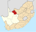
The Northern Cape is the largest and most sparsely populated province of South Africa. It was created in 1994 when the Cape Province was split up. Its capital is Kimberley. It includes the Kalahari Gemsbok National Park, part of the Kgalagadi Transfrontier Park and an international park shared with Botswana. It also includes the Augrabies Falls and the diamond mining regions in Kimberley and Alexander Bay.

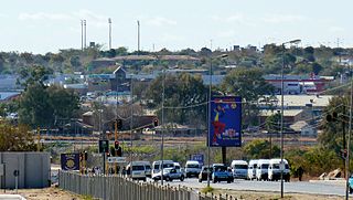
Kuruman is a town with just over 13,000 inhabitants in the Northern Cape province of South Africa. It is known for its scenic beauty and the Eye of Kuruman, a geological feature that brings water from deep underground. The abundance of water produce an unexpected swathe of green amidst the barren plains and is known as the Oasis of the Kalahari. It was at first a mission station of the London Missionary Society founded by Robert Moffat in 1821. It was also the place where David Livingstone arrived for his first position as a missionary in 1841. The Kuruman River, which is dry except for flash floods after heavy rain, is named after the town.
Hammanskraal is a functional, trans-provincial region anchored in northern Gauteng Province, South Africa. The region consists of multiple, residential, industrial and commercial areas in a decentralized settlement pattern.

Kgosi (Chief) Galeshewe,, was a chief of the Batlhaping group in South Africa. He was an anti-colonial revolutionary and orchestrated rebellions against the Cape Colony government. The Galeshewe Township in the Sol Plaatje Municipality, Kimberley, has been named after him. A South African Navy fast attack craft has also named after him. Galeshewe was born in 1835 near Taung, South Africa.

Moshupa is a large village in the Southern District of Botswana with a population of 20016 per the 2011 census. The people of Moshupa are called the Bakgatla-ba-ga Mmanaana, a group also found in Thamaga. Along with the related Bakgatla-ba-ga Kgafela of Mochudi, they arrived to the region from the Transvaal region in South Africa throughout the eighteenth century.

The Royal Bafokeng Nation is the ethnic homeland of the Bafokeng people, a Setswana-speaking traditional community. The monarchy covers 1,000 square kilometers (390 sq mi) in the North West Province of South Africa. The capital is Phokeng, near Rustenburg. "Bafokeng" is used to refer to both the tribal grouping as well as the land its members inhabit. The kingdom's current ruler is Kgosi (King) Leruo Molotlegi, who has reigned since 2000. The Bafokeng first settled in the Rustenburg Valley in c.1450AD, the presence of the ceramics in the area suggesting the arrival of the Bafokeng in the Rustenburg Phokeng valley at about this time. Kgosi Tshukudu Became the first king of a unified Bafokeng in 1750.

Circular migration or repeat migration is the temporary and usually repetitive movement of a migrant worker between home and host areas, typically for the purpose of employment. It represents an established pattern of population mobility, whether cross-country or rural-urban. There are several benefits associated with this migration pattern, including gains in financial capital, human capital, and social capital. There also costs associated with circular migration, such as brain drain, poor working conditions, forced labor, and the inability to transfer acquired skills to home economies. Socially, there are strong connections to gender, health outcomes, development, poverty, and global immigration policy.
Peter Ishmael Rocky Malebana-Metsing
Serule is a village in Central District of Botswana. Serule, with a latitude of -21.95 and a longitude of 27.3, is a streets, highways, roads, or railroad. The village is located along the road between Francistown and Palapye, and is an important railroad junction with rails leading towards north to Francistown, south to Palapye and east to the mining town of Selebi-Phikwe, 72 km from Palapye north up the A1 road, 88 km from Francistown down south the A1 road and 60 km west of Selibe Phikwe to the T-junction. The location is situated 340 kilometers east (90°) of the approximate center of Botswana and 332 kilometers north east (26°) of the capital Gaborone.

Matšitšileng is a village Next to Ga-Mathapo(Ga-Matlala) in the Mogalakwena Local Municipality of the Waterberg District Municipality of the Limpopo province of South Africa. It is situated about 110 km northwest of Polokwane and Mokopane.
South African Education and Environment Project is a non-profit organisation serving children and youth through educational support at every level of academic development. The organisation helps young people who are neglected by South Africa's education system.
Dithakong is the name of a place east of Kuruman in the Northern Cape, South Africa, which had been a major destination for several of the earliest nineteenth century expeditions from the Cape to the interior of the subcontinent. In colonial literature the name is often rendered in such ways as Litakun, also Litakoo or Lattakoo.
Alan John Butler, a Director of the Kuruman Moffat Mission in Kuruman, South Africa, and Canon of Kimberley Cathedral, was a priest who served in the Diocese of Kimberley and Kuruman for a major part of the second half of the twentieth century. He was responsible for the restoration of the historic Moffat Mission precinct which became renowned as a conservation area and as a beacon of hope in the troubled last years of Apartheid. He was born in the United Kingdom in 1930 and died at Wimborne on 13 January 2011.
Schoonoord is a village in Sekhukhune District Municipality in the Limpopo province of South Africa. The name Schoonoord is Dutch, it is imposed on the natives of this area by Berlin Missionary Society.
Marulaneng is a village in the Sekhukhune District Municipality in the Limpopo Province, South Africa. Marulaneng falls within the administrative boundaries of the Makhuduthamaga Local Municipality.

Kangongo is a settlement on the Eastern banks of the Okavango River in the Kavango East Region, Namibia, 156 km east of Rundu along the Trans-Caprivi Highway. Kangongo has a population of around 4000 inhabitants.
Kgosi (Chief) Luka Jantjie was a hunter, trader, diamond prospector, and farmer. He was a chief of the Batlhaping ba Manyeding group of the Batswana in Kuruman. He was born in Kimberley, South Africa in 1835 and was the son of a Christian convert. Jantjie spent most of his life protecting the rights to land of his people and is considered a struggle hero for his battle against British colonialism. He was the cousin of Kgosi Galeshewe.
Mosimanegare Kenneth Mmoiemang is a South African politician who has been a permanent delegate to the National Council of Provinces since May 2019. He is a member of the Northern Cape delegation. He was the provincial MEC for Cooperative Governance, Human Settlements and Traditional Affairs from 2009 to 2013 and the speaker of the Northern Cape Provincial Legislature from 2013 to 2019. Mmoiemang is a member of the African National Congress (ANC).