John Taolo Gaetsewe District Municipality

Last updated
John Taolo Gaetsewe
Kgalagadi District
John Taolo Gaetsewe CoA.png
Map of South Africa with John Taolo Gaetsewe highlighted (2011).svg
Location in South Africa
Coordinates: 27°S23°E / 27°S 23°E / -27; 23
Country South Africa
Province Northern Cape
Seat Kuruman
Local municipalities
Government
[1]
  Type Municipal council
  MayorBenjamin Gaobusiwe
Area
  Total
27,283 km2 (10,534 sq mi)
Population
 (2011) [2]
  Total
224,799
  Density8.2/km2 (21/sq mi)
Racial makeup (2011)
[2]
   Black African 84.8%
   Coloured 9.3%
   Indian/Asian 0.4%
   White 5.0%
First languages (2011)
[3]
   Tswana 75.6%
   Afrikaans 16.5%
   English 2.6%
  Other5.3%
Time zone UTC+2 (SAST)
Municipal codeDC45

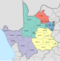
The John Taolo Gaetsewe District Municipality (Tswana : Mmasepala wa Sedika wa John Taolo Gaetsewe; Afrikaans : John Taolo Gaetsewe-distriksmunisipaliteit), formerly the Kgalagadi District Municipality, is one of the five districts of the Northern Cape province of South Africa. The seat of the authority is Kuruman. As of 2011, the majority of its 176,899 residents speak Setswana. The district code is DC45. It was named after a trade unionist John Taolo Gaetsewe (1916-1988).

Contents

Geography

Neighbours

John Taolo Gaetsewe is surrounded by:

Local municipalities

The district contains the following local municipalities:

Local municipalityPopulation%Dominant language
Joe Morolong (formerly Moshaweng) 84 09947.54% Tswana
Ga-Segonyana 70 39039.79%Tswana
Gamagara 16 1759.14% Afrikaans
Kalahari 6 2313.52%

Demographics

The following statistics are from the 2001 census.

LanguagePopulation%
Setswana 151 65485.73%
Afrikaans 20 40111.53%
IsiXhosa 1 5750.89%
Sesotho 7370.42%
English 7350.42%
Other 4470.25%
Sepedi 4290.24%
IsiZulu 3530.20%
SiSwati 1830.10%
IsiNdebele 1670.09%
Xitsonga 1510.09%
Tshivenda 630.04%

Gender

GenderPopulation%
Female92 68952.40%
Male84 21047.60%

Ethnic group

Ethnic groupPopulation%
Black African157 09188.80%
Coloured10 3585.86%
White9 3525.29%
Indian/Asian980.06%

Age

AgePopulation%
000 - 00420 96711.85%
005 - 00922 64712.80%
010 - 01423 65113.37%
015 - 01920 82411.77%
020 - 02415 4758.75%
025 - 02912 2346.92%
030 - 03410 8856.15%
035 - 03910 2675.80%
040 - 0449 6435.45%
045 - 0497 6554.33%
050 - 0545 8833.33%
055 - 0594 6492.63%
060 - 0643 7262.11%
065 - 0693 1331.77%
070 - 0742 2351.26%
075 - 0791 4310.81%
080 - 0849640.54%
085 - 0893790.21%
090 - 0941650.09%
095 - 099630.04%
100 plus230.01%

Politics

Election results

Election results for the district (under its former name, Kgalagadi) in the South African general election, 2004.

PartyVotes%
African National Congress 51 45678.92%
United Christian Democratic Party 6 76310.37%
Democratic Alliance 2 6874.12%
Independent Democrats 1 0841.66%
African Christian Democratic Party 7901.21%
New National Party 6901.06%
Freedom Front Plus 5850.90%
Pan African Congress 2670.41%
Azanian People's Organisation 2120.33%
United Democratic Movement 1610.25%
Inkhata Freedom Party 970.15%
EMSA 810.12%
NA 570.09%
CDP 570.09%
SOPA 540.08%
PJC 400.06%
TOP 360.06%
UF 350.05%
NLP 170.03%
Minority Front 150.02%
KISS 140.02%
Total65 198100.00%

References

  1. "Contact list: Executive Mayors". Government Communication & Information System. Archived from the original on 14 July 2010. Retrieved 22 February 2012.
  2. 1 2 "Statistics by place". Statistics South Africa. Retrieved 27 September 2015.
  3. "Statistics by place". Statistics South Africa. Retrieved 27 September 2015.