Hantam Local Municipality

Last updated
Hantam
Hantam CoA.png
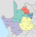
Map of the Northern Cape with Hantam highlighted (2011).svg
Location in the Northern Cape
Coordinates: 31°15′S19°45′E / 31.250°S 19.750°E / -31.250; 19.750
Country South Africa
Province Northern Cape
District Namakwa
Seat Calvinia
Wards 7
Government
[1]
  Type Municipal council
  MayorRoger Nieldo Swartz (ANC) [2]
Area
  Total36,128 km2 (13,949 sq mi)
Population
 (2011) [3]
  Total21,578
  Density0.60/km2 (1.5/sq mi)
Racial makeup (2011)
[3]
   Black African 4.4%
   Coloured 82.2%
   Indian/Asian 0.7%
   White 12.1%
First languages (2011)
[4]
   Afrikaans 96.7%
   English 1.1%
  Other2.2%
Time zone UTC+2 (SAST)
Municipal codeNC065

Hantam Municipality (Afrikaans : Hantam Munisipaliteit) is a local municipality within the Namakwa District Municipality, in the Northern Cape province of South Africa.

Contents

Hantam is a Khoekhoe word that means "mountains where the bulbs grow". The municipality is named after the Hantam Mountains found in the area. [5]

Main places

The 2011 census divided the municipality into the following main places: [6]

PlaceCodePopulationArea (km2)
Brandvlei 366001 2,85929.3
Calvinia 366005 9,680154.5
Loeriesfontein 366003 2,74434.5
Nieuwoudtville 366004 2,09326.3
Tankwa Karoo National Park 366006 28267.9
Remainder 366002 4,17535,615.7
Total21,57836,128.0

Finances

In the 2018/19 financial year, 78% of the council's expenditure was deemed unauthorised, irregular, fruitless and wasteful, down from 95% the previous year. At the end of the 2019 year, the council had a cash balance to cover its operating costs for ten days. [7]

Politics

The municipal council consists of thirteen members elected by mixed-member proportional representation. Seven councillors are elected by first-past-the-post voting in seven wards, while the remaining six are chosen from party lists so that the total number of party representatives is proportional to the number of votes received. In the election of 1 November 2021 no party obtained a majority of seats on the council. The following table shows the results of the election. [8] [9]

Hantam local election, 1 November 2021
PartyVotesSeats
WardListTotal %WardListTotal
African National Congress 3,6603,6377,29744.5%516
Democratic Alliance 2,3222,3594,68128.6%224
Patriotic Alliance 6026231,2257.5%011
Freedom Front Plus 6045871,1917.3%011
Namakwa Civic Movement 3383907284.4%011
Good 2402544943.0%000
Congress of the People 1442163602.2%000
Independent candidates 2072071.3%00
Economic Freedom Fighters 75821571.0%000
African Christian Democratic Party 2621470.3%000
Total8,2188,16916,3877613
Valid votes8,2188,16916,38798.0%
Spoilt votes 1611723332.0%
Total votes cast8,3798,34116,720
Voter turnout8,393
Registered voters13,732
Turnout percentage61.1%

Related Research Articles

<span class="mw-page-title-main">Inxuba Yethemba Local Municipality</span> Local municipality in Eastern Cape, South Africa

Inxuba Yethemba Local Municipality, formerly known as Cradock Local Municipality, is a local municipality in Chris Hani District Municipality, Eastern Cape. The seat is Cradock.

<span class="mw-page-title-main">Ubuntu Local Municipality</span> Local municipality in Northern Cape, South Africa

Ubuntu Municipality is a local municipality within the Pixley ka Seme District Municipality, in the Northern Cape province of South Africa. Its seat is Victoria West. Other towns in the municipality are Richmond, Loxton and two small railway villages Hutchinson and Merriman.

<span class="mw-page-title-main">Siyancuma Local Municipality</span> Local municipality in Northern Cape, South Africa

Siyancuma Municipality is a local municipality within the Pixley ka Seme District Municipality, in the Northern Cape province of South Africa.

<span class="mw-page-title-main">Emthanjeni Local Municipality</span> Local municipality in Northern Cape, South Africa

Emthanjeni Municipality is a local municipality within the Pixley ka Seme District Municipality, in the Northern Cape province of South Africa. Emthanjeni is a Xhosa word meaning "vein", symbolising the importance of an underground water supply system to the area. It is also a translation of the name of the municipality's seat, De Aar.

<span class="mw-page-title-main">Umsobomvu Local Municipality</span> Local municipality in Northern Cape, South Africa

Umsobomvu Municipality is a local municipality within the Pixley ka Seme District Municipality, in the Northern Cape province of South Africa.

<span class="mw-page-title-main">Siyathemba Local Municipality</span> Local municipality in Northern Cape, South Africa

Siyathemba Municipality is a local municipality within the Pixley ka Seme District Municipality, in the Northern Cape province of South Africa.

<span class="mw-page-title-main">Kareeberg Local Municipality</span> Local municipality in Northern Cape, South Africa

Kareeberg Municipality is a local municipality within the Pixley ka Seme District Municipality, in the Northern Cape province of South Africa. The name originates from a mountain range in the region, the Karee Mountains.

<span class="mw-page-title-main">Renosterberg Local Municipality</span> Local municipality in Northern Cape, South Africa

Renosterberg Municipality is a local municipality within the Pixley ka Seme District Municipality, in the Northern Cape province of South Africa.

<span class="mw-page-title-main">Karoo Hoogland Local Municipality</span> Local municipality in Northern Cape, South Africa

Karoo Hoogland Municipality is a local municipality within the Namakwa District Municipality, in the Northern Cape province of South Africa. The municipality incorporates the towns of Williston, Fraserburg and Sutherland. Although the towns are separated by more than 100 km by road, they share many administrative tasks.

<span class="mw-page-title-main">Sol Plaatje Local Municipality</span> Local municipality in Northern Cape, South Africa

Sol Plaatje Municipality is a local municipality within the Frances Baard District Municipality, in the Northern Cape province of South Africa. It is named after Sol T. Plaatje. It includes the diamond mining city of Kimberley.

<span class="mw-page-title-main">Gamagara Local Municipality</span> Local municipality in Northern Cape, South Africa

Gamagara Municipality is a local municipality within the John Taolo Gaetsewe District Municipality, in the Northern Cape province of South Africa.

<span class="mw-page-title-main">Kgatelopele Local Municipality</span> Local municipality in Northern Cape, South Africa

Kgatelopele Municipality is a local municipality within the ZF Mgcawu District Municipality, in the Northern Cape province of South Africa. Kgatelopele is a Setswana name meaning "progress".

<span class="mw-page-title-main">Tsantsabane Local Municipality</span> Local municipality in Northern Cape, South Africa

Tsantsabane Municipality is a local municipality within the ZF Mgcawu District Municipality, in the Northern Cape province of South Africa.

<span class="mw-page-title-main">Phokwane Local Municipality</span> Local municipality in Northern Cape, South Africa

Phokwane Municipality is a local municipality within the Frances Baard District Municipality, in the Northern Cape province of South Africa. The name means "small Billy goat" in Setswana.

<span class="mw-page-title-main">Magareng Local Municipality</span> Local municipality in Northern Cape, South Africa

Magareng Municipality is a local municipality within the Frances Baard District Municipality, in the Northern Cape province of South Africa.

<span class="mw-page-title-main">Joe Morolong Local Municipality</span> Local municipality in Northern Cape, South Africa

Joe Morolong Municipality, formerly Moshaweng Municipality, is a local municipality within the John Taolo Gaetsewe District Municipality, in the Northern Cape province of South Africa.

<span class="mw-page-title-main">Ga-Segonyana Local Municipality</span> Local municipality in Northern Cape, South Africa

Ga-Segonyana Municipality is a local municipality within the John Taolo Gaetsewe District Municipality, in the Northern Cape province of South Africa.

<span class="mw-page-title-main">Khâi-Ma Local Municipality</span> Local municipality in Northern Cape, South Africa

Khâi-Ma Municipality is a local municipality within the Namakwa District Municipality, in the Northern Cape province of South Africa. Khâi-Ma is a Khoekhoe word meaning "to stand up".

<span class="mw-page-title-main">Kai ǃGarib Local Municipality</span> Local municipality in Northern Cape, South Africa

Kai ǃGarib Municipality is a local municipality within the ZF Mgcawu District Municipality, in the Northern Cape province of South Africa. The name Kai ǃGarib originates from the Khoekhoe language and means "big great river", referring to the Orange River that flows through the area.

<span class="mw-page-title-main">ǃKheis Local Municipality</span> Local municipality in Northern Cape, South Africa

ǃKheis Municipality is a local municipality within the ZF Mgcawu District Municipality, in the Northern Cape province of South Africa. ǃKheis is a Khoikhoi name meaning "a place where you live, or a home". The municipality is named in recognition of the Khoekhoe people who were the first permanent dwellers of the area.

References

  1. "Contact list: Executive Mayors". Government Communication & Information System. Archived from the original on 14 July 2010. Retrieved 22 February 2012.
  2. "Hantam Municipality - About Us". Hantam Municipality. Retrieved 2022-03-12.
  3. 1 2 "Statistics by place". Statistics South Africa. Retrieved 27 September 2015.
  4. "Statistics by place". Statistics South Africa. Retrieved 27 September 2015.
  5. South African Languages - Place names
  6. "Hantam Local Municipality". Census 2011.
  7. Kretzmann, By Steve (2021-05-26). "Elections 2021: Despite scandals and huge wastage, the ANC council looks secure in Hantam". GroundUp News. Retrieved 2022-03-12.
  8. "Results Summary - All Ballots" (PDF). Electoral Commission of South Africa. 8 November 2021. Retrieved 12 November 2021.{{cite web}}: CS1 maint: url-status (link)
  9. "Seat Calculation Detail" (PDF). Electoral Commission of South Africa. 8 November 2021. Retrieved 12 November 2021.{{cite web}}: CS1 maint: url-status (link)