Kamieskroon

Last updated
Kamieskroon
Kamieskroon Church, South Africa.jpg
Kamieskroon Church
South Africa Northern Cape location map.svg
Red pog.svg
Kamieskroon
South Africa adm location map.svg
Red pog.svg
Kamieskroon
Coordinates: 30°12′S17°56′E / 30.200°S 17.933°E / -30.200; 17.933 Coordinates: 30°12′S17°56′E / 30.200°S 17.933°E / -30.200; 17.933
Country South Africa
Province Northern Cape
District Namakwa
Municipality Kamiesberg
Area
[1]
  Total8.78 km2 (3.39 sq mi)
Elevation
750 m (2,460 ft)
Population
(2011) [1]
  Total893
  Density100/km2 (260/sq mi)
Racial makeup (2011)
[1]
   Black African 10.8%
   Coloured 76.1%
   Indian/Asian 0.1%
   White 13.0%
First languages (2011)
[1]
   Afrikaans 96.9%
   Tswana 1.5%
  Other1.5%
Time zone UTC+2 (SAST)
Postal code (street)
8241
PO box
8241
Area code 027

Kamieskroon is a small town in the Kamiesberg Local Municipality, lying in the foothills of the Kamiesberge at an elevation of approximately 800 m (2 600 ft). The town is more or less in the centre of Namaqualand, about 70 km (43 mi) to the south of Springbok, Northern Cape, South Africa. It is known mainly for its abundance of wild flowers during spring.

Kamiesberg Local Municipality Local municipality in Northern Cape, South Africa

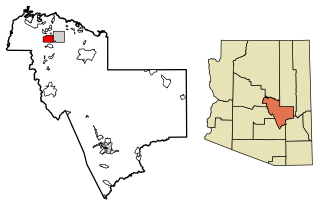
Kamiesberg Local Municipality is in South Africa.

Kamiesberge

The Kamiesberg or Kamiesberge, is a mountain range of jumbled granite inselbergs or bornhardts dotted over sandy plains and centered on Kamieskroon in Namaqualand in South Africa. This range is very like the Matopos of Zimbabwe in appearance. It stretches for about 140 km (60 mi) from Garies in the south to Springbok in the north and forms a plateau between the Sandveld of the Cape West Coast and Bushmanland in the east, with the Hardveld of the mountainous central Kamiesberg escarpment in the midst.

Namaqualand arid region of Namibia and South Africa, extending along the west coast over 1,000 kilometres and covering a total area of 440,000 square kilometres.

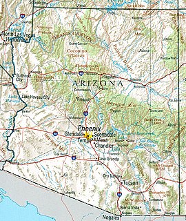
Namaqualand is an arid region of Namibia and South Africa, extending along the west coast over 1,000 kilometres (600 mi) and covering a total area of 440,000 square kilometres (170,000 sq mi). It is divided by the lower course of the Orange River into two portions – Little Namaqualand to the south and Great Namaqualand to the north.

Kamieskroon was founded in 1924, when the Dutch Reformed Church bought the land to relocate from Bowesdorp, 8 km to the north of the current location of the town. The move was forced by a shortage of water and restricted space for the growth of the town. Kamieskroon is located at the foot of the "Kroon" (Afrikaans, meaning Crown), a small koppie that resembles the crown of a king and is near Sneeukop, the second highest peak in Namaqualand. Also located close to Kamieskroon is Boesmankop, a mountain that resembles a Boesman (Bushman or San) lying on his back. Between 1969 and 2003 it was a military base housing two Armoured Squadrons equipped with Ratel-90 and four Companies of SA 9th Light Infantry Regiment.

The Dutch Reformed Church was the largest Christian denomination in the Netherlands from the onset of the Protestant Reformation until 1930. It was the foremost Protestant denomination, and—since 1892—one of the two major Reformed denominations along with the Reformed Churches in the Netherlands.

Bowesdorp was formerly a town between Garies and Springbok, 60 km south of the latter. Established on the farm Wilgenhoutskloof and named after Henry Bowe, doctor in Namaqualand. Situated in a narrow valley between high mountains, there was not sufficient water or space for expansion, and the church, post office, police station and shops were moved to Kamieskroon, 7 km away.

Namaqua National Park is located 20 km west of Kamieskroon. It is 1,000 km² in area and its principal purpose is to preserve the natural local flora. Since 2002 native wild animals have been re-introduced to the Park. (They had been shot out at least a century before). Springbok, Hartebeest and Oryx (Gemsbok) now roam there again.

Namaqua National Park A South African national park in Namaqualand in the Northern Cape

Namaqua National Park is a South African national park situated approximately 495 km north of Cape Town and 22 km northwest of Kamieskroon. It has an area of more than 700 km2. The park is part of Namaqualand, an area covering 55,000 km2 located within the semi-desert Succulent Karoo biome. This biome is a biodiversity hotspot with the largest concentration of succulent plants in the world. The park also has an arid environment with succulent plants. The park was created to protect its flowers. During the spring, wildflowers bloom there in a spectacular fashion. The park's main tourist attraction is this abundant spring bloom of brightly coloured wildflowers.

Hartebeest African grassland antelope

The hartebeest, also known as kongoni, is an African antelope. Eight subspecies have been described, including two sometimes considered to be independent species. A large antelope, the hartebeest stands just over 1 m (3.3 ft) at the shoulder, and has a typical head-and-body length of 200 to 250 cm. The weight ranges from 100 to 200 kg. It has a particularly elongated forehead and oddly shaped horns, short neck, and pointed ears. Its legs, which often have black markings, are unusually long. The coat is generally short and shiny. Coat colour varies by the subspecies, from the sandy brown of the western hartebeest to the chocolate brown of the Swayne's hartebeest. Both sexes of all subspecies have horns, with those of females being more slender. Horns can reach lengths of 45–70 cm (18–28 in). Apart from its long face, the large chest and the sharply sloping back differentiate the hartebeest from other antelopes.

<i>Oryx</i> genus of mammals

Oryx is a genus consisting of four large antelope species called oryxes. Three of them are native to arid parts of Africa, and the fourth to the Arabian Peninsula. Their fur is pale with contrasting dark markings in the face and on the legs, and their long horns are almost straight. The exception is the scimitar oryx, which lacks dark markings on the legs, only has faint dark markings on the head, has an ochre neck, and horns that are clearly decurved.

The climate is arid but temperatures are moderated somewhat by the elevation. Daytime temperatures commonly reach thirty-five degrees Celsius (95°F) in summer while some frost may be experienced during clear winter nights.

Related Research Articles

Geography of South Africa geography of South Africa

South Africa occupies the southern tip of Africa, its coastline stretching more than 2,850 kilometres from the desert border with Namibia on the Atlantic (western) coast southwards around the tip of Africa and then northeast to the border with Mozambique on the Indian Ocean. The low-lying coastal zone is narrow for much of that distance, soon giving way to a mountainous escarpment that separates the coast from the high inland plateau. In some places, notably the province of KwaZulu-Natal in the east, a greater distance separates the coast from the escarpment. Although most of the country is classified as semi-arid, it has considerable variation in climate as well as topography.

Payson, Arizona Town in Arizona, United States

Payson is a town in northern Gila County, Arizona, United States. Its location puts it very near to the geographic center of Arizona. Payson has been called "The Heart of Arizona". The town is surrounded by the Tonto National Forest and has many outdoor activities year round. As of the 2010 census, the population of Payson was 15,301.

Baxter State Park state park

Baxter State Park is a large wilderness area permanently preserved as a state park, located in Northeast Piscataquis, Piscataquis County in north-central Maine, United States. It is in the North Maine Woods region, and the Katahdin Woods and Waters National Monument borders Baxter State Park.

Tzaneen Place in Limpopo, South Africa

Tzaneen is a large tropical garden town situated in the Mopani District Municipality of the Limpopo province in South Africa. It is situated in a lush, high rainfall fertile region with tropical and subtropical agriculture taking place in a 20,000 km2 region. It is Limpopo's second largest town after Polokwane.

Alexander Bay, Northern Cape Place in Northern Cape, South Africa

Alexander Bay is a town in the extreme north-west of South Africa. It is located on the southern bank of the Orange River mouth. It was named for Sir James Alexander, who was the first person to map the area whilst on a Royal Geographical Society expedition into Namibia in 1836. With diamonds being discovered along the West Coast in 1925, Alexander Bay was established to service the mining industry.

Port Nolloth Place in Northern Cape, South Africa

Port Nolloth is a town and small domestic seaport in the Namaqualand region on the northwestern coast of South Africa, 144 kilometres (89 mi) northwest of Springbok. It is the seat of the Richtersveld Local Municipality.

Garies Place in Northern Cape, South Africa

Garies is a small agricultural centre situated in South Africa's Northern Cape province about 110 km south of Springbok, the chief town of the Namaqualand district. Current population approximately 1500.

Melkbosstrand Place in Western Cape, South Africa

Melkbosstrand is a coastal suburb and beach located on the South West Coast of South Africa, 35 km north of Cape Town.

Sierra de Guadarrama mountain range

The Sierra de Guadarrama is a mountain range forming the main eastern section of the Sistema Central, the system of mountain ranges along the centre of the Iberian Peninsula. It is located between the systems Sierra de Gredos in the province of Ávila, and Sierra de Ayllón in the province of Guadalajara.

Springbok, Northern Cape Place in Northern Cape, South Africa

Springbok is the largest town in the Namaqualand area in the Northern Cape province of South Africa. It was called Springbokfontein, until 1911, when it was shortened to Springbok. Springbok is located on the N7 national route which connects the Cape with Namibia, and at the western end of the N14, which connects it with Upington and Pretoria. It is the main town of the Nama Khoi Local Municipality, which also includes a number of surrounding towns such as Okiep and Nababeep.

Middle Atlas mountain range in Morocco

The Middle Atlas is a mountain range in Morocco. It is part of the Atlas mountain range, a vast mountainous region with more than 100,000 km2, 15 percent of its landmass, rising above 2,000 metres. The Middle Atlas is the northernmost and second highest of three main Atlas Mountains chains of Morocco. To south, separated by the Moulouya and Um Er-Rbiâ rivers, lies the High Atlas. The Middle Atlas form the westernmost end of a large plateaued basin extending eastward into Algeria, also bounded by the Tell Atlas to the north and the Saharan Atlas to the south, both lying largely in Algeria. North of the Middle Atlas and separated by the Sebou River, lie the Rif mountains which are an extension of the Baetic System, which includes the Sierra Nevada in the south of Spain. The basin of the Sebou is not only the primary transportation route between Atlantic Morocco and Mediterranean Morocco but is an area, watered by the Middle Atlas range, that constitutes the principal agricultural region of the country.

Colla Swart, born 1930, is a well-known South African Photographer. She started professional photography in 1982, and has become famous for her nature and people photography in and around her birth town of Kamieskroon. Colla and her Canadian photographer friend Freeman Patterson hosted, until recently, annual photographic workshops in Namaqualand, known for its beautiful floral scenery around August - September.

Geography of Arizona

Arizona is a landlocked state situated in the southwestern region of the United States of America. It has a vast and diverse geography famous for its deep canyons, high- and low-elevation deserts, numerous natural rock formations, and volcanic mountain ranges. Arizona shares land borders with Utah to the north, the Mexican state of Sonora to the south, New Mexico to the east, and Nevada to the northwest, as well as water borders with California and the Mexican state of Baja California to the southwest along the Colorado River. Arizona is also one of the Four Corners states and is diagonally adjacent to Colorado.

Pofadder, Northern Cape Place in Northern Cape, South Africa

Pofadder is a very small town in the Northern Cape province of South Africa. In spite of its small size it is an important local centre in the region known in South Africa as Bushmanland. The surrounding districts are arid, sparsely populated, rugged and picturesque. There is little in the way of cropping and local farmers run sheep or goats for a living. As a tourist destination it is not sufficiently spectacular to rival the spring flowers of the coastal regions of Namaqualand, but it has its attractions for biologists and conservationists and those with an interest in its remarkable diversity of often-tiny xerophytes and animal life.

Vaalputs Place in Northern Cape, South Africa

Vaalputs is the only South African radioactive waste-disposal facility, called the Vaalputs Radioactive Waste Disposal Facility, operated by NECSA. The facility is located about 100 km south-east of Springbok, in the Northern Cape. It covers an area of approximately 10,000 hectare, measuring 16,5 km from east to west and 6,5 km from north to south at its narrowest point.

Bushmanland is an arid area south of the Orange River and west of Kenhardt and east of Springbok (Namaqualand) in the Northern Cape, South Africa.

References

  1. 1 2 3 4 "Main Place Kamieskroon". Census 2011.