Spoegrivier

Last updated
Spoegrivier
South Africa Northern Cape location map.svg
Red pog.svg
Spoegrivier
South Africa adm location map.svg
Red pog.svg
Spoegrivier
Coordinates: 30°20′28″S17°45′36″E / 30.341°S 17.760°E / -30.341; 17.760 Coordinates: 30°20′28″S17°45′36″E / 30.341°S 17.760°E / -30.341; 17.760
Country South Africa
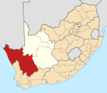
Province Northern Cape
District Namakwa
Municipality Kamiesberg
Area
[1]
  Total0.34 km2 (0.13 sq mi)
Population
(2011) [1]
  Total513
  Density1,500/km2 (3,900/sq mi)
Racial makeup (2011)
[1]
   Black African 4.3%
   Coloured 94.7%
   Indian/Asian 1.0%
First languages (2011)
[1]
   Afrikaans 97.5%
   Sign language 1.8%
  Other0.8%
Time zone UTC+2 (SAST)

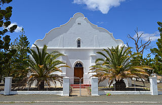
Spoegrivier is a town in Namakwa District Municipality in the Northern Cape province of South Africa.

Namakwa District Municipality District municipality in Northern Cape, South Africa

Namakwa is one of the 5 districts of the Northern Cape province of South Africa. The seat of Namakwa is Springbok and the region is also known as Little Namaqualand. The majority of its 108,118 people speak Afrikaans. The district code is DC6.
Northern Cape Province of South Africa

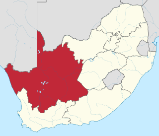
The Northern Cape is the largest and most sparsely populated province of South Africa. It was created in 1994 when the Cape Province was split up. Its capital is Kimberley. It includes the Kalahari Gemsbok National Park, part of the Kgalagadi Transfrontier Park, an international park shared with Botswana. It also includes the Augrabies Falls and the diamond mining regions in Kimberley and Alexander Bay. The Namaqualand region in the west is famous for its Namaqualand daisies. The southern towns of De Aar and Colesberg, in the Great Karoo, are major transport nodes between Johannesburg, Cape Town and Port Elizabeth. In the northeast, Kuruman is known as a mission station and also for its artesian spring, the Eye of Kuruman. The Orange River flows through the province, forming the borders with the Free State in the southeast and with Namibia to the northwest. The river is also used to irrigate the many vineyards in the arid region near Upington.

South Africa Republic in the southernmost part of Africa

South Africa, officially the Republic of South Africa (RSA), is the southernmost country in Africa. It is bounded to the south by 2,798 kilometres (1,739 mi) of coastline of Southern Africa stretching along the South Atlantic and Indian Oceans; to the north by the neighbouring countries of Namibia, Botswana, and Zimbabwe; and to the east and northeast by Mozambique and Eswatini (Swaziland); and it surrounds the enclaved country of Lesotho. South Africa is the largest country in Southern Africa and the 25th-largest country in the world by land area and, with over 57 million people, is the world's 24th-most populous nation. It is the southernmost country on the mainland of the Old World or the Eastern Hemisphere. About 80 percent of South Africans are of Sub-Saharan African ancestry, divided among a variety of ethnic groups speaking different African languages, nine of which have official status. The remaining population consists of Africa's largest communities of European (White), Asian (Indian), and multiracial (Coloured) ancestry.

Town some 13 km west-north-west of Karkams and 46 km east of Hondeklipbaai. It takes its name from the non-perennial stream which rises north of it and extends south and then west to enter the Atlantic Ocean 20 km south-east of Hondeklipbaai. Afrikaans for ‘spit river’, the name is probably translated from Khoekhoen Kanoep, referring to a disease affecting cattle. [2]

Karkams Place in Northern Cape, South Africa

Karkams is a town in Namakwa District Municipality in the Northern Cape province of South Africa.

Related Research Articles

Geography of South Africa geography of South Africa

South Africa occupies the southern tip of Africa, its coastline stretching more than 2,850 kilometres from the desert border with Namibia on the Atlantic (western) coast southwards around the tip of Africa and then northeast to the border with Mozambique on the Indian Ocean. The low-lying coastal zone is narrow for much of that distance, soon giving way to a mountainous escarpment that separates the coast from the high inland plateau. In some places, notably the province of KwaZulu-Natal in the east, a greater distance separates the coast from the escarpment. Although most of the country is classified as semi-arid, it has considerable variation in climate as well as topography.

Namaqualand arid region of Namibia and South Africa, extending along the west coast over 1,000 kilometres and covering a total area of 440,000 square kilometres.

Namaqualand is an arid region of Namibia and South Africa, extending along the west coast over 1,000 kilometres (600 mi) and covering a total area of 440,000 square kilometres (170,000 sq mi). It is divided by the lower course of the Orange River into two portions – Little Namaqualand to the south and Great Namaqualand to the north.

Dealesville Place in Free State, South Africa

Dealesville is a mixed farming town in the Free State province of South Africa and is surrounded by numerous salt pans. There are many natural springs in the vicinity, most notably Florisbad some 35 km from the town.

Marble Hall Place in Limpopo, South Africa

Marble Hall is a town in the south of the Limpopo province of South Africa. It was formerly in Mpumalanga province.

Mookgophong Place in Limpopo, South Africa

Mookgophong, also known by its former name, Naboomspruit, is a town in the Limpopo province of South Africa. The town is located approximately 42 km north-east of Modimolle and 51 km south-west of Mokopane.

Delareyville Place in North West, South Africa

Delareyville is a maize and peanut farming town situated in North West Province of South Africa. The town is 96 km south-west of Lichtenburg, 82 km north-east of Vryburg, 114 km north-west of Wolmaransstad, and 61 km north of Schweizer-Reneke.

Derby, North West Place in North West, South Africa

Derby is a small town situated in North West Province of South Africa that was named after the British Secretary of State Lord Derby. Derby began as a refuge for destitute people.

Langeberg

The Langeberg Range is a mountain range in the Western Cape province of South Africa. Its highest peak is Keeromsberg at 2075m and 15 km NE of the town of Worcester. Some of the highest peaks of the range are located just to the north of Swellendam, in a subrange known as the Clock Peaks whose highest point is 1710 m high Misty Point. Local lore states one can tell the time by means of the shadows cast by the seven summits of the Clock Peaks.

Hondeklip Bay Place in Northern Cape, South Africa

Hondeklip Bay is a coastal village in the Namakwa district of the Northern Cape province of South Africa. It lies about 95 km south west of the district capital Springbok.

Vosburg Place in Northern Cape, South Africa

Vosburg is a town 61 km west of Britstown, in the Northern Cape province of South Africa. The town has relatively low crime rate and features many 18th century buildings.

Strydenburg Place in Northern Cape, South Africa

Strydenburg is a town in the east of the Northern Cape province in South Africa. Seventy-seven km north of Britstown, it was laid out by the Dutch Reformed Church on the farm Roodepan in 1892. It also lies on the N12, which separates the actual town from its township.

Prieska Place in Northern Cape, South Africa

Prieska is a town on the south bank of the Orange River, in the province of the Northern Cape, in western South Africa.

Marydale Place in Northern Cape, South Africa

Marydale is a town in the Northern Cape province in western South Africa. Established in 1903 by the Dutch Reformed Church, Marydale was named after the wife of Mr GP Snyman, owner of the farm on which the town was laid out. The town is 76 km north-west of Prieska.

Postmasburg Place in Northern Cape, South Africa

Postmasburg is a town in the Northern Cape province of South Africa, located approximately 170 km east of Upington.

Bothasig A suburban area of the Northern Suburbs of Cape Town

Bothasig also known as 'The Sig' is a suburban area of the City of Cape Town in Western Cape, South Africa. It is located north of Edgemead and east of Milnerton. It is located approximately 15 km north-east of the Cape Town city centre.

Willowmore Place in Eastern Cape, South Africa

Willowmore is a town in Sarah Baartman District Municipality in the Eastern Cape province of South Africa.
Seymour, Eastern Cape Place in Eastern Cape, South Africa

Seymour is a town in Amatole District Municipality in the Eastern Cape province of South Africa.

Klipplaat Place in Eastern Cape, South Africa

Klipplaat is a town in Sarah Baartman District Municipality in the Eastern Cape province of South Africa.

Middledrift, Eastern Cape Place in Eastern Cape, South Africa

Middledrift is a small town located 90 kilometres (60 mi) north-west of East London in the Eastern Cape province of South Africa. It is situated in Raymond Mhlaba Municipality in Amathole District in an area that was formerly part of the Ciskei.

Thaba Phatswa Place in Free State, South Africa

Thaba Phatswa is a town in Thabo Mofutsanyane District Municipality in the Free State province of South Africa.

References

  1. 1 2 3 4 "Main Place Spoegrivier". Census 2011.
  2. "Dictionary of Southern African Place Names (Public Domain)". Human Science Research Council. p. 413.