
Mahikeng, formerly known as Mafikeng and alternatively known as Mafeking, is the capital city of the North West province of South Africa.

David Livingstone was a Scottish physician, Congregationalist, pioneer Christian missionary with the London Missionary Society, and an explorer in Africa. Livingstone was married to Mary Moffat Livingstone, from the prominent 18th-century Moffatt missionary family. Livingstone came to have a mythic status that operated on a number of interconnected levels: Protestant missionary martyr, working-class "rags-to-riches" inspirational story, scientific investigator and explorer, imperial reformer, anti-slavery crusader, and advocate of British commercial and colonial expansion. As a result, Livingstone became one of the most popular British heroes of the late 19th-century Victorian era.
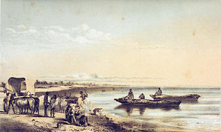
Lake Ngami is an endorheic lake in Botswana, north of the Kalahari Desert. It is seasonally filled by the Taughe River, an effluent of the Okavango River system flowing out of the western side of the Okavango Delta. It is one of the fragmented remnants of the ancient Lake Makgadikgadi. Although the lake has shrunk dramatically beginning from 1890, it remains an important habitat for birds and wildlife, especially in flood years.

Kuruman is a small town in the Northern Cape province of South Africa. It is known for its scenery and the Eye of Kuruman, a geological feature that brings water from deep underground. The abundance of water produces an unexpected swathe of green amidst the barren plains and is known as the "Oasis of the Kalahari". It was at first a mission station of the London Missionary Society founded by Robert Moffat in 1821. It was also the place where David Livingstone arrived for his first position as a missionary in 1841. The Kuruman River, which is dry except for flash floods after heavy rain, is named after the town.

Bethulie is a small sheep and cattle farming town in the Free State province of South Africa. The name meaning chosen by God was given by directors of a mission station in 1829 which the town formed around. The mission building is the oldest settler built building still standing in the Free State. The town was also home to one of the largest concentration camps run by the British during the Boer War. The Dutch Reformed Church was built in 1862.

The Great Fish River is a river running 644 kilometres (400 mi) through the South African province of the Eastern Cape. The coastal area between Port Elizabeth and the Fish River mouth is known as the Sunshine Coast. The Great Fish River was originally named Rio do Infante, after João Infante, the captain of one of the caravels of Bartolomeu Dias. Infante visited the river in the late 1480s.

Robert Moffat was a Scottish Congregationalist missionary to Africa from 1817–1870. Moffat began his missionary career in South Africa at the age of twenty-one. He was married to Mary Moffat. Their daughter was Mary Moffat Livingstone and their son-in-law was David Livingstone, who often worked with Moffat and his missionary efforts at various stations in southern Africa While doing missionary work at the mission at Kuruman, Moffat was the first to translate and have the Bible printed into the Sechuana language. While in Africa, Moffat devoted much of his time preaching the gospel and discussing the Bible, and also taught many of the natives how to read and write. Moffat's missionary career in Africa spanned a total of fifty-four years.

Alfred Saker was a British Baptist missionary of the Baptist Missionary Society. In 1858 he led a Baptist Mission that relocated from the then Spanish island of Fernando Po and landed in Southern Cameroons. According to the record, he bought land from indigenous Bimbia chiefs, established a seaside settlement christened Victoria after the reigning British Empress. The settlement was renamed Limbe by decree in 1982 by President Ahmadou Ahidjo of Cameroon.

Alice is a small town in Eastern Cape, South Africa that is named after Princess Alice, the daughter of the British Queen Victoria. It was settled in 1824 by British colonists. It is adjacent to the Tyhume River. It has a rail and road connection to East London, Qonce and other towns in the province. It forms part of Raymond Mhlaba Local Municipality.
Kalemie, formerly Albertville or Albertstad, is a city on the western shore of Lake Tanganyika in the Democratic Republic of the Congo. The Lukuga River, that drains Lake Tanganyika to the Lualaba River, runs through the city. Kalemie is the capital of Tanganyika Province.

Kuils River is a town in the Western Cape, South Africa, 25 km east of Cape Town and 20 km west of Stellenbosch at the gateway of the Cape Winelands. It is also the name of the main tributary of the Eerste River, and forms part of the Eastern Suburbs zone of the City of Cape Town.
The Church Mission Society (CMS), formerly known as the Church Missionary Society, is a British Anglican mission society working with Christians around the world. Founded in 1799, CMS has attracted over nine thousand men and women to serve as mission partners during its 200-year history. The society has also given its name "CMS" to a number of daughter organisations around the world, including Australia and New Zealand, which have now become independent.

George Grenfell (21 August 1849, in Sancreed, Cornwall – 1 July 1906, in Basoko, Congo Free State was a Cornish missionary and explorer.
Nkurenkuru is a town on the south-western banks of the Kavango River. It is the capital of the Kavango West Region of northern Namibia, located 140 kilometres (87 mi) west of Rundu. It is also a former mission station of the Finnish Missionary Society.

Haarlem is a settlement in Garden Route District Municipality in the Western Cape province of South Africa.
Enon is a small town in the Eastern Cape in South Africa. It is named after the biblical place mentioned in John 3:23 It lies 13 kilometres (8.1 mi) east of Kirkwood and 60 kilometres (37 mi) north-east of Uitenhage.

Steinkopf is a town in Namakwa District Municipality in the Northern Cape province of South Africa.
Wesley is a town in Amathole District Municipality in the Eastern Cape province of South Africa.
Mupini is a settlement and former mission station of the Finnish Missionary Society in Kavango East, Namibia. It is located along the Kavango River about 18 km to the northwest of Rundu and 62 km east of Rupara.

Lüneburg is a farming community in eDumbe Local Municipality in the KwaZulu-Natal province of South Africa.


