Karoo Hoogland Local Municipality

Last updated
Karoo Hoogland
Karoo Hoogland CoA.png
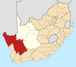
Map of the Northern Cape with Karoo Hoogland highlighted (2011).svg
Location in the Northern Cape
Coordinates: 31°45′S21°15′E / 31.750°S 21.250°E / -31.750; 21.250
Country South Africa
Province Northern Cape
District Namakwa
Seat Williston
Wards 6
Government
[1]
  Type Municipal council
  MayorJohan van der Colff (DA)
Area
  Total32,274 km2 (12,461 sq mi)
Population
 (2011) [2]
  Total12,588
  Density0.39/km2 (1.0/sq mi)
Racial makeup (2011)
[2]
   Black African 5.5%
   Coloured 78.9%
   Indian/Asian 0.7%
   White 14.6%
First languages (2011)
[3]
   Afrikaans 96.3%
   English 1.3%
  Other2.4%
Time zone UTC+2 (SAST)
Municipal codeNC066

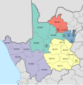
Karoo Hoogland Municipality (Afrikaans : Karoo Hoogland Munisipaliteit) is a local municipality within the Namakwa District Municipality, in the Northern Cape province of South Africa. The municipality incorporates the towns of Williston, Fraserburg and Sutherland. Although the towns are separated by more than 100 km by road, they share many administrative tasks.

Contents

Hoogland is an Afrikaans word meaning "highland" and Karoo is a Khoekhoe word meaning "hard" or "dry". The name reflects the area which has dry, arid and desert-like conditions. [4]

In 2011, Karoo Hoogland elected the first mayor from the Congress of the People (COPE) party, Jan Julies, and a COPE-DA coalition took control of the council after the election of 18 May 2011. [5] This lasted until the 2016 elections.

Main places

The 2011 census divided the municipality into the following main places: [6]

PlaceCodeArea (km2)Population
Fraserburg 367003 98.93,029
Sutherland 367004 36.02,836
Williston 367001 77.93,368
Remainder 367002 32,061.13,356
Total32,273.912,588

Politics

The municipal council consists of eleven members elected by mixed-member proportional representation. Six councillors are elected by first-past-the-post voting in six wards, while the remaining five are chosen from party lists so that the total number of party representatives is proportional to the number of votes received. In the election of 1 November 2021 no party obtained a majority of seats on the council. The following table shows the results of the election. [7] [8]

Karoo Hoogland local election, 1 November 2021
PartyVotesSeats
WardListTotal %WardListTotal
African National Congress 1,8151,8033,61840.8%325
Democratic Alliance 1,3371,3352,67230.2%303
Patriotic Alliance 9629941,95622.1%022
Freedom Front Plus 2292254545.1%011
Congress of the People 42601021.2%000
Economic Freedom Fighters 2929580.7%000
Total4,4144,4468,8606511
Valid votes4,4144,4468,86098.7%
Spoilt votes 64571211.3%
Total votes cast4,4784,5038,981
Voter turnout4,507
Registered voters7,250
Turnout percentage62.2%

On 8 December 2022 the PA/ANC coalition collapsed during a no confidence motion brought by the DA. Consequently the PA mayor Anthony Mietas was replaced by the DA’s Johan van der Colff. [9]

Related Research Articles

<span class="mw-page-title-main">Knysna Local Municipality</span> Local municipality in Western Cape, South Africa

Knysna Municipality is a local municipality within the Garden Route District Municipality, in the Western Cape province of South Africa. As of 2011, the population is 68,659. Its municipal code is WC048.

<span class="mw-page-title-main">George Local Municipality</span> Local municipality in Western Cape, South Africa

George Municipality is a local municipality within the Garden Route District Municipality, in the Western Cape province of South Africa. As of 2011, the population is 193,672. Its municipality code is WC044.

<span class="mw-page-title-main">Witzenberg Local Municipality</span> Local municipality in Western Cape, South Africa

Witzenberg Municipality is a local municipality located within the Cape Winelands District Municipality, in the Western Cape province of South Africa. As of 2011 it had a population of 115,946.

<span class="mw-page-title-main">Bitou Local Municipality</span> Local municipality in Western Cape, South Africa

Bitou Municipality, formerly known as Plettenberg Bay Municipality, is a local municipality within the Garden Route District Municipality, in the Western Cape province of South Africa. Its municipality code is WC047.

<span class="mw-page-title-main">Langeberg Local Municipality</span> Local municipality in Western Cape, South Africa

Langeberg Municipality, known before 28 August 2009 as Breede River/Winelands Municipality, is a local municipality located within the Cape Winelands District Municipality, in the Western Cape province of South Africa. As of 2011, it had a population of 97,724. Its municipality code is WC026.

<span class="mw-page-title-main">Beaufort West Local Municipality</span> Local municipality in Western Cape, South Africa

Beaufort West Municipality is a local municipality located in the Western Cape province of South Africa. As of 2011, the population is 49,586. Its municipality code is WC053.

<span class="mw-page-title-main">Oudtshoorn Local Municipality</span> Local municipality in Western Cape, South Africa

Oudtshoorn Municipality is a local municipality within the Garden Route District Municipality, in the Western Cape province of South Africa. As of 2011, the population was 95,933.

<span class="mw-page-title-main">Overstrand Local Municipality</span> Local municipality in Western Cape, South Africa

Overstrand Municipality is a local municipality in the Western Cape province of South Africa. It is located along the Atlantic coast between Cape Town and Cape Agulhas, within the Overberg District Municipality. The principal towns in the municipality are Hermanus, Gansbaai and Kleinmond. As of 2011, it had a population of 80,432.

<span class="mw-page-title-main">Prince Albert Local Municipality</span> Local municipality in Western Cape, South Africa

Prince Albert Municipality is a local municipality located in the Western Cape province of South Africa.

<span class="mw-page-title-main">Cederberg Local Municipality</span> Local municipality in Western Cape, South Africa

Cederberg Municipality is a local municipality which governs an area of the Western Cape province of South Africa stretching from the Cederberg mountains through the middle valley of the Olifants River to the Atlantic coast. It includes the towns of Clanwilliam, Citrusdal and Lamberts Bay, and the surrounding villages and farms. As of 2011 it had a population of 49,768. It is located within the West Coast District Municipality and its municipality code is WC012.

<span class="mw-page-title-main">Central Karoo District Municipality</span> District municipality in Western Cape, South Africa

The Central Karoo District Municipality is a district municipality located in the Western Cape province of South Africa. Its municipality code is DC5.

<span class="mw-page-title-main">Kannaland Local Municipality</span> Local municipality in Western Cape, South Africa

Kannaland Municipality is a local municipality located within the Garden Route District Municipality, in the Western Cape province of South Africa. The municipal area is situated in the western part of the Little Karoo and includes the towns of Ladismith, Calitzdorp and Zoar. As of 2011, it has a population of 24,767. Its municipality code is WC041.

<span class="mw-page-title-main">Laingsburg Local Municipality</span> Local municipality in Western Cape, South Africa

Laingsburg Municipality is a local municipality located in the Western Cape province of South Africa. As of 2011, the population is 8,289. Its municipality code is WC051.

<span class="mw-page-title-main">Nelson Mandela Bay Metropolitan Municipality</span> Metropolitan municipality in Eastern Cape, South Africa

The Nelson Mandela Bay Municipality is one of eight metropolitan municipalities in South Africa. It is located on the shores of Algoa Bay in the Eastern Cape province and comprises the city of Gqeberha, the nearby towns of Uitenhage and Despatch, and the surrounding rural area.

<span class="mw-page-title-main">Nama Khoi Local Municipality</span> Local municipality in Northern Cape, South Africa

Nama Khoi Municipality is a local municipality within the Namakwa District Municipality, in the Northern Cape province of South Africa. Its seat is Springbok.

<span class="mw-page-title-main">Kamiesberg Local Municipality</span> Local municipality in Northern Cape, South Africa

Kamiesberg Municipality is a local municipality within the Namakwa District Municipality, in the Northern Cape province of South Africa.

<span class="mw-page-title-main">2011 South African municipal elections</span> South African municipal elections held on 18 August 2011

Municipal elections were held in South Africa on 18 May 2011, electing new councils for all municipalities in the country. Municipal elections are held every five years, and the previous municipal elections were held in 2006. The first municipal elections following the reorganisation of municipalities took place in December 2000.

<span class="mw-page-title-main">Thembelihle Local Municipality</span> Local municipality in Northern Cape, South Africa

Thembelihle Municipality, formerly known as Oranje-Karoo Municipality, is a local municipality within the Pixley ka Seme District Municipality, in the Northern Cape province of South Africa. Thembelihle is a Xhosa word meaning "good hope".

<span class="mw-page-title-main">Gamagara Local Municipality</span> Local municipality in Northern Cape, South Africa

Gamagara Municipality is a local municipality within the John Taolo Gaetsewe District Municipality, in the Northern Cape province of South Africa.

The Prince Albert Local Municipality council consists of seven members elected by mixed-member proportional representation. Four councillors are elected by first-past-the-post voting in four wards, while the remaining three are chosen from party lists so that the total number of party representatives is proportional to the number of votes received. In the election of 1 November 2021 no party obtained a majority of seats.

References

  1. "Contact list: Executive Mayors". Government Communication & Information System. Archived from the original on 14 July 2010. Retrieved 22 February 2012.
  2. 1 2 "Statistics by place". Statistics South Africa. Retrieved 27 September 2015.
  3. "Statistics by place". Statistics South Africa. Retrieved 27 September 2015.
  4. South African Languages - Place names
  5. "First COPE mayor sworn in". IOL. Sapa. 31 May 2011. Retrieved 11 June 2011.
  6. "Karoo Hoogland Local Municipality". Census 2011.
  7. "Results Summary - All Ballots" (PDF). Electoral Commission of South Africa. 8 November 2021. Retrieved 12 November 2021.
  8. "Seat Calculation Detail" (PDF). Electoral Commission of South Africa. 8 November 2021. Retrieved 12 November 2021.
  9. Cruywagen, Vincent (8 December 2022). "MUNICIPAL POLITICS: Another coalition crumbles as Patriotic Alliance mayor and Speaker are deposed in Karoo Hoogland". Daily Maverick. Retrieved 9 December 2022.