Eksteenfontein

Last updated
Eksteenfontein
060 Eksteenfontein.jpg
Eksteenfontein
South Africa Northern Cape location map.svg
Red pog.svg
Eksteenfontein
South Africa adm location map.svg
Red pog.svg
Eksteenfontein
Coordinates: 28°49′26″S17°15′18″E / 28.824°S 17.255°E / -28.824; 17.255 Coordinates: 28°49′26″S17°15′18″E / 28.824°S 17.255°E / -28.824; 17.255
Country South Africa
Province Northern Cape
District Namakwa
Municipality Richtersveld
Area
[1]
  Total0.73 km2 (0.28 sq mi)
Population
(2011) [1]
  Total531
  Density730/km2 (1,900/sq mi)
Racial makeup (2011)
[1]
   Black African 0.9%
   Coloured 89.3%
  Other9.8%
First languages (2011)
[1]
   Afrikaans 94.5%
   English 1.3%
   Tswana 1.1%
  Other3.0%
Time zone UTC+2 (SAST)
PO box
8284

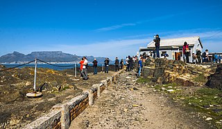
Eksteenfontein is a town in Namakwa District Municipality in the Northern Cape province of South Africa, on the edge of the Richtersveld World Heritage Site. [2]

Namakwa District Municipality District municipality in Northern Cape, South Africa

Namakwa is one of the 5 districts of the Northern Cape province of South Africa. The seat of Namakwa is Springbok and the region is also known as Little Namaqualand. The majority of its 108,118 people speak Afrikaans. The district code is DC6.

Northern Cape Province of South Africa

The Northern Cape is the largest and most sparsely populated province of South Africa. It was created in 1994 when the Cape Province was split up. Its capital is Kimberley. It includes the Kalahari Gemsbok National Park, part of the Kgalagadi Transfrontier Park, an international park shared with Botswana. It also includes the Augrabies Falls and the diamond mining regions in Kimberley and Alexander Bay. The Namaqualand region in the west is famous for its Namaqualand daisies. The southern towns of De Aar and Colesberg, in the Great Karoo, are major transport nodes between Johannesburg, Cape Town and Port Elizabeth. In the northeast, Kuruman is known as a mission station and also for its artesian spring, the Eye of Kuruman. The Orange River flows through the province, forming the borders with the Free State in the southeast and with Namibia to the northwest. The river is also used to irrigate the many vineyards in the arid region near Upington.

South Africa Republic in the southernmost part of Africa

South Africa, officially the Republic of South Africa (RSA), is the southernmost country in Africa. It is bounded to the south by 2,798 kilometres (1,739 mi) of coastline of Southern Africa stretching along the South Atlantic and Indian Oceans; to the north by the neighbouring countries of Namibia, Botswana, and Zimbabwe; and to the east and northeast by Mozambique and Eswatini (Swaziland); and it surrounds the enclaved country of Lesotho. South Africa is the largest country in Southern Africa and the 25th-largest country in the world by land area and, with over 57 million people, is the world's 24th-most populous nation. It is the southernmost country on the mainland of the Old World or the Eastern Hemisphere. About 80 percent of South Africans are of Sub-Saharan African ancestry, divided among a variety of ethnic groups speaking different African languages, nine of which have official status. The remaining population consists of Africa's largest communities of European (White), Asian (Indian), and multiracial (Coloured) ancestry.

The locals are mostly of Baster ancestry, people of mixed blood who were forcibly removed from the white farming area near Pofadder in 1945. [2] The town was originally known as Stinkfontein (stinking spring), but was later renamed in honour of a Reverend Eksteen, the pastor who had helped the Baster in finding a new place to live. [2]

Baster ethnic group

The Basters are a Namibian ethnic group descended from Afrikaners and indigenous tribes which formerly resided in the Dutch Cape Colony. Since the second half of the nineteenth century, the Baster community has been concentrated in central Namibia, in and around the town of Rehoboth. It is closely related to the Cape Coloured and Griqua ethnic groups in South Africa.

Pofadder, Northern Cape Place in Northern Cape, South Africa

Pofadder is a very small town in the Northern Cape province of South Africa. In spite of its small size it is an important local centre in the region known in South Africa as Bushmanland. The surrounding districts are arid, sparsely populated, rugged and picturesque. There is little in the way of cropping and local farmers run sheep or goats for a living. As a tourist destination it is not sufficiently spectacular to rival the spring flowers of the coastal regions of Namaqualand, but it has its attractions for biologists and conservationists and those with an interest in its remarkable diversity of often-tiny xerophytes and animal life.

Related Research Articles

The protected areas of South Africa include national parks and marine protected areas managed by the national government, public nature reserves managed by provincial and local governments, and private nature reserves managed by private landowners. Most protected areas are intended for the conservation of flora and fauna. National parks are maintained by South African National Parks (SANParks). A number of national parks have been incorporated in transfrontier conservation areas.

Khoikhoi ethnic group

The Khoikhoi are the traditionally nomadic pastoralist non-Bantu indigenous population of southwestern Africa. They are grouped with the hunter-gatherer San under the compound term Khoisan.

The Griqua are a subgroup of Southern Africa's heterogeneous and multiracial Coloured people, who have a unique origin in the early history of the Cape Colony.

Namaqualand arid region of Namibia and South Africa, extending along the west coast over 1,000 kilometres and covering a total area of 440,000 square kilometres.

Namaqualand is an arid region of Namibia and South Africa, extending along the west coast over 1,000 kilometres (600 mi) and covering a total area of 440,000 square kilometres (170,000 sq mi). It is divided by the lower course of the Orange River into two portions – Little Namaqualand to the south and Great Namaqualand to the north.

Rehoboth, Namibia Town in Hardap Region, Namibia

Rehoboth is a town in central Namibia just north of the Tropic of Capricorn. Located 90 kilometres south of the Namibian capital Windhoek, Rehoboth lies on a high elevation plateau with several natural hot-water springs. It receives sparse mean annual rainfall of 240 millimetres (9.4 in), although in the 2010/2011 a record 731 millimetres (28.8 in) were measured. In 2005, it had a population of 21,378 later increased to 28,843 in 2011, according to the 2011 Namibian Population and Housing Census.

Alexander Bay, Northern Cape Place in Northern Cape, South Africa

Alexander Bay is a town in the extreme north-west of South Africa. It is located on the southern bank of the Orange River mouth. It was named for Sir James Alexander, who was the first person to map the area whilst on a Royal Geographical Society expedition into Namibia in 1836. With diamonds being discovered along the West Coast in 1925, Alexander Bay was established to service the mining industry.

Richtersveld

The Richtersveld is a desert landscape characterised by rugged kloofs and high mountains, situated in the north-western corner of South Africa’s Northern Cape province. It is full of changing scenery from flat, sandy, coastal plains, to craggy sharp mountains of volcanic rock and the lushness of the Orange River, which forms the border with neighboring Namibia. The area ranges in altitude from sea level, to 1,377 m (4,518 ft) at Cornellberg. Located in the north-eastern side of the Northern Cape province in South Africa, the Richtersveld is regarded as the only arid biodiversity hotspot on earth and the majority of the area is inscribed on UNESCO's World Heritage List due to its cultural values.

Tourism in South Africa

South Africa is a tourist destination and the industry accounts for a substantial amount of the country's revenue. According to the World Travel & Tourism Council, the tourism industry directly contributed ZAR 102 billion to South African GDP in 2012, and supports 10.3% of jobs in the country. The official national marketing agency of the South African government, with the goal of promoting tourism in South Africa both locally and globally is known as South African Tourism.

ǀAi-ǀAis Holiday resort in ǁKaras Region, Namibia

ǀAi-ǀAis is a Namibian holiday resort with hot mineral springs in the bed of the Fish River. It is situated in Southern Namibia's ǁKaras Region at the base of the Great Karas Mountains, 128 kilometres (80 mi) west of Karasburg and 224 kilometres (139 mi) south-west of Keetmanshoop.

ǀAi-ǀAis/Richtersveld Transfrontier Park Transfrontier park in Namibia and South Africa

The ǀAi-ǀAis/Richtersveld Transfrontier Park is a peace park straddling the border between South Africa and Namibia. It was formed in 2003 by combining the Namibian ǀAi-ǀAis Hot Springs Game Park and the South African Richtersveld National Park. Most of the South African part of the park forms part of the buffer zone of the Richtersveld Cultural and Botanical Landscape World Heritage Site, which measures 5 920 km2. The Fish River Canyon is located in the park, the largest canyon in Africa. A Memorandum of Understanding was signed on 17 August 2003 by the presidents of South Africa and Namibia, which formalized the establishment of the park.

Richtersveld Local Municipality Local municipality in Northern Cape, South Africa

Richtersveld is an administrative area in the Namakwa District of Northern Cape in South Africa.

Keimoes Place in Northern Cape, South Africa

Keimoes is a town in the Northern Cape province of South Africa. It lies on the Orange River and is about halfway between Upington and Kakamas.

Coloured people in Namibia

Coloured people in Namibia are people with both European and African ancestry. Coloureds have immigrated to Namibia, been born in Namibia or returned to the country. These distinctively different periods of arrival, from diverse backgrounds and origins have led to a diverse Coloured population. This diversity was even further exploited by South African officials who referred to three distinct groups amongst the coloureds, namely: "Baster", "Cape Coloureds" and "Namibian Coloureds".

Lekkersing Place in Northern Cape, South Africa

Lekkersing is a town in Namakwa District Municipality in the Northern Cape province of South Africa.

The Northern Cape Heritage Resources Authority, previously called Ngwao Boswa jwa Kapa Bokone, and commonly known as 'Boswa', is a provincial heritage resources authority established in 2003 by the MEC for Sport, Arts and Culture in the Northern Cape Province of South Africa, and reconstituted in terms of the Northern Cape Heritage Resources Authority Act, 2013. It is an institution set up under the terms of the National Heritage Resources Act. It is mandated to care for that part of South Africa's national estate that is of provincial and local significance in the Northern Cape.

Kuboes Place in Northern Cape, South Africa

Kuboes is a town in Richtersveld Local Municipality in the Northern Cape province of South Africa.

Sanddrif Place in Northern Cape, South Africa

Sanddrif is a town in Richtersveld Local Municipality in the Northern Cape province of South Africa, on the banks of the Orange River. It is located 57 km east of Alexander Bay.

References

  1. 1 2 3 4 "Main Place Eksteenfontein". Census 2011.
  2. 1 2 3 "Eksteenfontein is a perfect base to explore the Richtersveld World Heritage Site". South African Tourism. Retrieved 7 January 2014.