Thembelihle Local Municipality

Last updated

Thembelihle
Thembelihle CoA.png
Map of the Northern Cape with Thembelihle highlighted (2011).svg
Location in the Northern Cape
Coordinates: 29°45′S23°45′E / 29.750°S 23.750°E / -29.750; 23.750
Country South Africa
Province Northern Cape
District Pixley ka Seme
Seat Hopetown
Wards 6
Government
[1]
  Type Municipal council
  MayorLeonard Makena [2] (EFF)
Area
  Total8,023 km2 (3,098 sq mi)
Population
 (2011) [3]
  Total15,701
  Density2.0/km2 (5.1/sq mi)
Racial makeup (2011)
[3]
   Black African 15.2%
   Coloured 70.7%
   Indian/Asian 0.5%
   White 13.1%
First languages (2011)
[4]
   Afrikaans 90.4%
   Xhosa 5.1%
   English 1.3%
   Tswana 1.3%
  Other1.9%
Time zone UTC+2 (SAST)
Municipal codeNC076

Thembelihle Municipality (Afrikaans : Thembelihle Munisipaliteit), formerly known as Oranje-Karoo Municipality, is a local municipality within the Pixley ka Seme District Municipality, in the Northern Cape province of South Africa. Thembelihle is a Xhosa word meaning "good hope". [5]

Contents

History

At the end of the apartheid era, in the area that is today the Thembelihle Municipality, there were municipal councils for Hopetown and Strydenburg which were elected by the white residents, while the coloured residents of Steynville (Hopetown) and Strydenburg were governed by management committees subordinate to the white councils. The remaining rural areas were served by the Bo-Karoo Regional Services Council.

After the national elections of 1994 a process of local government transformation began, in which negotiations were held between the existing local authorities, political parties, and local community organisations. As a result of these negotiations, the existing local authorities were dissolved and transitional local councils (TLCs) were created for each town. The Strydenburg municipality and management committee were replaced by a TLC in September 1994, and the Hopetown municipality and Steynville management committee were replaced by a TLC in March 1995. The transitional councils were initially made up of members nominated by the various parties to the negotiations, until May 1996 when elections were held. At these elections the Bo-Karoo District Council was established, replacing the Bo-Karoo Regional Services Council. Transitional representative councils (TRCs) were also elected to represent the areas not included in the TLCs on the District Council; the area that was to become Thembelihle Municipality was part of the Oranje-Karoo TRC, except for Orania which had a separate TRC.

At the local elections of December 2000 the TLCs and TRCs were dissolved and the Oranje-Karoo Municipality (renamed Thembelihle in June 2001) was established as a single local authority. The Orania TRC challenged its dissolution in the Kimberley High Court, and under a settlement with the provincial government this TRC retained its powers and functions indefinitely pending further negotiations. [6] [7] Orania residents are entitled to vote in elections for the Thembelihle council, and 21% of registered voters in Orania cast a ballot in the 2021 elections, [8] but as of 2016 they did not receive any municipal services from Thembelihle. [6]

Geography

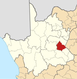
The municipality covers an area of 8,023 square kilometres (3,098 sq mi) on the left (south) bank of the Orange River, approximately 130 kilometres (80 mi) south of the provincial capital Kimberley. In the census of 2011 it had a reported population of 15,701 inhabitants in 4,140 households, giving a population density of 1.96 inhabitants per square kilometre (5.1/sq mi). [9] The principal town is Hopetown (pop. 10,259), which is situated on the Orange River. Other settlements are Strydenburg (pop. 2,987) situated 50 kilometres (30 mi) to the south-west of Hopetown, and Orania (pop. 2,377 at 2021) situated on the Orange River 35 kilometres (22 mi) to the south-east of Hopetown. The remainder of the municipality is rural, mostly used for farming of sheep and goats while intensive irrigated agriculture occurs along the Orange River. The main transport links in the municipal area are the N12 national road and the De Aar–Kimberley railway line, both of which pass north-south through the municipality.

According to the census, the main spoken language in the municipality is Afrikaans, which is home language of 89% of residents. It is followed by isiXhosa (5%), English and Setswana (1% each). 71% of residents identified themselves as Coloured, 15% as Black African, and 13% as White. 31% of residents were under the age of 15. [9]

Politics

The municipal council consists of eleven members elected by mixed-member proportional representation. Six councillors are elected by first-past-the-post voting in six wards, while the remaining three are chosen from party lists so that the total number of party representatives is proportional to the number of votes received.

For most of the time since its creation in 2000 Thembelihle has been governed by the African National Congress (ANC), which won outright majorities in the 2000, 2006 and 2011 municipal elections. The opposition took control of the council in December 2011, however, after ANC lost a by-election to an independent candidate. The independent, former ANC member Danny Jonas, became the new mayor of the municipality supported by the Congress of the People and the Democratic Alliance. [10] Jonas later joined the Economic Freedom Fighters (EFF).

In the election of 3 August 2016 the ANC regained control of the municipality, winning a majority of four seats on the council.

The following table shows the results of the 2021 election. [11] [12]

Thembelihle local election, 1 November 2021
PartyVotesSeats
WardListTotal %WardListTotal
African National Congress 2,1862,1574,34339.8%415
Economic Freedom Fighters 1,3151,3622,67724.5%123
Democratic Alliance 6277051,33212.2%011
Freedom Front Plus 5514701,0219.4%101
Siyathemba Community Movement1525577096.5%011
Independent candidates 4624624.2%00
Patriotic Alliance 1031172202.0%000
African Christian Democratic Party 69751441.3%000
Total5,4655,44310,9086511
Valid votes5,4655,44310,90898.4%
Spoilt votes 91861771.6%
Total votes cast5,5565,52911,085
Voter turnout5,562
Registered voters9,386
Turnout percentage59.3%

Related Research Articles

<span class="mw-page-title-main">Knysna Local Municipality</span> Local municipality in Western Cape, South Africa

Knysna Municipality is a local municipality within the Garden Route District Municipality, in the Western Cape province of South Africa. As of 2011, the population is 68,659. Its municipal code is WC048.

<span class="mw-page-title-main">Stellenbosch Local Municipality</span> Local municipality in Western Cape, South Africa

Stellenbosch Municipality is the local municipality that governs the towns of Stellenbosch, Franschhoek and Pniel, and the surrounding rural areas, in the Western Cape province of South Africa. It covers an area of 831 square kilometres (321 sq mi), and as of 2011 had a population of 155,733 people in 43,420 households. It falls within the Cape Winelands District Municipality.

<span class="mw-page-title-main">George Local Municipality</span> Local municipality in Western Cape, South Africa

George Municipality is a local municipality within the Garden Route District Municipality, in the Western Cape province of South Africa. As of 2011, the population is 193,672. Its municipality code is WC044.

<span class="mw-page-title-main">Mossel Bay Local Municipality</span> Local municipality in Western Cape, South Africa

Mossel Bay Municipality is a local municipality within the Garden Route District Municipality, in the Western Cape province of South Africa. As of 2011, the population was 89,430.

<span class="mw-page-title-main">Witzenberg Local Municipality</span> Local municipality in Western Cape, South Africa

Witzenberg Municipality is a local municipality located within the Cape Winelands District Municipality, in the Western Cape province of South Africa. As of 2011 it had a population of 115,946.

<span class="mw-page-title-main">Bitou Local Municipality</span> Local municipality in Western Cape, South Africa

Bitou Municipality, formerly known as Plettenberg Bay Municipality, is a local municipality within the Garden Route District Municipality, in the Western Cape province of South Africa. Its municipality code is WC047.

<span class="mw-page-title-main">Langeberg Local Municipality</span> Local municipality in Western Cape, South Africa

Langeberg Municipality, known before 28 August 2009 as Breede River/Winelands Municipality, is a local municipality located within the Cape Winelands District Municipality, in the Western Cape province of South Africa. As of 2011, it had a population of 97,724. Its municipality code is WC026.

<span class="mw-page-title-main">Beaufort West Local Municipality</span> Local municipality in Western Cape, South Africa

Beaufort West Municipality is a local municipality located in the Western Cape province of South Africa. As of 2011, the population is 49,586. Its municipality code is WC053.

<span class="mw-page-title-main">Oudtshoorn Local Municipality</span> Local municipality in Western Cape, South Africa

Oudtshoorn Municipality is a local municipality within the Garden Route District Municipality, in the Western Cape province of South Africa. As of 2011, the population was 95,933.

<span class="mw-page-title-main">Overstrand Local Municipality</span> Local municipality in Western Cape, South Africa

Overstrand Municipality is a local municipality in the Western Cape province of South Africa. It is located along the Atlantic coast between Cape Town and Cape Agulhas, within the Overberg District Municipality. The principal towns in the municipality are Hermanus, Gansbaai and Kleinmond. As of 2011, it had a population of 80,432.

<span class="mw-page-title-main">Prince Albert Local Municipality</span> Local municipality in Western Cape, South Africa

Prince Albert Municipality is a local municipality located in the Western Cape province of South Africa.

<span class="mw-page-title-main">Drakenstein Local Municipality</span> Local municipality in Western Cape, South Africa

Drakenstein Municipality is a local municipality located within the Cape Winelands District Municipality, in the Western Cape province of South Africa. As of 2011, it had a population of 251,262. Its municipality code is WC023.

<span class="mw-page-title-main">Breede Valley Local Municipality</span> Local municipality in Western Cape, South Africa

Breede Valley Municipality is a local municipality located within the Cape Winelands District Municipality, in the Western Cape province of South Africa. As of 2007, it had a population of 166,825. Its municipality code is WC025.

<span class="mw-page-title-main">Cape Agulhas Local Municipality</span> Local municipality in Western Cape, South Africa

Cape Agulhas Municipality is a municipality located in the Western Cape province of South Africa. As of 2011, it had a population of 33,038. Its municipality code is WC033. It is named after Cape Agulhas, the southernmost point of Africa. The largest town is Bredasdorp, which is the seat of the municipal headquarters. It also includes the villages of Napier, Struisbaai, Elim, Arniston and L'Agulhas, and the De Hoop Nature Reserve.

<span class="mw-page-title-main">Cederberg Local Municipality</span> Local municipality in Western Cape, South Africa

Cederberg Municipality is a local municipality which governs an area of the Western Cape province of South Africa stretching from the Cederberg mountains through the middle valley of the Olifants River to the Atlantic coast. It includes the towns of Clanwilliam, Citrusdal and Lamberts Bay, and the surrounding villages and farms. As of 2011 it had a population of 49,768. It is located within the West Coast District Municipality and its municipality code is WC012.

<span class="mw-page-title-main">Kannaland Local Municipality</span> Local municipality in Western Cape, South Africa

Kannaland Municipality is a local municipality located within the Garden Route District Municipality, in the Western Cape province of South Africa. The municipal area is situated in the western part of the Little Karoo and includes the towns of Ladismith, Calitzdorp and Zoar. As of 2011, it has a population of 24,767. Its municipality code is WC041.

<span class="mw-page-title-main">Laingsburg Local Municipality</span> Local municipality in Western Cape, South Africa

Laingsburg Municipality is a local municipality located in the Western Cape province of South Africa. As of 2011, the population is 8,289. Its municipality code is WC051.

<span class="mw-page-title-main">Swellendam Local Municipality</span> Local municipality in Western Cape, South Africa

Swellendam Municipality is a local municipality located within the Overberg District Municipality, in the Western Cape province of South Africa. As of 2011, it had a population of 35,916. Its municipality code is WC034.

<span class="mw-page-title-main">Theewaterskloof Local Municipality</span> Local municipality in Western Cape, South Africa

Theewaterskloof Municipality is a local municipality located within the Overberg District Municipality, in the Western Cape province of South Africa. As of 2007, the population was 108,790. Its municipality code is WC031. The enormous Theewaterskloof Dam, which provides water for Cape Town and the surrounding areas, is located in this municipality.

The Orania Representative Council is the local municipal representative council in the Northern Cape province of South Africa that governs the Afrikaner-town of Orania in the Pixley ka Seme District Municipality. During the implementation of a new municipal system in South Africa in 2000, the Orania Representative Council was the only representative council that was not abolished. Therefore, the Orania Representative Council is the only municipal body that still uses the old (pre-2000) municipal structure, based on the Local Government Transition Act of 1993.

References

  1. "Contact list: Executive Mayors". Government Communication & Information System. Archived from the original on 14 July 2010. Retrieved 22 February 2012.
  2. "EFF mayor elected in Northern Cape municipality, which includes Orania". The South African. 2021-11-26. Retrieved 2022-04-18.
  3. 1 2 "Statistics by place". Statistics South Africa. Retrieved 27 September 2015.
  4. "Statistics by place". Statistics South Africa. Retrieved 27 September 2015.
  5. South African Languages - Place names
  6. 1 2 De Wet, Phillip (5 August 2016). "Orania held its own election this week, buoyed by a vision of growth and prosperity". Mail & Guardian. Retrieved 10 April 2022.
  7. Cavanagh, Edward (2013). Settler Colonialism and Land Rights in South Africa: Possession and Dispossession on the Orange River. Palgrave Macmillan. p. 82. ISBN   9781137305763.
  8. "Results Summary - All Ballots: Voting District 65320017" (PDF). Electoral Commission. Retrieved 10 April 2022.
  9. 1 2 "Thembelihle". Stats SA. Retrieved 11 April 2022.
  10. "By-elections: The DA and Cope learn how to steal ANC marbles by and by". 9 December 2011.
  11. "Results Summary - All Ballots" (PDF). Electoral Commission of South Africa. 8 November 2021. Retrieved 12 November 2021.
  12. "Seat Calculation Detail" (PDF). Electoral Commission of South Africa. 8 November 2021. Retrieved 12 November 2021.