This article needs additional citations for verification .(November 2007) |
Hopetown | |
|---|---|
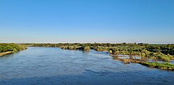 The Orange River on the outskirts of town | |
 Hopetown  Hopetown | |
| Coordinates: 29°37′33″S24°05′08″E / 29.62583°S 24.08556°E | |
| Country | South Africa |
| Province | Northern Cape |
| District | Pixley ka Seme |
| Municipality | Thembelihle |
| Area | |
• Total | 73.86 km2 (28.52 sq mi) |
| Population (2011) [1] | |
• Total | 10,259 |
| • Density | 140/km2 (360/sq mi) |
| Racial makeup (2011) | |
| • Black African | 18.8% |
| • Coloured | 73.1% |
| • Indian/Asian | 0.7% |
| • White | 6.9% |
| • Other | 0.5% |
| First languages (2011) | |
| • Afrikaans | 88.1% |
| • Xhosa | 7.2% |
| • Tswana | 1.5% |
| • English | 1.3% |
| • Other | 2.0% |
| Time zone | UTC+2 (SAST) |
| Postal code (street) | 8750 |
| PO box | 8750 |
| Area code | 053 |
Hopetown is a town which lies at the edge of the Great Karoo in South Africa's Northern Cape province. It is situated on an arid slope leading down to the Orange River. Two of the largest diamonds discovered in South Africa, the Eureka Diamond and the Star of Africa were found at Hopetown between 1867 and 1869
