Strydenburg

Last updated
Strydenburg
Reformed Church, Strydenburg.jpg
Reformed Church, Strydenburg
South Africa Northern Cape location map.svg
Red pog.svg
Strydenburg
South Africa adm location map.svg
Red pog.svg
Strydenburg
Coordinates: 29°56′S23°40′E / 29.933°S 23.667°E / -29.933; 23.667 Coordinates: 29°56′S23°40′E / 29.933°S 23.667°E / -29.933; 23.667
Country South Africa
Province Northern Cape
District Pixley ka Seme
Municipality Thembelihle
Area
[1]
  Total37.98 km2 (14.66 sq mi)
Population
(2011) [1]
  Total2,987
  Density79/km2 (200/sq mi)
Racial makeup (2011)
[1]
   Black African 10.2%
   Coloured 83.9%
   Indian/Asian 0.3%
   White 5.2%
  Other0.4%
First languages (2011)
[1]
   Afrikaans 93.5%
   Xhosa 1.7%
   English 1.6%
   Tswana 1.2%
  Other2.0%
Time zone UTC+2 (SAST)
Postal code (street)
8765
PO box
8765
Area code 053

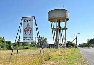
Strydenburg is a town in the east of the Northern Cape province in South Africa. Seventy-seven km north of Britstown, it was laid out by the Dutch Reformed Church on the farm Roodepan in 1892. It also lies on the N12, which separates the actual town from its township.

Northern Cape Province of South Africa

The Northern Cape is the largest and most sparsely populated province of South Africa. It was created in 1994 when the Cape Province was split up. Its capital is Kimberley. It includes the Kalahari Gemsbok National Park, part of the Kgalagadi Transfrontier Park, an international park shared with Botswana. It also includes the Augrabies Falls and the diamond mining regions in Kimberley and Alexander Bay. The Namaqualand region in the west is famous for its Namaqualand daisies. The southern towns of De Aar and Colesberg, in the Great Karoo, are major transport nodes between Johannesburg, Cape Town and Port Elizabeth. In the northeast, Kuruman is known as a mission station and also for its artesian spring, the Eye of Kuruman. The Orange River flows through the province, forming the borders with the Free State in the southeast and with Namibia to the northwest. The river is also used to irrigate the many vineyards in the arid region near Upington.

South Africa Republic in the southernmost part of Africa

South Africa, officially the Republic of South Africa (RSA), is the southernmost country in Africa. It is bounded to the south by 2,798 kilometres (1,739 mi) of coastline of Southern Africa stretching along the South Atlantic and Indian Oceans; to the north by the neighbouring countries of Namibia, Botswana, and Zimbabwe; and to the east and northeast by Mozambique and Eswatini (Swaziland); and it surrounds the enclaved country of Lesotho. South Africa is the largest country in Southern Africa and the 25th-largest country in the world by land area and, with over 57 million people, is the world's 24th-most populous nation. It is the southernmost country on the mainland of the Old World or the Eastern Hemisphere. About 80 percent of South Africans are of Sub-Saharan African ancestry, divided among a variety of ethnic groups speaking different African languages, nine of which have official status. The remaining population consists of Africa's largest communities of European (White), Asian (Indian), and multiracial (Coloured) ancestry.

Britstown Place in Northern Cape, South Africa

Britstown is a small farming town situated in the Northern Cape province of South Africa, in the Pixley ka Seme District Municipality, Emthanjeni Local Municipality. The town is named after Hans Brits who settled here after he accompanied David Livingstone on a venture into the interior.

The town is 55km south-west of Hopetown and 75km north-north-west of Britstown. It was laid out in 1892 on the farm Roodepan and attained municipal status in 1914. The name is Dutch for ‘town of argument’. The name refers to disagreement as to on which farm it should be situated. [2]

Hopetown Place in Northern Cape, South Africa

Hopetown is a town which lies at the edge of the Great Karoo in South Africa's Northern Cape province. It is situated on an arid slope leading down to the Orange River. The first diamond discovered in South Africa, the Eureka Diamond, was found at Hopetown.

Related Research Articles

Dealesville Place in Free State, South Africa

Dealesville is a mixed farming town in the Free State province of South Africa and is surrounded by numerous salt pans. There are many natural springs in the vicinity, most notably Florisbad some 35 km from the town.

Koppies Place in Free State, South Africa

Koppies is a small town situated near the Renoster River in the Free State province of South Africa.

Luckhoff Place in Free State, South Africa

Lückhoff is a small merino sheep farming town in the Free State province of South Africa. It was established on the farm Koffiekuil in 1892 and named after a Dutch Reformed Church minister Reverend HJ Luckhoff.

Morgenzon Place in Mpumalanga, South Africa

Morgenzon(Dutch for morning sun) is a small farming town situated on the banks of the Osspruit River (Ox Stream) with an important agricultural school in Mpumalanga province, South Africa. The town is 45 km south-west of Ermelo and 35 km south-east of Bethal.

Delmas, Mpumalanga Place in Mpumalanga, South Africa

Delmas is a small maize farming town situated east of Johannesburg in Mpumalanga, South Africa. The town is located some 19 km north-east of Springs and 73 km south-east of Pretoria.

Wolmaransstad Place in North West, South Africa

Wolmaransstad is a maize-farming town situated on the N12 between Johannesburg and Kimberley in North West Province of South Africa. The town lies in an important alluvial diamond-mining area and it is the main town of the Maquassi Hills Local Municipality.

Derby, North West Place in North West, South Africa

Derby is a small town situated in North West Province of South Africa that was named after the British Secretary of State Lord Derby. Derby began as a refuge for destitute people.

Aberdeen, Eastern Cape Place in Eastern Cape, South Africa

Aberdeen is a small town in the Sarah Baartman District Municipality of the Eastern Cape province of South Africa. With its numerous examples of Victorian architecture, it is one of the architectural conservation areas of the Karoo.

Trompsburg Place in Free State, South Africa

Trompsburg is a town in the Free State province of South Africa off the N1 highway, the major road connection between Johannesburg and Cape Town.

Victoria West Place in Northern Cape, South Africa

Victoria West is a town in the central Karoo region of South Africa's Northern Cape province. It is situated on the main N12 route, at an elevation of 1,300 metres (4,300 ft). It is the seat of the Ubuntu Local Municipality within the Pixley ka Seme District Municipality.

Vosburg Place in Northern Cape, South Africa

Vosburg is a town 61 km west of Britstown, in the Northern Cape province of South Africa. The town has relatively low crime rate and features many 18th century buildings.

Prieska Place in Northern Cape, South Africa

Prieska is a town on the south bank of the Orange River, in the province of the Northern Cape, in western South Africa.

Marydale Place in Northern Cape, South Africa

Marydale is a town in the Northern Cape province in western South Africa. Established in 1903 by the Dutch Reformed Church, Marydale was named after the wife of Mr GP Snyman, owner of the farm on which the town was laid out. The town is 76 km north-west of Prieska.

Bothasig A suburban area of the Northern Suburbs of Cape Town

Bothasig also known as 'The Sig' is a suburban area of the City of Cape Town in Western Cape, South Africa. It is located north of Edgemead and east of Milnerton. It is located approximately 15 km north-east of the Cape Town city centre.

Hopefield, Western Cape Place in Western Cape, South Africa

Hopefield is a settlement in West Coast District Municipality in the Western Cape province of South Africa on the R45 between Malmesbury and Vredenburg.The town is east of Saldanha Bay and Langebaan, 40 km southeast of Vredenburg and 120 km north of Cape Town.

Willowmore Place in Eastern Cape, South Africa

Willowmore is a town in Sarah Baartman District Municipality in the Eastern Cape province of South Africa.

Camperdown, KwaZulu-Natal Place in KwaZulu-Natal, South Africa

Camperdown is a settlement in Umgungundlovu District Municipality in the KwaZulu-Natal province of South Africa. Town some 60km by road north-west of Durban. Laid out in 1865 on the farm Camperdown, named to commemorate the victory of the British navy under Admiral Adam Duncan over the Dutch fleet under Admiral Jan Willem de Winter in October 1797.

Hotazel Place in Northern Cape, South Africa

Hotazel is a town in John Taolo Gaetsewe District Municipality in the Northern Cape province of South Africa.

References

  1. 1 2 3 4 "Main Place Strydenburg". Census 2011.
  2. "Dictionary of Southern African Place Names (Public Domain)". Human Science Research Council. p. 420.