The Orange River is a river in Southern Africa. It is the longest river in South Africa. With a total length of 2,432 km (1,511 mi), the Orange River Basin extends from Lesotho into South Africa and Namibia to the north. It rises in the Drakensberg mountains in Lesotho, flowing westwards through South Africa to the Atlantic Ocean. The river forms part of the international borders between South Africa and Lesotho and between South Africa and Namibia, as well as several provincial borders within South Africa. Except for Upington, it does not pass through any major cities. The Orange River plays an important role in the South African economy by providing water for irrigation and hydroelectric power. The river was named the Orange River in honour of the Dutch ruling family, the House of Orange, by the Dutch explorer Robert Jacob Gordon. Other names include simply the word for river, in Khoekhoegowab orthography written as !Garib, which is rendered in Afrikaans as Gariep River with the intrusion of a velar fricative in place of the alveolar click, Groote River or Senqu River, derived from ǂNū "Black".

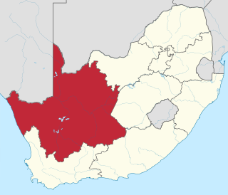
The Northern Cape is the largest and most sparsely populated province of South Africa. It was created in 1994 when the Cape Province was split up. Its capital is Kimberley. It includes the Kalahari Gemsbok National Park, part of the Kgalagadi Transfrontier Park and an international park shared with Botswana. It also includes the Augrabies Falls and the diamond mining regions in Kimberley and Alexander Bay.

Hartbeespoort, informally also known as "Harties", is a small resort town in the North West Province of South Africa, situated on slopes of the Magaliesberg mountain and the banks of the Hartbeespoort Dam. The name of the town means "gateway of the hartbees" in Afrikaans. Schoemansville, named after General Hendrik Schoeman, a Boer General in the Anglo-Boer War, who owned the farm that the Hartbeespoort Dam was built on, is the oldest neighbourhood of Hartbeespoort.

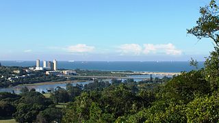
The Umgeni River or Mgeni River is a river in KwaZulu-Natal, South Africa. It rises in the "Dargle" in the KZN Midlands, and its mouth is at Durban, some distance north of Durban's natural harbour. The name is taken to mean "the river of entrance" in Zulu, though other meanings have been proposed.

The Olifants River,Lepelle, iBhalule or Obalule is a river in South Africa and Mozambique, a tributary of the Limpopo River. It falls into the Drainage Area B of the Drainage basins of South Africa. The historical area of the Pedi people, Sekhukhuneland, is located between the Olifants River and one of its largest tributaries, the Steelpoort River.

The R48 is a provincial route in South Africa that connects De Aar with Petrusburg on the N8.

The Gariep Dam is located in South Africa, near the town of Norvalspont, bordering the Free State and Eastern Cape provinces. Its primary purpose is for irrigation, domestic and industrial use as well as for power generation.

The Pongola or Phongolo River is a river in South Africa. It is a tributary of the Maputo River. It rises near Utrecht in northern KwaZulu-Natal, flows east through Pongola, is dammed at Pongolapoort, and crosses the Ubombo Mountains; then it flows north towards Mozambique, joining the Maputo River.

The Sterkfontein Dam, located just outside the town of Harrismith, in the Free State, province of South Africa, is part of the Tugela-Vaal Water Project and the Drakensberg Pumped Storage Scheme, and located on the Nuwejaarspruit, a tributary of the Wilge River in the upper catchment area of the Vaal River. It is the second highest dam wall in South Africa and its highest earth fill dam.

The Riet River is a westward-flowing tributary of the Vaal River in central South Africa. In precolonial times the Riet was known as the Gama-!ab, a !Kora name meaning 'muddy'. Its main tributary is the Modder River and after the confluence the Riet River flows westwards to meet the Vaal.
Upper Orange WMA, or Upper Orange Water Management Area , Includes the following major rivers: the Modder River, Riet River, Caledon River and Orange River, and covers the following Dams:
Welbedacht Dam is a concrete-gravity type dam situated in South Africa, and was established in 1973. Bloemfontein is the sixth-largest city in South Africa, with a population around 300 000. It is situated in the Modder River catchment, which has insufficient water resources to meet the growing water requirements. The water supply to Bloemfontein is, therefore, augmented from the adjacent Caledon River by means of the Caledon - Modder River Government Water Scheme (CMRGWS).

The Levubu River or Levuvhu is located in the northern Limpopo province of South Africa. Some of its tributaries, such as the Mutshindudi River and Mutale River rise in the Soutpansberg Mountains.
The Berg River is one of seven smaller rivers that run into Vanderkloof Dam in South Africa. The other rivers are:

Gariep Dam, founded as "Oranjekrag", is a settlement in Xhariep District Municipality in the Free State (province) of South Africa.


