 | ||||
|---|---|---|---|---|
| Major junctions | ||||
| East end | ||||
| West end | ||||
| Highway system | ||||
| ||||
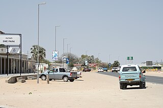
C41 is a secondary route in Namibia that runs from Outapi to Oshakati. The C41 diverges from C46, the direct route between Outapi to Oshakati, to incorporate the villages of Tsandi and Okahao. [1]
| | ||||
|---|---|---|---|---|
| Major junctions | ||||
| East end | ||||
| West end | ||||
| Highway system | ||||
| ||||
C41 is a secondary route in Namibia that runs from Outapi to Oshakati. The C41 diverges from C46, the direct route between Outapi to Oshakati, to incorporate the villages of Tsandi and Okahao. [1]

Oshana is one of the fourteen regions of Namibia, its capital is Oshakati. The towns of Oshakati, Ongwediva and Ondangwa, all situated with this region, form an urban cluster with the second largest population concentration in Namibia after the capital Windhoek. As of 2020, Oshana had 113,112 registered voters.

Omusati is one of the fourteen regions of Namibia, its capital is Outapi. The towns of Okahao, Oshikuku and Ruacana as well as the self-governed village Tsandi are situated in this region. As of 2020, Omusati had 148,834 registered voters.

Oshakati is a town of 37,000 inhabitants in northern Namibia. It is today the regional capital of Oshana Region and one of Namibia's largest cities.
Outapi wa Nakafingo na Temba, also Outapi or Uutapi and Ombalantu, is a town in northern Namibia near the border with Angola situated 90 km (56 mi) northwest of Oshakati. It is the capital of Omusati region and the district capital of the Outapi electoral constituency. The language spoken there is Oshiwambo.
Oshakati Independence Stadium is a football stadium in Oshakati, Oshana Region, Namibia. Home to Oshakati City F.C. formerly of the Namibia Premier League, Oshakati Independence Stadium can seat 8,000 spectators. It was built over seven years at a cost of 20 million Namibian dollars, but needed N$55,000 worth of repairs just a year later. In February 2008, two people died at the stadium during intense flooding across northern Namibia.
The Caluequee Dam, is an operational multipurpose dam across the Kunene River, in Kunene Province, in southwestern Angola. The dam stores water for the 347 MW (465,000 hp) Ruacana Hydroelectric Power Station, in neighboring Namibia. Its waters are also used for the irrigation of farmland, both in Angola and Namibia.

Oshakati East is an electoral constituency in the Oshana Region of Namibia. It comprises the eastern parts of the town of Oshakati. The Okatana River separates Oshakati East from the Oshakati West constituency. The constituency had 22,634 inhabitants in 2004 and 19,606 registered voters in 2020.

Oshakati West is an electoral constituency in the Oshana Region of Namibia. It contains the western parts of the town of Oshakati. The Okatana River separates Oshakati West from the Oshakati East constituency. The constituency had 20,015 inhabitants in 2004 and 15,120 registered voters in 2020.
Oshakati Airport is an airport serving Oshakati in the Oshana Region of Namibia.
Ogongo is a settlement in the Omusati Region, in the central North of Namibia. Its neighbouring places include Outapi, Elim and Oshikuku.
Trustco Bank Namibia limited, formerly the FIDES Bank Namibia, is a commercial bank in Namibia owned by Trustco Group Holdings. Its main commercial activity is to provide microfinancing services.
C24 is a secondary route in Namibia that runs from the southern outskirts of Rehoboth.
C29 is a secondary route in Namibia that runs from the south, at the B6 junction approximately 65 miles east of Windhoek. The C29 then terminates to the north at the C22 junction near Otjinene.
The C31 is a secondary route in Namibia that runs from the Okahandja at the B1 junction up north-westerly to Summerdown, Omaheke, where it meets the C29.
C30 is a secondary route in Namibia that runs from the C22 near Otjiwarongo and Okakarara, where it meets the B6 in Gobabis.
C35 is a secondary route in Namibia that runs from C34 in Henties Bay, up to the Angolan-Namibian border in Ruacana.
C36 is a secondary route in Namibia that runs from the B2 at Wilhelmstal. It is intersected by the C33 at Omaruru before terminating at Uis, where it joins the C35. The C36 is paved.
C43 is a secondary route in Namibia that begins in Bergsig, running for 457 kilometres to the Angolan-Namibian border where it terminates at Epupa Falls.
C46 is a secondary route in northern Namibia that runs from Ruacana, near the border with Angola, to the B1 trunk road at Ondangwa.
C49 is a secondary route in the Caprivi Strip in Namibia, which leaves and rejoins the B8, at Katima Mulilo and Kongola, respectively.
| Freeways | ||
|---|---|---|
| Trunk routes | ||
| Secondary routes | ||
| International routes | ||