This article deals with the system of transport in Namibia, both public and private.

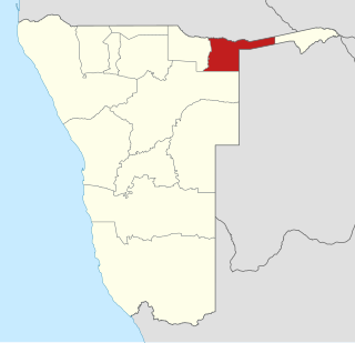
The Zambezi Region, until 2013 known as the Caprivi Region, is one of the 14 regions of Namibia, located in the extreme north-east of the country. It is largely concurrent with the Caprivi Strip and takes its name from the Zambezi River that runs along its border. Katima Mulilo is its capital and the largest city, the Governor is Lawrence Sampofu.

Kavango was one of the thirteen regions of Namibia until it was split into the Kavango East and Kavango West Regions in 2013. Its capital was Rundu.

Grootfontein is a city of 23,793 inhabitants in the Otjozondjupa Region of central Namibia. It is one of the three towns in the Otavi Triangle, situated on the B8 national road that leads from Otavi to the Caprivi Strip.

Katima Mulilo is a town situated in the Caprivi strip and is the capital of the Zambezi Region, Namibia's far northeast extension into central Southern Africa. It comprises two electoral constituencies, Katima Mulilo Rural and Katima Mulilo Urban. Katima Mulilo, which is sometimes shortened to just "Katima", had 28,362 inhabitants in 2010, It is located on the national road B8 on the banks of the Zambezi River in lush riverine vegetation with tropical birds and monkeys. The town receives an annual average rainfall of 654 millimetres (25.7 in).

Sesheke is a border town in the Western Province of Zambia, and a district of the same name. It lies on the northern bank of the Zambezi River which forms the border with Namibia's Caprivi Strip at that point.

The Walvis Bay-Ndola-Lubumbashi Development Road opened in 1999 runs from Rundu, in north eastern Namibia, along the Caprivi Strip as the B8 road to Katima Mulilo on the Zambezi River, which forms the border between Namibia and Zambia. The Katima Mulilo Bridge spans the river to the Zambian town of Sesheke from where a recently upgraded paved road runs to Livingstone joining the main north-south highway to Lusaka, connecting onwards to the Copperbelt.

Kongola is a settlement in Namibia's Caprivi Strip and the district capital of Kongola Constituency in the Zambezi Region. It is situated on the national road B8. Kongola has a petrol station and a wholesaler. Although the village is situated on a national power line, it has not yet been connected to the electricity grid. There is also no access to safe water at Kongola.
The Katima Mulilo Bridge carries the TransCaprivi Highway over the Zambezi River between Katima Mulilo, Namibia and Sesheke, Zambia. It is a road bridge, completed in 2004, 900 metres long and with 19 spans. It links Namibia's Trans–Caprivi Highway to the Zambian road network, forming a section of the trade route from south-central Africa to the Atlantic known as the Walvis Bay Corridor. It also carries tourist traffic.

Luhonono, until 2013 Schuckmannsburg, is a settlement in the Caprivi Strip in northeastern Namibia with a population of about 800. It belongs to the Kabbe electoral constituency of the Zambezi Region. During the time of German colonialism, it was the capital of the Caprivi Strip.
Articles related to Namibia include:

The Kazungula Ferry is a pontoon ferry across the 400-metre-wide (1,300 ft) Zambezi River between Botswana and Zambia. It is one of the largest ferries in south-central Africa, having a capacity of 70 tonnes. The service is provided by two motorised pontoons and operates between border posts at Kazungula, Zambia and Kazungula, Botswana.
Richard Kapelwa Kabajani was a Namibian activist, militant, diplomat and politician. Kabajani was a military commander for SWAPO during the Namibian War of Independence and after independence served a minister in the Namibian government.

Bwabwata National Park is a protected area in northeastern Namibia that was established in 2007 and covers 6,274 km2 (2,422 sq mi). It was created by merging Caprivi Game Park and Mahango Game Reserve. It is situated in the Zambezi and Kavango East regions, extending along the Caprivi Strip. It is bounded by the Okavango River to the west and the Kwando River to the east. Angola lies to the north and Botswana to the south.
The Mayuni Conservancy is a conservation area in Linyanti Constituency, in Namibia's northeastern Caprivi Region, along the eastern bank of the Cuando River.
Kavango East is one of the fourteen regions of Namibia. Its capital is Rundu. Because of its rather higher rainfall than most other parts of Namibia, this region has agricultural potential for the cultivation of a variety of crops, as well as for organised forestry and agro-forestry, which stimulates furniture making and related industries.

The Namibian Army is the landward defence branch of the Namibian Defence Force.
26 Motorised Infantry Brigade is a brigade of the Namibian Army based at Grootfontein. The prefix "26" is taken from 26 August 1966, the day on which SWAPO guerrillas first encounter with South African security forces at Ongulumbashe. The brigade is responsible for defence of the Northern areas of Namibia. Its subordinate units are situated in Zambezi, Kavango, Omusati, Kunene and Oshana regions.
The M10 Road is a Road in Zambia. It goes from Livingstone, through Sesheke, to Mongu. The Road is approximately 508 kilometres and follows the Zambezi River for its entire length.


