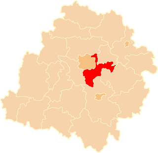
Brójce is a village in Łódź East County, Łódź Voivodeship, in central Poland. It is the seat of the gmina called Gmina Brójce. It lies approximately 18 km (11 mi) south-east of the regional capital Łódź.
Będzelin is a village in the administrative district of Gmina Koluszki, within Łódź East County, Łódź Voivodeship, in central Poland. It lies approximately 4 kilometres (2 mi) south of Koluszki and 26 km (16 mi) east of the regional capital Łódź. The population of the village is approximately 430 people.
Erazmów is a village in the administrative district of Gmina Koluszki, within Łódź East County, Łódź Voivodeship, in central Poland. It lies approximately 3 kilometres (2 mi) north-east of Koluszki and 25 km (16 mi) east of the regional capital Łódź.
Gałków Mały is a village in the administrative district of Gmina Koluszki, within Łódź East County, Łódź Voivodeship, in central Poland. It lies approximately 5 kilometres (3 mi) west of Koluszki and 20 km (12 mi) east of the regional capital Łódź.
Jeziorko is a village in the administrative district of Gmina Koluszki, within Łódź East County, Łódź Voivodeship, in central Poland. It lies approximately 4 kilometres (2 mi) north-east of Koluszki and 27 km (17 mi) east of the regional capital Łódź.
Katarzynów is a village in the administrative district of Gmina Koluszki, within Łódź East County, Łódź Voivodeship, in central Poland. It lies approximately 4 kilometres (2 mi) east of Koluszki and 27 km (17 mi) east of the regional capital Łódź.
Leosin is a village in the administrative district of Gmina Koluszki, within Łódź East County, Łódź Voivodeship, in central Poland. It lies approximately 7 kilometres (4 mi) east of Koluszki and 30 km (19 mi) east of the regional capital Łódź.
Różyca is a village in the administrative district of Gmina Koluszki, within Łódź East County, Łódź Voivodeship, in central Poland. It lies approximately 3 kilometres (2 mi) south-west of Koluszki and 23 km (14 mi) east of the regional capital Łódź. The village has a population of 770.
Byszewy is a village in the administrative district of Gmina Nowosolna, within Łódź East County, Łódź Voivodeship, in central Poland. It lies approximately 13 km (8 mi) north-east of the regional capital Łódź.
Stare Skoszewy is a village in the administrative district of Gmina Nowosolna, within Łódź East County, Łódź Voivodeship, in central Poland. It lies approximately 14 kilometres (9 mi) north-east of the regional capital Łódź.
Teolin is a village in the administrative district of Gmina Nowosolna, within Łódź East County, Łódź Voivodeship, in central Poland. It lies approximately 12 km (7 mi) east of the regional capital Łódź.
Czekaj is a village in the administrative district of Gmina Uniejów, within Poddębice County, Łódź Voivodeship, in central Poland. It lies approximately 3 kilometres (2 mi) north-east of Uniejów, 14 km (9 mi) north-west of Poddębice, and 50 km (31 mi) north-west of the regional capital Łódź.
Dąbrowa is a village in the administrative district of Gmina Uniejów, within Poddębice County, Łódź Voivodeship, in central Poland. It lies approximately 8 kilometres (5 mi) north of Uniejów, 18 km (11 mi) north-west of Poddębice, and 52 km (32 mi) north-west of the regional capital Łódź.
Helenów is a village in the administrative district of Gmina Ujazd, within Tomaszów Mazowiecki County, Łódź Voivodeship, in central Poland. It lies approximately 7 kilometres (4 mi) west of Ujazd, 16 km (10 mi) north-west of Tomaszów Mazowiecki, and 33 km (21 mi) south-east of the regional capital Łódź.
Teklów is a village in the administrative district of Gmina Ujazd, within Tomaszów Mazowiecki County, Łódź Voivodeship, in central Poland. It lies approximately 3 kilometres (2 mi) south-west of Ujazd, 11 km (7 mi) north-west of Tomaszów Mazowiecki, and 39 km (24 mi) south-east of the regional capital of Łódź.
Tobiasze is a village in the administrative district of Gmina Ujazd, within Tomaszów Mazowiecki County, Łódź Voivodeship, in central Poland. It lies approximately 8 kilometres (5 mi) north-west of Tomaszów Mazowiecki and 41 km (25 mi) south-east of the regional capital Łódź.
Stara Gąska is a village in the administrative district of Gmina Stanin, within Łuków County, Lublin Voivodeship, in eastern Poland. It lies approximately 5 kilometres (3 mi) south-east of Stanin, 15 km (9 mi) south-west of Łuków, and 69 km (43 mi) north of the regional capital Lublin.
Kalonka is a village in the administrative district of Gmina Pilawa, within Garwolin County, Masovian Voivodeship, in east-central Poland. It lies approximately 8 kilometres (5 mi) north-east of Pilawa, 14 km (9 mi) north of Garwolin, and 47 km (29 mi) south-east of Warsaw.
Ulów-Kolonia is a village in the administrative district of Gmina Klwów, within Przysucha County, Masovian Voivodeship, in east-central Poland. It lies approximately 6 kilometres (4 mi) north-east of Klwów, 24 km (15 mi) north of Przysucha, and 75 km (47 mi) south of Warsaw.