
Wilson County is a county located in the U.S. state of North Carolina. As of the 2020 census, the population was 78,784. The county seat is Wilson. The county comprises the Wilson, NC Micropolitan Statistical Area, which is also included within the Rocky Mount-Wilson-Roanoke Rapids, NC Combined Statistical Area.

Washington County is a county located in the U.S. state of North Carolina. As of the 2020 census, the population was 11,003. Its county seat is Plymouth. The county was formed in 1799 from the western third of Tyrrell County. It was named for George Washington.

Union County is a county located in the U.S. state of North Carolina. As of the 2020 census, the population was 238,267. Its county seat is Monroe. Union County is included in the Charlotte-Concord-Gastonia, NC-SC Metropolitan Statistical Area.

Edgecombe County is a county located in the U.S. state of North Carolina. As of the 2020 census, the population was 48,900. Its county seat is Tarboro.

Durham County is a county located in the U.S. state of North Carolina. As of the 2020 census, the population was 324,833, making it the sixth-most populous county in North Carolina. Its county seat is Durham, which is the only incorporated municipality predominantly in the county, though very small portions of cities and towns mostly in neighboring counties also extend into Durham County. The central and southern parts of Durham County are highly urban, consisting of the city as well as several unincorporated suburbs. Southeastern Durham County is dominated by the Research Triangle Park, most of which is in Durham County. The northern third of Durham County is rural in nature.

Brunswick County is a county located in the U.S. state of North Carolina. It is the southernmost county in the state. As of the 2020 census, the population was 136,693. Its population was only 73,143 in 2000, making it one of the fastest-growing counties in the state. With a nominal growth rate of approximately 47% in ten years, much of the growth is centered in the eastern section of the county in the suburbs of Wilmington such as Leland, Belville and Southport. The county seat is Bolivia, which at a population of around 150 people is among the least populous county seats in the state.
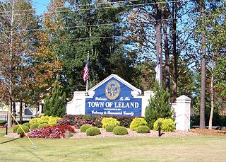
Leland is the most populous town in Brunswick County, North Carolina, United States. The population was 23,504 at the 2020 census, up from 13,527 in 2010. As of 2020, it is considered to be one of the fastest growing towns in North Carolina. It is part of the Wilmington, NC Metropolitan Statistical Area. and the Cape Fear Council of Governments. The town of Leland is in the northeastern part of Brunswick County, with the town of Navassa to the north, Belville to east, and Boiling Spring Lakes to the south. It is part of the Town Creek township, and Cape Fear region of North Carolina, a short distance north of the South Carolina state line. Leland is located five miles (8.0 km) west of Wilmington, 71 miles (114 km) north of Myrtle Beach, 84 miles (135 km) southeast of Fayetteville, and 135 miles (217 km) southeast of Raleigh.

Beaufort is a town in and the county seat of Carteret County, North Carolina, United States. Established in 1713 and incorporated in 1723, Beaufort is the fourth oldest town in North Carolina . On February 1, 2012, Beaufort was ranked as "America's Coolest Small Town" by readers of Budget Travel Magazine.

Yanceyville is a town in and the county seat of Caswell County, North Carolina, United States. Located in the Piedmont Triad region of the state, the town had a population of 1,937 at the 2020 census.
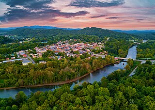
Murphy is a town in and the county seat of Cherokee County, North Carolina, United States. It is situated at the confluence of the Hiwassee and Valley rivers. It is the westernmost county seat in the state of North Carolina, approximately 360 miles (580 km) from the state capital in Raleigh. The population of Murphy was 1,608 at the 2020 census.

Snow Hill is a town in Greene County, North Carolina, United States. The population was 1,595 at the 2010 census. It is the county seat of Greene County. Snow Hill hosts numerous tennis tournaments during the year. Snow Hill is home to the Green Ridge Racquet Club. Many junior players and adults travel to Snow Hill in order to play in the USTA Sanctioned tournaments.
Weldon is a town in Halifax County, North Carolina, United States. The population was 1,655 at the 2010 census. It is part of the Roanoke Rapids, North Carolina Micropolitan Statistical Area.

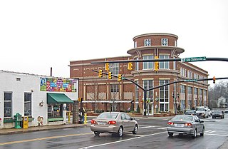
Erwin is a town that is located in the eastern part of Harnett County, North Carolina, United States, located approximately 5 miles (8.0 km) from Dunn and approximately 20 miles (32 km) from Fayetteville. The city is a part of the Dunn, NC Micropolitan Statistical Area, which is additionally a part of the greater Raleigh-Durham-Cary, NC CSA, according to the United States Census Bureau. Currently, the city has a population of 5,270 as of the 2020 census. Its current mayor is Randy Baker, who has been the mayor since being elected on May 17, 2022.
Cornelius is a suburban town located along Lake Norman in northern Mecklenburg County, North Carolina, United States. It is a major suburb in the Charlotte metropolitan area. The population was 24,866 at the 2010 census.
Huntersville is a large suburban town in northern Mecklenburg County, North Carolina, United States. At the 2020 census, its population was 61,376, making Huntersville the 15th-most populous municipality in North Carolina. It is located in the Charlotte metropolitan area and 14 mi (23 km) north of Charlotte.

Apex is a town in Wake County, North Carolina, United States. At its southern border, Apex encompasses the community of Friendship. In 1994, the downtown area was designated a historic district, and the Apex train depot, built in 1867, is designated a Wake County landmark. The depot location marks the highest point on the old Chatham Railroad, hence the town's name. The town motto is "The Peak of Good Living".

Fuquay-Varina is a town in southern Wake County, North Carolina, United States, lying south of Holly Springs and southwest of Garner, and north of the Harnett County town of Angier and west of the unincorporated community of Willow Springs. The population was 17,937 at the 2010 census, and estimated at 36,736 as of July 2021. The hyphenated name attests to the town's history as two separate towns. Fuquay Springs and Varina merged in 1963 to create the modern town. Economically, the town initially grew due to tobacco trade and agriculture, but has seen recent population growth and real estate development due to its proximity to Research Triangle Park.
Wake Forest is a town in Franklin and Wake counties in the U.S. state of North Carolina. Located almost entirely in Wake County, it lies just north of the state capital, Raleigh. At the 2020 census, the population was 47,601, up from 30,117 in 2010. It is part of the Raleigh metropolitan area. Wake Forest was the original home of Wake Forest University for 122 years before it moved to Winston-Salem in 1956.

Morrisville is a town located primarily in Wake County, North Carolina, United States. According to the 2020 census, the population was 29,630. Morrisville is part of the Research Triangle metropolitan region. The regional name originated after the 1959 creation of the Research Triangle Park, located midway between the cities of Raleigh and Durham. The Research Triangle region encompasses the Raleigh-Durham-Cary, NC Combined Statistical Area. The population of the Raleigh-Durham-Cary, NC Combined Statistical Area was 2,106,463 in 2020, while the population of the Raleigh-Cary, NC Metropolitan Statistical Area was 1,413,982 in 2020. The operational headquarters of Lenovo is located in the municipal limits.

Kernersville is a town in Forsyth County, North Carolina, and the largest suburb of Winston-Salem. A small portion of the town is also in Guilford County. The population was 26,481 at the 2020 census, up from 23,123 in 2010. Kernersville is located at the center of the Piedmont Triad metropolitan area, between Greensboro to the east, High Point to the south, and Winston-Salem to the west. Some of the farmland surrounding the town has been sold and turned into large middle-to-upper-class housing developments.