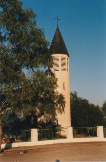
Swakopmund is a city on the coast of western Namibia, 352 km (219 mi) west of the Namibian capital Windhoek via the B2 main road. It is the capital of the Erongo administrative district. It has 75,921 inhabitants.

Omaruru is a town in the Erongo Region of central Namibia. The town has 14,000 inhabitants and encompasses 352 square kilometres (136 sq mi) of land. It is situated near Mount Erongo, on the usually dry Omaruru River. It is located on the main paved road from Swakopmund to Otjiwarongo. The name in the Otjiherero language means 'bitter milk', as Herero cattle herds used to graze on the local bush that turned their milk bitter.

Karibib is a town in the Erongo Region of western Namibia. It has 8,434 inhabitants. Karibib is the district capital of the Karibib electoral constituency. It is situated on the Khan River, halfway between Windhoek and Swakopmund on the B2, the main road between Walvis Bay and Johannesburg. The town is known for its aragonite marble quarries and the Navachab Gold Mine.

Kamanjab is a constituency in the Kunene Region of Namibia. In 2004, the population was 6,012. As of 2020, it had 4,862 registered voters. The district capital is the settlement of Kamanjab.
Okahandja is a city of 45,159 inhabitants in Otjozondjupa Region, central Namibia, and the district capital of the Okahandja electoral constituency. It is known as the Garden Town of Namibia. It is located 70 km north of Windhoek on the B1 road. It was founded around 1800, by two local groups, the Herero and the Nama.

Mariental is a town of 10,000 inhabitants in south-central Namibia, lying on the B1 national road 232 kilometres (144 mi) north of Keetmanshoop and 274 kilometres (170 mi) southeast of Windhoek. It lies at an elevation of 1,090 metres (3,580 ft). Mariental is connected to the TransNamib railway line from Windhoek to Keetmanshoop. The town and the surrounding area are situated in a hot, arid region.

Henties Bay is a coastal town in the Erongo Region of western Namibia. The town had 7,569 inhabitants in 2023, an increase from 3,285 in 2001.

Karasburg is a town with 4,000 inhabitants in the ǁKaras Region of southern Namibia and the district capital of the Karasburg electoral constituency. It lies at the heart of the southern Namibian sheep farming industry.

Outjo is a town of 15,000 inhabitants in the Kunene Region of Namibia. It is the district capital of Outjo Constituency. It is best known as the main gateway to Etosha National Park.

Khorixas is a town with about 9,000 inhabitants in the southern part of the Kunene Region, Namibia. It was the capital of the Damaraland bantustan before Namibia's independence. It is the administrative capital of Khorixas Constituency. Most of the inhabitants are from the Damara ethnic group. The town is located near the Petrified Forest, Khorixas - a deposit of petrified wood and well known tourist attraction of Namibia. The Twyfelfontein valley, known for its rock art, is also accessible from Khorixas.

Maltahöhe is a village in southern central Namibia close to the Swartrand escarpment, about 110 km west of Mariental in the Hardap Region. It has about 6,000 inhabitants and owns about 17,000 hectares of land. Maltahöhe has two suburbs, the Andreville location and the Blikkiesdorp informal settlement which has neither sewerage nor electricity supply.

Usakos is a town on the banks of river Khan, 140 kilometres north-east of Swakopmund in the Erongo Region of Namibia. It is located on the B2, the main road between the Walvis Bay and Johannesburg. The town has 5,094 inhabitants.
Gibeon is a village in Gibeon Constituency in the Hardap Region of Namibia. The village had 4,120 inhabitants in 2023.

Otavi is a town with 10,000 inhabitants in the Otjozondjupa Region of Namibia. Situated 360 km north of Windhoek, it is the district capital of the Otavi electoral constituency.

Arandis is a mining town in the Erongo Region of western central Namibia. The town has 5,726 inhabitants. Originally a camp for workers of the nearby Rössing uranium mine, Arandis was declared a town in 1994.
Okakarara is a town in Otjozondjupa Region, Namibia, located 50 kilometres (31 mi) southeast of Waterberg National Park. It has an estimated population of 7,000 and is currently growing by 1,500 inhabitants annually.
Tses is a village in the ǁKaras Region of southern Namibia with a population of approximately 1000; probably 1000 more live in the surrounding semi-desert farming hinterland. It is situated one kilometre off the main B1 highway from Windhoek to Noordoewer, opposite the turning to Berseba and the Brukkaros Mountain. Tses in Khoekhoegowab means 'place of daylight'.

Aranos is a town in the Hardap Region of central Namibia, situated in the Nossob River basin in the Kalahari Desert. The town had 5,493 inhabitants in 2023.

Gochas is a village in the Hardap Region of Namibia. The village had 1,868 inhabitants in 2023.

Witvlei is a village in the Okarukambe Constituency in the Omaheke Region of central-eastern Namibia. It is situated on the B6 150 kilometres (93 mi) from Windhoek on the way to Gobabis. It is known for producing high quality meat.


