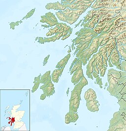
Kames Bay, Loch Melfort

Last updated

Kames Bay
Kames Bay ,Loch Melfort - geograph.org.uk - 1748375.jpg
Kames Bay, Loch Melfort. The north east view of Kames Bay and Loch Melfort beyond.
Argyll and Bute UK relief location map.jpg
Red pog.svg
Kames Bay
Location Argyll and Bute, Scotland
Coordinates 56°14′55.345″N5°30′57.701″W / 56.24870694°N 5.51602806°W / 56.24870694; -5.51602806 Coordinates: 56°14′55.345″N5°30′57.701″W / 56.24870694°N 5.51602806°W / 56.24870694; -5.51602806
Ocean/sea sources Loch Melfort
Basin  countries Scotland
Max. length0.658 km (0.409 mi)
Max. width0.346 km (0.215 mi)

Kames Bay is small remote tidal north by northwest facing coastal embayment forming part of the southern coast of Loch Melfort within Argyll and Bute, Scotland. [1] [2]

Contents

Settlements

The main A816 road from Oban to Lochgilphead passes the bay. To the south west is the small village of Arduaine situated close to the Arduaine Point and Asknish Bay. To the north east is the small settlement of Kilmelford.

Kames Bay hosts a fish farm.

Shoreline, Kames Bay, Loch Melfort, Argyll & Bute Looking across the Loch towards An Coire and Dun Crutagain Shoreline, Kames Bay, Loch Melfort, Argyll and Bute - geograph.org.uk - 749396.jpg
Shoreline, Kames Bay, Loch Melfort, Argyll & Bute Looking across the Loch towards An Coire and Dun Crutagain

Geography

To the east, the bay is bounded by Rubh án Àird Fhada point. To the west is the small tidal sea loch Loch na Cille, which provide a sheltered haven for yachts. [3] On the other side of Loch Melfort from the bay, is the small rocky island of Eilean Coltair to the north west. Further to the west is the larger Kilchoan Bay which contains the island. Directly opposite is the Bàgh na Dalach Dubh-Chlachaich point and east at the head of Loch Melfort is the Fearnach Bay

Related Research Articles

Firth is a word in the English and Scots languages used to denote various coastal waters in the United Kingdom, predominantly within Scotland. In the Northern Isles, it more usually refers to a smaller inlet. It is linguistically cognate to fjord which has a more constrained sense in English. Bodies of water named "firths" tend to be more common on the Scottish east coast, or in the southwest of the country, although the Firth of Clyde is an exception to this. The Highland coast contains numerous estuaries, straits, and inlets of a similar kind, but not called "firth" ; instead, these are often called sea lochs. Before about 1850, the spelling "Frith" was more common.

Argyll and Bute Council area of Scotland

Argyll and Bute is one of 32 unitary authority council areas in Scotland and a lieutenancy area. The current Lord-Lieutenant for Argyll and Bute is Jane Margaret MacLeod. The administrative centre for the council area is in Lochgilphead at Kilmory Castle, a 19th-century Gothic Revival building and estate. The current Council leader is Councillor Robin Currie, a councillor for Kintyre and the Islands.

Argyll Historic county in Scotland

Argyll, sometimes called Argyllshire, is a historic county and registration county of western Scotland.

The Isle of Bute, known as Bute, is an island in the Firth of Clyde in Scotland, United Kingdom. It is divided into highland and lowland areas by the Highland Boundary Fault.

Loch Fyne Sea inlet on west coast of Scotland

Loch Fyne, is a sea loch off the Firth of Clyde and forms part of the coast of the Cowal peninsula. Located on the west coast of Argyll and Bute, Scotland. It extends 65 kilometres (40 mi) inland from the Sound of Bute, making it the longest of the sea lochs in Scotland. It is connected to the Sound of Jura by the Crinan Canal. Although there is no evidence that grapes have grown there, the title is probably honorific, indicating that the river, Abhainn Fìne, was a well-respected river.

Loch Dùghaill

Loch Dùghaill is a freshwater tidal loch on the River Carron in Wester Ross, Scotland. The A890 road and the Kyle of Lochalsh Line a branch of the Highland railway both run along its northwest shore. Loch Carron is located 8 km downriver.

Kentra Bay

Kentra Bay, also known as the Singing Sands, is a remote tidal, 306° orientated, coastal embayment located on the northern shore of the Ardnamurchan peninsula, at the extreme eastern side, where it meets the mainland proper, near Acharacle, in the western Highlands of Scotland. Kentra Bay contains a large expanse of mudflat at low tide and small fragments of salt marsh, sand dune, and machair. Kentra Bay is an inland bay separated from the sea via a channel at the northeast side.

Loch Sween Loch in Argyll and Bute, Scotland, UK

Loch Sween is a sea loch located near Lochgilphead, Argyll and Bute, Scotland. Castle Sween is located on the southern shore towards the seaward end of the loch. The village of Tayvallich, a favoured haven for water craft as it sits at the head of sheltered Loch a' Bhealaich, lies on the northern shore.

Enard Bay

Enard Bay is a large remote tidal coastal embayment, located 10.5 miles northwest of Ullapool, in northwestern Ross and Cromarty, Scottish Highlands in the west coast of Scotland. The mouth of the bay is about 4.5 miles across running from the head of Rubha Mòr peninsula at Rubna Na CòiGeach point to Rubna Na Brèige to the east.

Asknish Bay Bay on the west coat of Scotland

Asknish Bay is a small, remote, southwest-facing coastal embayment, located next to the small settlement of Arduaine within Argyll and Bute, Scotland. To the east of the bay lies Arduaine Point, which makes up the west most southern coast of Loch Melfort to the north. It is 12 miles (20 km) south southwest of large west coast town of Oban.

Ettrick Bay Bay on the Isle of Bute, west coast of Scotland

Ettrick Bay is a wide, tidal, sandy coastal embayment with a chord of 1 mile (2 km), on a 218° bearing, located on the west coast of the Isle of Bute in the Firth of Clyde, within council area of Argyll and Bute in Scotland. The bay was used for practice training for the D-Day landings.

Glenborrodale Bay A bay in Lochaber, Scotland

Glenborrodale Bay is a remote tidal, 200° orientated, coastal embayment, located on the southern coastline of the west to east orientated Ardnamurchan peninsula, at the head of the sea loch Loch Sunart in western Scottish Highlands of Scotland. To the west is the large Ardgour peninsula, of which the Ardnamurchan and the larger Morven peninsula to the south is part of.

Glenmore Bay A bay in Lochaber, Scotland

Glenmore Bay is a remote, tidal, 150° orientated, coastal embayment, located on the southern coastline of the west to east orientated Ardnamurchan peninsula, at the head of the sea loch Loch Sunart.

Applecross Bay A bay on the west coast of Scotland

Applecross Bay is large remote tidal coastal embayment, located next to the small fishing village of Applecross and is on the west coast of the Applecross peninsula in the Wester Ross part of Ross and Cromarty, in the Scottish Highlands in the west coast of Scotland. It lies between Loch Torridon and Loch Kishorn. The bay and village was inaccessible by road until the late 18th century and can now be reached by the long coastal road Shieldaig that was completed in 1982, or from the Scottish Gaelic: Bealach na Bà or Pass of the Cattle which at 625 metres (2,051 ft), is one of the highest roads in Scotland. The village of Applecross was established by St. Moalrubha, in the 7th century. A sculptured stone is the only relic of St. Moalrubha remaining, who built a chapel there.

Balmacara Bay

Balmacara Bay is a remote wide mouthed embayment on a 193° orientation, located on the north shore of the Lochalsh peninsula, on the north coast of sea loch of Loch Alsh and is situated next to the scattered village of Balmacara in the Scottish Highlands in the west coast of Scotland.

Loch Kirkaig

Loch Kirkaig is a small tidal sea loch, located in the region and parish of Assynt in south-west of Sutherland, in the west coast of Scotland and in the Scottish Highlands. Loch Kirkaig is 1.25 miles south of Loch Inver. The scattered crofting township of Inverkirkaig is located at the headland of the bay, next to the pebbly beach, on the round bay, which has no known name. The name Kirgaig comes from old Norse, Kirkju-vik meaning church bay, perhaps suggesting that in Viking times, there was a church, with a village located in the bay.

References

  1. Microsoft; Nokia (28 March 2017). "Editing Kames Bay, Loch Melfort" (Map). Bing Maps . Microsoft. Retrieved 28 March 2017.
  2. "Kames Bay". Scotlands Gardens. Scotlands Gardens, Edinburgh. 2012. Retrieved 31 March 2017.
  3. Perrin Towler; Mark Fishwick (6 October 2016). Reeds Western Almanac 2017. Bloomsbury Academic. pp. 64–. ISBN   978-1-4729-3053-8.