Pietrzykowice is a village in the administrative district of Gmina Długołęka, within Wrocław County, Lower Silesian Voivodeship, in south-western Poland. Prior to 1945 it was in Germany.

Zduny is a village in the administrative district of Gmina Świedziebnia, within Brodnica County, Kuyavian-Pomeranian Voivodeship, in north-central Poland. It lies approximately 4 kilometres (2 mi) south of Świedziebnia, 18 km (11 mi) south-east of Brodnica, and 64 km (40 mi) east of Toruń.

Płonne is a village in the administrative district of Gmina Radomin, within Golub-Dobrzyń County, Kuyavian-Pomeranian Voivodeship, in north-central Poland. It lies 9 kilometres (6 mi) east of Golub-Dobrzyń and 39 km (24 mi) east of Toruń.
Kamień-Kolonia is a village in the administrative district of Gmina Kamień, within Chełm County, Lublin Voivodeship, in eastern Poland.
Uścianki is a village in the administrative district of Gmina Grajewo, within Grajewo County, Podlaskie Voivodeship, in north-eastern Poland.

Swoboda is a village in the administrative district of Gmina Niemce, within Lublin County, Lublin Voivodeship, in eastern Poland. It lies approximately 5 kilometres (3 mi) south-east of Niemce and 13 km (8 mi) north-east of the regional capital Lublin.

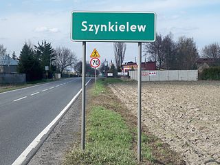
Szynkielew is a village in the administrative district of Gmina Pabianice, within Pabianice County, Łódź Voivodeship, in central Poland. It lies approximately 6 kilometres (4 mi) north-west of Pabianice and 15 km (9 mi) south-west of the regional capital Łódź.

Przatów Dolny is a village in the administrative district of Gmina Szadek, within Zduńska Wola County, Łódź Voivodeship, in central Poland. It lies approximately 3 kilometres (2 mi) south-east of Szadek, 10 km (6 mi) north of Zduńska Wola, and 34 km (21 mi) west of the regional capital Łódź.

Wilkowice is a village in the administrative district of Gmina Klimontów, within Sandomierz County, Świętokrzyskie Voivodeship, in south-central Poland. It lies approximately 5 kilometres (3 mi) north-east of Klimontów, 18 km (11 mi) west of Sandomierz, and 66 km (41 mi) east of the regional capital Kielce.

Kraśnicza Wola is a village in the administrative district of Gmina Grodzisk Mazowiecki, within Grodzisk Mazowiecki County, Masovian Voivodeship, in east-central Poland. It lies approximately 5 kilometres (3 mi) west of Grodzisk Mazowiecki and 32 km (20 mi) west of Warsaw.
Brudzyno is a village in the administrative district of Gmina Staroźreby, within Płock County, Masovian Voivodeship, in east-central Poland.
Brzeście Nowe is a village in the administrative district of Gmina Baboszewo, within Płońsk County, Masovian Voivodeship, in east-central Poland.
Stare Bulkowo is a village in the administrative district of Gmina Winnica, within Pułtusk County, Masovian Voivodeship, in east-central Poland.
Wólka Wołyniecka is a village in the administrative district of Gmina Wiśniew, within Siedlce County, Masovian Voivodeship, in east-central Poland.

Orły is a village in the administrative district of Gmina Ożarów Mazowiecki, within Warsaw West County, Masovian Voivodeship, in east-central Poland. It lies approximately 8 kilometres (5 mi) west of Ożarów Mazowiecki and 22 km (14 mi) west of Warsaw.

Pakawie is a village in the administrative district of Gmina Wronki, within Szamotuły County, Greater Poland Voivodeship, in west-central Poland. It lies approximately 10 kilometres (6 mi) west of Wronki, 26 km (16 mi) west of Szamotuły, and 56 km (35 mi) north-west of the regional capital Poznań.

Nowa Wieś is a village in Gmina Parchowo, Bytów County, Pomeranian Voivodeship, in northern Poland. It lies approximately 18 kilometres (11 mi) north-east of Bytów and 62 km (39 mi) west of Gdańsk.
Przybyszów is a village in the administrative district of Gmina Sława, within Wschowa County, Lubusz Voivodeship, in western Poland.

Pędziszewo is a village in the administrative district of Gmina Debrzno, within Człuchów County, Pomeranian Voivodeship, in northern Poland. It lies approximately 9 kilometres (6 mi) north-west of Debrzno, 19 km (12 mi) south-west of Człuchów, and 133 km (83 mi) south-west of the regional capital Gdańsk.

Ronin is a village in the administrative district of Gmina Frombork, within Braniewo County, Warmian-Masurian Voivodeship, in northern Poland. It lies approximately 2 kilometres (1 mi) south of Frombork, 12 km (7 mi) south-west of Braniewo, and 82 km (51 mi) north-west of the regional capital Olsztyn.


