Bogusza is a village in southern Poland. It lies approximately 8 kilometres (5 mi) east of Kamionka Wielka, 15 km (9 mi) south-east of Nowy Sącz, and 88 km (55 mi) south-east of the regional capital Kraków.

Gmina Chełmiec is a rural gmina in Nowy Sącz County, Lesser Poland Voivodeship, in southern Poland. Its seat is the village of Chełmiec, which lies approximately 3 kilometres (2 mi) west of Nowy Sącz and 71 km (44 mi) south-east of the regional capital Kraków.
Gmina Grybów is a rural gmina in Nowy Sącz County, Lesser Poland Voivodeship, in southern Poland. Its seat is the town of Grybów, although the town is not part of the territory of the gmina.
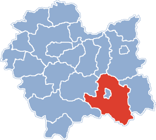
Gmina Kamionka Wielka is a rural gmina in Nowy Sącz County, Lesser Poland Voivodeship, in southern Poland. Its seat is the village of Kamionka Wielka, which lies approximately 9 kilometres (6 mi) south-east of Nowy Sącz and 82 km (51 mi) south-east of the regional capital Kraków.
Gmina Łabowa is a rural gmina in Nowy Sącz County, Lesser Poland Voivodeship, in southern Poland. Its seat is the village of Łabowa, which lies approximately 16 kilometres (10 mi) south-east of Nowy Sącz and 89 km (55 mi) south-east of the regional capital Kraków.
Gmina Nawojowa is a rural gmina in Nowy Sącz County, Lesser Poland Voivodeship, in southern Poland. Its seat is the village of Nawojowa, which lies approximately 8 kilometres (5 mi) south-east of Nowy Sącz and 81 km (50 mi) south-east of the regional capital Kraków.

Kunów is a village in the administrative district of Gmina Chełmiec, within Nowy Sącz County, Lesser Poland Voivodeship, in southern Poland. It lies approximately 8 kilometres (5 mi) south-east of Chełmiec, 6 km (4 mi) south-east of Nowy Sącz, and 79 km (49 mi) south-east of the regional capital Kraków.
Jamnica is a village in the administrative district of Gmina Kamionka Wielka, within Nowy Sącz County, Lesser Poland Voivodeship, in southern Poland. It lies approximately 7 kilometres (4 mi) south-east of center of Nowy Sącz and 80 km (50 mi) south-east of the regional capital Kraków.
Kamionka Mała is a village in the administrative district of Gmina Kamionka Wielka, within Nowy Sącz County, Lesser Poland Voivodeship, in southern Poland. It lies approximately 8 kilometres (5 mi) south-east of Nowy Sącz and 81 km (50 mi) south-east of the regional capital Kraków.
Królowa Górna is a village in the administrative district of Gmina Kamionka Wielka, within Nowy Sącz County, Lesser Poland Voivodeship, in southern Poland. It lies approximately 5 kilometres (3 mi) east of Kamionka Wielka, 12 km (7 mi) south-east of Nowy Sącz, and 85 km (53 mi) south-east of the regional capital Kraków.
Królowa Polska is a village in the administrative district of Gmina Kamionka Wielka, within Nowy Sącz County, Lesser Poland Voivodeship, in southern Poland. It lies approximately 4 kilometres (2 mi) north-east of Kamionka Wielka, 10 km (6 mi) east of Nowy Sącz, and 82 km (51 mi) south-east of the regional capital Kraków.
Mszalnica is a village in the administrative district of Gmina Kamionka Wielka, within Nowy Sącz County, Lesser Poland Voivodeship, in southern Poland.
Mystków is a village in the administrative district of Gmina Kamionka Wielka, within Nowy Sącz County, Lesser Poland Voivodeship, in southern Poland. It lies approximately 5 kilometres (3 mi) north of Kamionka Wielka, 8 km (5 mi) east of Nowy Sącz, and 80 km (50 mi) south-east of the regional capital Kraków.
Zagóry is a village in the administrative district of Gmina Kamionka Wielka, within Nowy Sącz County, Lesser Poland Voivodeship, in southern Poland. It lies approximately 13 kilometres (8 mi) south-east of Nowy Sącz and 86 km (53 mi) south-east of the regional capital Kraków.
Lipnica Wielka is a village in the administrative district of Gmina Korzenna, within Nowy Sącz County, Lesser Poland Voivodeship, in southern Poland. It lies approximately 3 kilometres (2 mi) north-east of Korzenna, 16 km (10 mi) north-east of Nowy Sącz, and 78 km (48 mi) south-east of the regional capital Kraków.
Roztoka Wielka is a village in the administrative district of Gmina Łabowa, within Nowy Sącz County, Lesser Poland Voivodeship, in southern Poland. It lies approximately 9 kilometres (6 mi) south-east of Łabowa, 25 km (16 mi) south-east of Nowy Sącz, and 98 km (61 mi) south-east of the regional capital Kraków.

Żeleźnikowa Wielka is a village in the administrative district of Gmina Nawojowa, within Nowy Sącz County, Lesser Poland Voivodeship, in southern Poland. It lies approximately 4 kilometres (2 mi) west of Nawojowa, 7 km (4 mi) south of Nowy Sącz, and 78 km (48 mi) south-east of the regional capital Kraków.
Gaboń is a village in the administrative district of Gmina Stary Sącz, within Nowy Sącz County, Lesser Poland Voivodeship, in southern Poland. It lies approximately 7 kilometres (4 mi) south-west of Stary Sącz, 15 km (9 mi) south-west of Nowy Sącz, and 74 km (46 mi) south-east of the regional capital Kraków.
Myślec is a village in the administrative district of Gmina Stary Sącz, within Nowy Sącz County, Lesser Poland Voivodeship, in southern Poland. It lies approximately 3 kilometres (2 mi) south-east of Stary Sącz, 9 km (6 mi) south of Nowy Sącz, and 78 km (48 mi) south-east of the regional capital Kraków.
Popowice is a village in the administrative district of Gmina Stary Sącz, within Nowy Sącz County, Lesser Poland Voivodeship, in southern Poland. It lies approximately 4 kilometres (2 mi) south-east of Stary Sącz, 10 km (6 mi) south of Nowy Sącz, and 78 km (48 mi) south-east of the regional capital Kraków.