
Aygudi, also spelled Aaikudi, is a panchayat town in Tenkasi district in the state of Tamil Nadu, India.
Ezhudesam is a town in Kanniyakumari district in the state of Tamil Nadu, India.
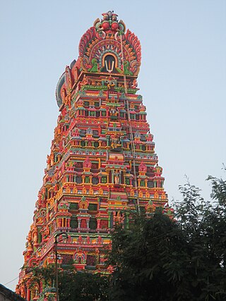
Karamadai is a town located near Mettupalayam, in the Indian state of Tamil Nadu. It is located on Coimbatore - Ooty NH 67. Nearby places are Teachers colony, Press Colony, Jodhipuram and Periyanaickenpalayam. The Ranganathaswamy temple and Nanjundeswarar temple are the most prominent landmarks in the town. The place of Karamadai came into limelight due to the presence of ex-steel giant Sri Ramakrishna Steel Industries.
Kilpennathur is a Panchayat Town in Tiruvanamalai district in the Indian state of Tamil Nadu. Kilpennathur is one of the taluks of Tiruvannamalai district and an assembly constituency of Tamil Nadu. The MLA of Kilpennathur assembly constituency is DMK party Mr. K. Pichandi. Vettavalam is the most populous town panchayat in this taluk. Kilpennathur is located a 12.25 degrees latitude and 79.224 degrees longitude. Nearest towns are Avalurpet, Vettavalam, Gingee and Tiruvannamalai, and Chennai is about 177 km away.
Melagaram is a panchayat town in Tenkasi district, in the Indian state of Tamil Nadu. The Famous Composer Thirigudarasapa Kavirayar was born in Melagaram. Thirutrala Kuravanji is a classic Tamil language poem composed by Thirigudarasapa Kavirayar around 1600 - 1700 CE.
Minjur is a suburb located in the northern outskirts of Chennai, India. It is located in Thiruvallur district in the Indian state of Tamil Nadu. Minjur is called 'Vada Kanchi' meaning North Kanchipuram. The locality has two famous temples for Shiva and Vishnu, similar to Kanchipuram. The neighbourhood is served by Minjur railway station of the Chennai Suburban Railway Network.

Mukkudal is a panchayat town in Tirunelveli district in the Indian state of Tamil Nadu.
Nallur (Nalloor) is a panchayat town in Kanniyakumari district in the Indian state of Tamil Nadu.
Papparapatti is a panchayat town in Dharmapuri district in the Indian state of Tamil Nadu. The original name of this town was Pallur Pettai, later it was officially renamed as Papparapatti by the local government.
Sambavarvadakarai is a Panchayat town in the Tenkasi district of the Indian state of Tamil Nadu. Located on the north shore of the Hanumannathi River in Tenkasi district of Tamil Nadu, Sambavarvadakarai is divided into two sections, Melur and Keelur corresponding to its location along the river. The name is a portmanteau of the Tamil words sambavar, vada (north), and karai (shore).

Singaperumal Koil is a satellite town city of Chennai located between Chengalpattu and Maraimalai Nagar in Chengalpattu district in the Indian state of Tamil Nadu. It is a part of the area Chennai Metropolitan Development Authority (CMDA) and a vital locality in Chennai Metropolitan Area.

Sundarapandiapuram is a panchayat town in Tenkasi district, in the Indian state of Tamil Nadu. It is a setting for several Tamil films and regional sitcoms.

Thenthiruperai is a panchayat town in Thoothukudi district in the Indian state of Tamil Nadu. It is located at a distance of 11 km from Tiruvaikuntam, 21 km from Thiruchendur, 30 km from Thoothukudi, 31 km from Tirunelveli and 187 km from Madurai. The village hosts one of the nine temple shrines that constitutes Nava Tirupathi temples. It is also hosts one of the Navakailasams, Then Thiruperai Sri Kailasanathar Temple, the seventh in the series.
Thiruporur is a panchayat town in Chengalpattu district in the Indian state of Tamil Nadu. The Thiruporur Kandaswamy temple is situated in the center of the town. There is a large temple tank in the vicinity of the temple. Thiruporur is located on Old Mahabalipuram Road and is flanked by Kelambakkam on one side and Alathur Pharmaceutical Industrial Estate on the other side, both of which are also on Old Mahabalipuram Road.

Uthamapalayam is a town and a taluka headquarters in Theni district in the Indian state of Tamil Nadu. Mullaiperiyar river is one of the attraction for this town.
Vettavalam is a first grade panchayat town in Tiruvanamalai district in the Indian state of Tamil Nadu.

Veerapandi is a panchayat gram in Theni district in the Indian state of Tamil Nadu.
Chetpet is a major town panchayat in Tiruvannamalai district in the state of Tamil Nadu, India. Chetpet's major economical activity is processing paddy and the town is home to one of the largest organised paddy exchange markets of the state. Chetpet is one of the very few places of German colonisation in Indian history. A village called Nedungunam nearby has one of the Famous temples of Lord Rama. The temple is very famous and called Sri Yoga Rama temple.

Thirumakkottai is a village in Mannargudi municipality in Thiruvarur district in the Indian state of Tamil Nadu. The village is Thirumakkottai consist of many streets like North street, South street, Bazaar Street, New street, Sivan koil street, Ponniyamman Temple Street, Theradi street, Nallan Pillai street.
Ulundurpettai or Ulundurpet is a municipality in Ulundurpet taluka of Kallakurichi district of Tamil Nadu, India. It is at the intersection of NH 68 and NH 45 located 205 km from Chennai and 129 km from Tiruchirappalli. Ulundurpettai itself is a Constituency for Tamil Nadu State Assembly, and is the Taluk headquarters for Ulundurpet taluka in the eastern region of Kallakurichi district, and is in Ulundurpet revenue block.


