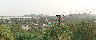
Thiruneermalai is a neighborhood in the city of Tambaram, situated within the Chennai Metropolitan Area, Tamil Nadu, India.

Shravasti district is one of the districts of the Uttar Pradesh state of India, with Bhinga town as its district headquarters. Shravasti district is a part of Devipatan Division. According to Government of India, it is among the 121 minority concentrated districts in India. It is the fourth most backward district in India, according to the 2018 Niti Aayog ranking. This district is the most poverty stricken district in the country.

Ambala district is one of the 22 districts of Haryana state in the country of India with Ambala town serving as the administrative headquarters of the district. District Ambala lies on the North-Eastern edge of Haryana and borders Punjab and Himachal Pradesh. Ambala district is a part of Ambala Division.

Bishnupur district or Bishenpur district, is a district of Manipur state in northeastern India.

Durg is a city in the Indian state of Chhattisgarh, east of the Shivnath River and is part of the Durg-Bhilai urban agglomeration. With an urban population of 1,064,077, Durg-Bhilai is the second largest urban area in Chhattisgarh after Raipur. It is the headquarters of Durg District.
The administrative divisions of India are subnational administrative units of India; they are composed of a nested hierarchy of administrative divisions.
Chinchani is a Census Town in the Dahanu Taluka of Palghar District of Maharashtra, India.
Jalalpur is a town, tehsil and a municipal board in Ambedkar Nagar district in the Indian state of Uttar Pradesh, India.
Old Malda is a census town in Malda district in the Indian state of West Bengal. It is a part of the Malda Metropolitan Area. It is located on the eastern bank of the river Mahananda.
Peerkankaranai is a neighborhood in the city of Tambaram, situated within the Chennai Metropolitan Area, Tamil Nadu, India.
Jafarabad is a town and nagar panchayat in Jaunpur district in the Indian state of Uttar Pradesh.
Banga is a town and Municipal council in the Shaheed Bhagat Singh Nagar district of Punjab, India. Banga is also one of the sub-division (tehsil) headquarters of the district. Banga is located on Phagwara-Rupnagar section of National Highway 344A. It is currently estimated to have a population of about 23,000 and is classified as a class 2 Municipality. The town also incorporates the former village of Jindowal apart from Banga town.

Kadamba Kanana Swami was a senior member and initiating guru of the International Society for Krishna Consciousness (ISKCON).
Kanana is a community council located in the Berea District of Lesotho. Its population in 2006 was 19,311.
Heirok is a town and a nagar panchayat in Thoubal district in the Indian state of Manipur.
Gidhour is a community development block that forms an administrative division in Simaria subdivision of Chatra district, Jharkhand state, India.
Pathalgada is a community development block that forms an administrative division in the Simaria subdivision of the Chatra district, Jharkhand state, India.
Dulmi (community development block) is an administrative division in the Ramgarh subdivision of the Ramgarh district in the Indian state of Jharkhand.
Loma is a village in the Jandaha block of Vaishali district in the Indian state of Bihar. It is located more than 30 km from the nearest city of Hajipur.

Bawan Buzurg Balla is a village in Amawan block of Rae Bareli district, Uttar Pradesh, India. It is located near Maharajganj, south of the road to Bachhrawan and west of the road to Rae Bareli. It is the largest village in the district by area. As of 2011, its population is 11,754 people, in 2,154 households.

