Narsipatnam is a census town in Anakapalle district of the Indian state of Andhra Pradesh. It was upgraded from a gram panchayat into municipality in 2012. The town is spread over an area of 42 km2 (16 sq mi) The resting place of the revolutionary Indian freedom fighter Alluri Sitarama Raju is located in Krishna Devi Peta village of From Narsipatnam to labasingi Village 30 km only.. labasingi most popular winter tourism place..so many Tourists enjoy -2 degree's temparature there.. Narsipatnam town is 43 km away from Tuni. And it is 72 km away from Visakhapatnam.

Narasannapeta is a census town in Srikakulam district of the Indian state of Andhra Pradesh. It is the mandal headquarters of Narasannapeta mandal in Srikakulam revenue division. 43 villages are there under the administrative division of Narasannapeta.

Pathapatnam is a town in Srikakulam district of the Indian state of Andhra Pradesh. It is located in Pathapatnam mandal of Palakonda revenue division. Pathapatnam is located on the border of Srikakulam district of Andhra Pradesh and Gajapati district of Odisha. Parlakhemundi, the headquarters of Gajapati District, can be considered as twin town of Pathapatnam because of its close proximity. It is located around 65 km from srikakulam. It was the old capital of Paralakhemundi Gajapati Maharajah of his erstwhile kingdom.
Pedakakani is a village in the Guntur district of the Indian state of Andhra Pradesh. It is located in Pedakakani mandal of Guntur revenue division. Hindu shrine of Shiva, Sri Bhramaramba Malleswara Swamy Temple is located in the village.

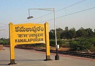
Kamalapuram is a Town in YSR Kadapa district of the Indian state of Andhra Pradesh. It is located in Kamalapuram mandal of Kadapa revenue division and is the Thaluka headquarter of Kamalapuram assembly constituency.
Peravali is a village in East Godavari district of the Indian state of Andhra Pradesh. The nearest railway station is Tanuku (TNKU) located at a distance of 7.25 Km. Postal index code of this village is 534328
Battili is a town in Bhamini Mandal of Parvathipuram Manyam district in Andhra Pradesh, India.
Sattenapalle is a town in Palnadu district of the Indian state of Andhra Pradesh. It is a municipality and the headquarters of Sattenapalle mandal under Sattenapalle revenue division. It is also part of APCRDA region.

Denduluru is a village in the Eluru district of the Indian state of Andhra Pradesh. It is located on the north-east side of district headquarters Eluru at a distance of 11 km. It is a member of the Eluru revenue division. The Bhimalingadibba or the mounds are one of the centrally protected monuments of national importance.
Amberpeta is a village in Eluru district in the state of Andhra Pradesh in India. The nearest railway station is Kacheguda(KCG) located at a distance of 0.81 Km.
Polasanipalle is a village in Eluru district in the state of Andhra Pradesh in India. The nearest railway station is located at Nuzvid (NZD) at a distance of 11.54 Km.
Allipalle is a village in Eluru district of the Indian state of Andhra Pradesh. The nearest railway station is Sitampet(STPT) located at a distance of 47.79 Km.
Kandaravalli is a village in West Godavari district in the state of Andhra Pradesh in India. The nearest railway station is located at Palacole which is more than 10 Km from Kandaravalli.
Karugorumilli is a village in West Godavari district in the state of Andhra Pradesh in India. The nearest railway station is located in town of Palacole.

Koderu is a village in West Godavari district in the state of Andhra Pradesh in India. The nearest railway station is Palakollu (PKO) located at a distance of 3.87 Km.
Ajjamuru is a village in West Godavari district in the state of Andhra Pradesh in India. akiveedu railway station is the nearest Railway Station.
Kollaparru is a village in West Godavari district in the state of Andhra Pradesh in India. Cherukuvada railway Station and Akividu railway Station are the nearest train stations.
Eduru is a village in West Godavari district in the state of Andhra Pradesh in India. The nearest railway station is at Krishnapatnam (KAPT) located at a distance of 15.83 Km
Gummampadu is a village in West Godavari district in the state of Andhra Pradesh in India. Relangi and Velpuru Rail Way Station are the nearest railway stations.
Anakoderu is a village in West Godavari district in the state of Andhra Pradesh in India. Bhimavaram town and junction stations are the nearest railway stations.


