Related Research Articles
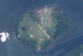
Daru is the capital of the Western Province of Papua New Guinea and a former Catholic bishopric. Daru town falls under the jurisdiction of Daru Urban LLG.

Mendi, Papua New Guinea, is the provincial capital of the Southern Highlands Province. The Lai River flows by the town. It is served by Mendi Airport. The town falls under Mendi Urban LLG.

Mount Hagen Airport is the second biggest airport in Papua New Guinea (PNG) and is located in the Waghi Valley, 13 km north-east of Mount Hagen, the capital of Western Highlands Province of Papua New Guinea. The airport has one terminal and two runways, and is operated by its owner, National Airports Corporation of Papua New Guinea.

Mining in Papua New Guinea is an important part of the Papua New Guinea economy.

Don Pomb Polye is a Papua New Guinean politician from Enga Province. He has been a Cabinet Minister under two Prime Ministers, and was briefly Deputy Prime Minister from July to December 2010. He has held Foreign Affairs, Immigration, Transport, Civil Aviation, Finance and Treasury portfolios.

Namatanai District is the southernmost and larger of the two districts of New Ireland Province in Papua New Guinea. The district covers the southern part of the island of New Ireland, as well as the Tabar Group, the Lihir Group, the Tanga Islands and the Feni Islands.
This page details the match results and statistics of the Papua New Guinea national football team from 1990 until 2019.

Saline County Regional Airport is a county-owned, public-use airport located five nautical miles east of the central business district of Benton, a city in Saline County, Arkansas, United States. The airport's address is 1100 Hill Farm Road in Bryant, Arkansas. It is included in the FAA's National Plan of Integrated Airport Systems for 2011–2015, which categorized it as a general aviation facility.
This is a list of members of the National Parliament of Papua New Guinea from 2007 to 2012, as elected at the 2007 election.

Nadzab Village is in the Markham Valley, Morobe Province, Papua New Guinea on the Highlands Highway. Administratively, it is located in Gabsongkeg ward of Wampar Rural LLG. The Nadzab Airport is located East of Nadzab Village and was the site of the only Allied paratrooper assault in New Guinea on 5 September 1943.

Kandep District is one of the five Districts of Enga Province in Papua New Guinea. It is located in the southern part of Wabag, capital town of Enga. Kandep shares land borders between Laiagam-Porgera district, Wabag, and Wapenamanda District. It also shares borders with Southern Highlands, Western Highlands and the newly breakaway Hela Province. Kandep is accessible by road, and the Kandep - Laiagam Road links to Wabag which is 3 hours drive back and forth. The Kandep - Mendi road, a newly sealed road can be used to travel to Mt. Hagen via Mendi. The Kandep - Magarima Road is also connected.
Gasmata is a village on the southern coast of New Britain, Papua New Guinea located at 6° 16' 60S 150° 19' 60E. There is a Gasmata Airport in Surumi Peninsula area adjacent. The village is administered under Gasmata Rural LLG in East New Britain Province.
Murik a.k.a. Nor is a Lower Sepik language spoken in Papua New Guinea. It is spoken in Murik ward of Marienberg Rural LLG, East Sepik Province, which is located around a large coastal lagoon.

Kandep Rural LLG is one of two LLGs of the Kandep District of Enga Province, Papua New Guinea. It is located in southern Wabag, the capital town of Enga Province. Kandep shares land borders with Laiagam - Porgera, Wabag, and Wapenimanda District, along with additional land borders between the Southern Highlands, the Western Highlands provinces, and the newly Provinces.
Wage Rural LLG in Kandep District is one of the two Local-Level Governments (LLGs) of the Kandep District of Enga Province, Papua New Guinea. It is located at Southern part of Wabag, capital town of [Enga Province]. Kandep shares land borders between Laiagam - Porgera, Wabag, and Wapenimanda District. Also shares borders with Southern Highland, Western highlands and newly breakaway Provinces of Hela.

Situm is a village outside of Lae in Labuta Rural LLG, Morobe Province, Papua New Guinea.

Bugandi is a suburb of Lae in the Morobe Province, Papua New Guinea.
The Morehead River is a river in southwestern Papua New Guinea. It is located just to the east of the Bensbach River, and to the west of the Fly River. The river flows through the Trans-Fly savanna and grasslands.
Segero Creek is a creek located in Western Province, Papua New Guinea.
References
- 1 2 "About Kandep". kandepmyhome.blogspot.com. Retrieved 28 March 2013.CS1 maint: discouraged parameter (link)
- ↑ "Kandep (KDP) Papua New Guinea". www.world-airport-codes.com. Retrieved 28 March 2013.CS1 maint: discouraged parameter (link)
Coordinates: 05°50′32″S143°30′38″E / 5.84222°S 143.51056°E
| | This Papua New Guinea-related article is a stub. You can help Wikipedia by expanding it. |