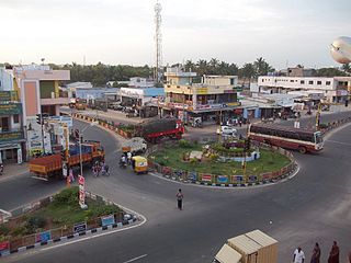
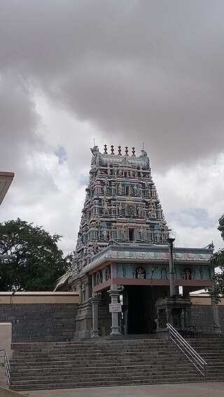
Perundurai is a Special Grade Town Panchayat in Erode district in the Indian state of Tamil Nadu. Perundurai is the only special grade town panchayat among 42 in the district. Perundurai has developed as the industrial center with SIPCOT Industrial Estate and SEZ Complex. It is the Asia's Second largest SIPCOT.
Rasipuram is a Municipality in the Indian state of Tamil Nadu and suburb of city of Salem located in Namakkal District. It is the headquarters for the Rasipuram taluk. As of 2015, the town had a population of 88,584 and an area of 24 km2 (9.3 sq mi). It has 27 wards and steps have been taken to increase the wards to 33. Rasipuram is known for ghee and tapioca sago.

Thirumuruganpoondi is a Municipality in Tirupur District in the Indian state of Tamil Nadu. It is about 7 kilometres (4 mi) South from Tirupur city and 38 kilometres (24 mi) west from Coimbatore city.
Chandameta-Butaria is a town and a nagar panchayat in Chhindwara district in the state of Madhya Pradesh, India.
Chennimalai is a town in Erode district, Tamil Nadu, India. It is situated away from Erode of about 28kms., Chenni which means Chief and Malai means Hill. It is popularly known as the 'Handloom Town'.
Dhali is a panchayat town in Tirupur district in the state of Tamil Nadu, India. It is a developing town Panchayat in Udumalaipettai and that is connecting to Anaimalai, Valparai and Thirumoothy reservoir

Dharapuram is a town situated along the banks of Amaravati River in Tiruppur district in the Indian state of Tamil Nadu. Dharapuram is one of the oldest towns in South India and was the capital of Kongu Nadu under the Cheras, Western Ganga Dynasty and later Kongu Cholas, at which time it was known as Viradapuram. Amaravathi River flows through the town. As of 2011, the town had a population of 67,007. The city houses famous temples including Agatheeswarar Temple, Kaadu Hanumanthasamy temple and many other old temples.

Kangeyam is a historical town and municipality in Kangeyam Taluk of Tiruppur district in the Indian state of Tamil Nadu. It is situated on National Highway 81. Kangeyam is an economic center in Tamil Nadu. The main commercial interests of the municipality are rice hulling, coconut oil extraction, ghee production, and groundnut cultivation. The town is located 28 km from the district headquarters at Tiruppur, 45 km from the city of Erode, 70 km from the industrial town of Coimbatore,30 km from the town of Dharapuram, 55 km from the city of Karur, 140 km from the Ancient city of Trichy and 441 km from the state capital Chennai.
Karumathampatti is a Municipality in the Coimbatore district in the state of Tamil Nadu, India. It is one of the prominent developing suburb in Coimbatore metropolitan area, about 25 km away from the city centre. It is situated in between NH544 which connects the city of Coimbatore with Salem – Erode – Tirupur and also in between the State Highway 165 connects Annur – Kamanaikenpalayam. Nearby places are Somanur-3 km, Avinashi-10 km, Tirupur-20 km, Sulur-15 km, Annur-16 km. Coimbatore -27,Mettupalayam-38,Palladam-19. Karumathampatti lies near the junction of two major roads, NH544(Coimbatore – Salem) and Karumathampatti – Annur road.
Keeranur 624617 is a panchayat town in Dindigul district in the Indian state of Tamil Nadu. It is situated between Palani and Dharapuram. There are more than three places in Tamil Nadu and in the rest of India with the same name, a bigger Keeranur situated near Trichy.
Kunnathur is a panchayat town in Tirupur district in the Indian state of Tamil Nadu. It was previously under the jurisdiction of the Erode district. However kunnathur is in tiruppur district, legislative assembly consistency for kunnathur is Perundurai which is in Erode district.
Madathukulam is Border to Dindigul District in Tirupur district in the Indian state of Tamil Nadu.
Mulanur is a panchayat town under in Dharapuram taluk in Tirupur District in the Indian state of Tamil Nadu.
Neikkarapatti is a panchayat town in Dindigul district in the Indian state of Tamil Nadu.
Samalapuram is a suburb of Tirupur in the Indian state of Tamil Nadu. Samalapuram is located near the twin townships of Somanur, Karumathampatti between Avinashi road and Trichy Road. It comes under the Palladam Taluk and Tiruppur district. The place is very famous for Vaazhaithottathu Ayyan Kovil.

Sulur is a town located in the Coimbatore district of Tamil Nadu, India. It is a suburb of Coimbatore. It is the headquarters of Sulur Taluk of Coimbatore district. There are many market places and many big retail and wholesale shops are available and also taluk office, police station, and a famous RVS institutions consisting of medical college, arts college is there in Sulur. And also two big famous temples are there. It is also a taluk and legislative constituency which comes under the Coimbatore parliamentary constituency.
Thiruporur is a panchayat town in Chengalpattu district in the Indian state of Tamil Nadu. The Thiruporur Kandaswamy temple is situated in the center of the town. There is a large temple tank in the vicinity of the temple. Thiruporur is located on Old Mahabalipuram Road and is flanked by Kelambakkam on one side and Alathur Pharmaceutical Industrial Estate on the other side, both of which are also on Old Mahabalipuram Road.
Vellakovil is a municipal town in Kangeyam taluk of Tirupur District, in the Indian state of Tamil Nadu. It is located on National Highway 81 between Trichy and Coimbatore. The town is spread in an area of 64.75 km2. As of 2011, the town had a population of 40,359. Kannapuram village located near to this town is famous for Kangeyam breed cattle market that happens on every year during Mariyamman temple festival in the month of April. It is an industrialized town with traditional agriculture being the occupation for most of the people. It holds lot of Power looms weaving bedsheets, floor mats and cotton materials being exported to foreign countries via exporters present in Karur.
Thirumalaigoundenvalasu is a village and a panchayat in the oddanchatram Taluk of Dindigul district in the South Indian state of Tamil Nadu.
Kerur is a town in Bagalkot district in Karnataka, which located on NH 218. It has an average elevation of 617 meters (2024 feet). It's the birthplace of Jagadish Shettar, a former Chief Minister of Karnataka. Kerur is a Town Panchayat city in the district of Bagalkot, Karnataka. The Kerur city is divided into 16 wards for which elections are held every five years. The Kerur Town Panchayat has a population of 19,731 of which 9,929 are males while 9,802 are females as per report released by Census India 2011.


